Garmin Map Pilot for Mercedes-Benz Manual de usuario
- Tipo
- Manual de usuario

MAP PILOT
Owner’s Manual
Manuel d'utilisation

All rights reserved. Under the copyright laws, this manual may not be copied, in whole or in part, without the written consent of Garmin. Garmin reserves the right to change or improve its
products and to make changes in the content of this manual without obligation to notify any person or organization of such changes or improvements. Go to www.garmin.com for current updates
and supplemental information concerning the use of this product.
Garmin
®
and the Garmin logo are trademarks of Garmin Ltd. or its subsidiaries, registered in the USA and other countries. Mercedes-Benz
®
is a registered trademark of Daimler AG. SiriusXM
®
is
a registered trademark of SiriusXM Radio Inc. The SDHC logo is a trademark of SD-3C, LLC.
El número de registro COFETEL/IFETEL puede ser revisado en el manual a través de la siguiente página de internet.

Owner’s Manual......................................................................................................................................................... 2
Manuel d'utilisation................................................................................................................................................. 10
Benutzerhandbuch................................................................................................................................................... 18
Manuale Utente....................................................................................................................................................... 27
Manual del usuario.................................................................................................................................................. 35
Руководство пользователя.............................................................................................................................................. 43
用户手册...........................................................................................................................................52
使用者手冊....................................................................................................................................... 59


Table of Contents
MAP PILOT Owner’s Manual......................................... 2
Getting Started............................................................................2
Warranty................................................................................ 2
Updates..................................................................................2
SD Card Copy Protection.......................................................2
Installing the SD Card............................................................ 2
Audio 20 Controller................................................................ 2
Volume Adjustment................................................................ 2
Satellite Signals..................................................................... 2
Using the Main Menu............................................................. 2
Using the On-Screen Keyboard............................................. 2
Finding Locations........................................................................3
Locations................................................................................3
Searching by Spelling a Name...............................................3
Changing the Search Area.................................................... 3
Finding a Location by Category............................................. 3
Search Tools.......................................................................... 3
Finding a Location Using Coordinates................................... 3
Finding Recently Found Places............................................. 3
Saving Locations....................................................................3
Saving a Home Location........................................................ 4
Using the GPS Simulator....................................................... 4
Voice Command......................................................................... 4
Activating Voice Command.................................................... 4
Voice Command Tips.............................................................4
Starting a Route Using Voice Command............................... 4
Using Voice Command While Navigating a Route................ 4
Navigation................................................................................... 4
Browsing the Map.................................................................. 4
Starting a Route..................................................................... 5
Stopping the Route................................................................ 5
Following a Route.................................................................. 5
Using My Route..................................................................... 5
Taking a Detour..................................................................... 5
Avoiding Road Features........................................................ 5
About Exit Services................................................................ 5
Map Pages..................................................................................6
Customizing the Map............................................................. 6
Viewing a List of Turns...........................................................6
Viewing Junctions.................................................................. 6
Viewing Current Location Information.................................... 6
About Traffic............................................................................... 6
About the Traffic Icon............................................................. 6
Traffic Providers..................................................................... 6
Traffic on Your Route............................................................. 6
Understanding Traffic Data.................................................... 7
Traffic Subscriptions.............................................................. 7
Customizing the Navigation System........................................... 7
System Settings..................................................................... 7
Navigation Settings................................................................ 7
Map Display Settings............................................................. 7
Traffic Settings....................................................................... 7
Language and Keyboard Settings......................................... 7
My Data Settings....................................................................8
My Maps Settings.................................................................. 8
Restoring Settings..................................................................8
MAP PILOT Owner’s Manual 1

MAP PILOT Owner’s Manual
Getting Started
WARNING
Failure to avoid the following potentially hazardous situations
could result in an accident or collision resulting in death or
serious injury.
Keep SD cards away from small children. Infants may swallow
an SD card by mistake. If an SD card is swallowed, consult a
doctor immediately.
Always use your best judgement, and operate the vehicle in a
safe manner. Do not become distracted by the navigation
system while driving, and always be fully aware of all
driving conditions. Minimize the amount of time spent viewing
the navigation screen while driving, and use voice prompts when
possible.
Do not input destinations, change settings, or access any
functions requiring prolonged use of the navigation system
controls while driving. Pull over in a safe and legal manner
before attempting such operations.
When navigating, carefully compare information displayed on
the navigation system to all available navigation sources,
including road signs, road closures, road conditions, traffic
congestion, weather conditions, and other factors that may
affect safety while driving. For safety, always resolve any
discrepancies before continuing navigation, and defer to posted
road signs and road conditions.
The navigation system is designed to provide route suggestions.
It is not a replacement for driver attentiveness and good
judgement. Do not follow route suggestions if they suggest an
unsafe or illegal maneuver or would place the vehicle in an
unsafe situation.
NOTICE
Excluding map updates, do not change or manipulate the SD
card content.
For safety reasons, some features are restricted or unavailable
while your vehicle is in motion. A message appears when
features are disabled.
Read this manual before using your MAP PILOT navigation
system.
Warranty
Contact your authorized Mercedes-Benz
®
center for warranty
information.
Updates
• Map and software updates are available at your Mercedes-
Benz dealer. In some countries, map and software updates
are available as downloads or SD cards from
http://shop.mercedes-benz.com/garmin-map-pilot.
• You may be eligible for a free map update. See your
Mercedes-Benz dealership for more information.
SD Card Copy Protection
Your SD card can only be installed on one navigation system.
You cannot install the SD card on an additional navigation
system.
If you receive an error message stating that your maps are
locked the first time you install the SD card on your navigation
system, your card might be corrupted. Contact your Mercedes-
Benz
dealer.
Installing the SD Card
1
Verify the SD card is not locked.
2
Insert the SD card into the SD card slot in your vehicle until it
clicks into place.
3
Follow the on-screen instructions.
Audio 20 Controller
Use the controller in your vehicle to maneuver through the
navigation system and make selections.
For complete operating instructions, refer to the operator’s
manual for your vehicle.
Using the Audio 20
Controller on the Map
• Move the controller in eight different directions to move to an
option or pan the map.
• Press the controller to make a selection or display the menu.
• Rotate the controller clockwise or counterclockwise to zoom
in and out on the map.
• From the map, press the controller to use menu shortcuts.
• From the map, press to return to the main menu.
Volume Adjustment
Volume adjustment of navigation announcements is only
possible during an announcement.
Satellite Signals
After the navigation system is turned on, it begins acquiring
satellite signals. The system may need a clear view of the sky to
acquire satellite signals.
For more information about GPS, go to www.garmin.com
/aboutGPS.
Viewing GPS Signal Status
Select Settings > System >
Satellite Information
.
Using the Main Menu
Rotate the main menu tools wheel for access to all of the
options.
• Select
À
to enter a destination or view current route
information.
• Select
Á
to view the map.
• Select
Â
to start voice recognition.
• Select
Ã
to mute or unmute navigation prompts.
• Select
Ä
to open the settings menu.
• Select
Å
to view traffic conditions.
• Select
Æ
to hear the most recent navigation prompt (only
while navigating).
• Select
Ç
to stop the current route (only while navigating).
• Select
È
to take a detour (only while navigating).
Using the On-Screen Keyboard
Use the controller to select letters, characters, diacritics, and
other options when making a search entry. Available diacritics
will be added in a third row, and will appear dynamically.
• Select to delete a search entry.
• Select
ok to accept an entry.
• Select to change the keyboard language.
• Select to add a space between entries.
2 MAP PILOT
Owner’s Manual

Finding Locations
The system offers many methods for finding locations.
• By spelling the name (Searching by Spelling a Name,
page 3)
• Near another location (Changing the Search Area, page 3)
• By Category
(
Finding a Location by Category, page 3)
• By address
(
Finding an Address,
page
3)
• Using coordinates (Finding a Location Using Coordinates,
page 3)
• Using recently found locations (Finding Recently Found
Places
, page
3)
• Using saved locations (Starting a Route to a Saved Location,
page 4)
Locations
The maps loaded in your navigation system contain locations,
such as restaurants, hotels, and auto services. You can use
categories to browse for nearby businesses and attractions.
Searching by Spelling a Name
You can search for specific locations by spelling the location
name.
1
Select Destination Entry > POIs > Enter Search Term.
2
Enter all or part of the location name.
Suggested locations appear below the bar.
3
Select a location.
Changing the Search Area
By default, the device searches near your current location. You
can also search other areas, such as near your destination, near
another city, or along your active route.
1
Select Destination Entry > POIs > Search Near.
2
Select an option:
• My Current Location
• A Different City
• A Recent Destination
• A Favorite Location
• My Current Route
• My Destination
3
If necessary, select a location.
Finding a Location by Category
1
Select Destination Entry > POIs.
2
Select a category.
3
If necessary, select a subcategory.
4
Select a location.
NOTE: To view the location on the expanded map, push the
controller to the right.
Finding Fuel
1
Select Destination Entry > POIs > Fuel.
2
If necessary, select a fuel type (not available in all areas).
3
Select a fuel location.
Finding an MB-Service Center
1
Select Destination Entry > MB-Service.
2
Select a service center.
Search Tools
Search tools allow you to search for specific types of locations
by responding to on-screen prompts.
Finding an Address
NOTE: The order of the steps may change depending on the
map data loaded on your navigation system.
1
Select Destination Entry > Address.
2
If necessary, select the city, the state, the province, or the
country.
3
Follow the on-screen instructions to enter address
information.
4
Select Go!.
Finding a City
1
Select Destination Entry > Cities.
2
If necessary, spell the city, change the state, the province, or
the country.
3
Select Go!.
Finding an Intersection
1
Select Destination Entry > Intersect..
2
Follow the on-screen instructions to enter street information.
3
Select the intersection.
Finding a Location Using Coordinates
You can find a location using latitude and longitude coordinates.
1
Select Destination Entry > Coord..
2
If necessary, select Change Format, and select the correct
coordinate format for the type of map you are using.
3
Select the latitude coordinate, and select ok.
4
Select the longitude coordinate, and select ok.
5
Select View on Map.
Finding Recently Found Places
Your device stores the last 50 locations you have found.
1
Select Destination Entry > Recently..
2
Select a location.
Clearing the List of Recently Found Places
Select Destination Entry > Recently. > Clear Recent Finds
> Yes.
Saving Locations
Saving a Location
1
Search for a location (Finding a Location by Category,
page 3).
2
From the search results, select a location.
MAP PILOT Owner’s Manual 3

3
Select
Save.
The location is saved to Favorites.
Saving Your Current Location
1
From the map, select the vehicle location icon.
2
Select > Save Location to Favorites.
Starting a Route to a Saved Location
1
Select Destination Entry
> Favorites
.
2
Select a location.
3
Select
Go!.
Editing a Saved Location
1
Select Destination Entry > Favorites.
2
Select a location.
3
Select
Edit.
4
Select an option:
• Select
Change Name.
• Select
Change Map Symbol to change the symbol used
to mark the saved location on a map.
5
Edit the information.
Deleting a Saved Location
NOTE:
Deleted locations cannot be recovered.
1
Select Destination Entry
> Favorites
.
2
Select a location.
3
Select Delete
> Yes
.
Clearing All Favorites
1
Select Settings
> My Data > Clear All Favorite Locations
.
2
Select
Yes.
Saving a Home Location
You can set your home location for the location you return to
most often.
1
Select Destination Entry > Go Home.
2
Select
Use My Current Location, Enter My Address, or
Select From Recents.
The location is saved as "Home".
Going Home
The first time you start a route home, the device prompts you to
enter your home location.
1
Select Destination Entry >
Go Home
.
2
If necessary, enter your home location.
Editing Your Home Location Information
1
Select Settings
> My Data > Set or Change Home
Location
.
2
Select
Use My Current Location, Enter My Address, or
Select From Recents.
3
Enter your changes.
Using the GPS Simulator
You can use the GPS simulator to set a simulated location or to
simulate a route.
1
Select Settings
> System > GPS Simulator
.
2
From the main menu, select
View Map.
3
Select an area on the map, and select Set Location
.
Voice Command
NOTE:
Voice command is not available for all languages and
regions, and may not be available on all models.
NOTE:
Voice Activated Navigation may not achieve desired
performance when in a noisy environment.
Voice command allows you to use your device by saying words
and commands. The voice command menu provides voice
prompts and a list of available commands.
Activating Voice Command
Press the voice command activation button on your steering
wheel, or select Start Voice Input.
Voice Command Tips
• Speak in a normal voice directed at the system.
• Reduce background noise, such as voices, or the radio, to
increase the accuracy of the voice recognition.
• Speak commands as they appear on the screen.
• Respond to voice prompts from the device as needed.
• When entering an address, say the address in the order
shown on the sample screen. You must enter a house
number to find an address.
Starting a Route Using Voice Command
You can say the names of popular, well-known locations.
1
Press the voice command activation button on your steering
wheel, or select Start Voice Input from the main menu.
2
Say
Find Place.
3
Listen for the voice prompt, and say the name of the location.
A list of locations appears.
4
Say the line number.
5
Say Navigate!.
Using Voice Command While Navigating a Route
1
Press the voice command activation button on your steering
wheel, or select Start Voice Input from the main menu.
2
Select an option:
• Say
Detour to take a detour on the route.
• Say
Stop Route to stop the current route.
Navigation
Browsing the Map
You can browse the map for POIs, change your view of the
map, select which layers to display, view location details, and
more.
1
Select
View Map.
2
Move the controller in any direction.
The map switches to browsing mode.
NOTE:
You can also browse the map by selecting
Destination Entry >
Browse M.
.
3
Press the controller.
The map tools appear.
4 MAP PILOT
Owner’s Manual

4
Select an option:
• Select Location Details to display details of your selected
location.
• Select Points of Interest to browse for businesses and
attractions near the current map section.
• Select Layers to select which map layers to display on the
map. You can select any combination of Traffic, 3D
Buildings, 3D Terrain, and POI.
• Select Rotate Mode to enable a rotated view of the map.
• Select View Toggle to view the map in 3-D or 2-D North
Up.
• Select Set Location to set your current location. You can
maneuver the controller over the map to find specific
locations.
NOTE: You must have your MAP PILOT set to GPS
Simulator mode and you must not be navigating a route
to set your location (Using the GPS Simulator, page 4).
Starting a Route
1
Search for a location (Finding a Location by Category,
page 3).
2
Select a location.
3
Select Go!.
Stopping the Route
From the main menu, select Stop Route.
Following a Route
The route is marked with a blue line. A checkered flag marks
your destination.
As you travel, the device guides you to the destination with voice
prompts, arrows on the map, and directions at the top of the
map. If you depart from the original route, the device
recalculates the route and provides new directions.
Using My Route
While navigating a route, you can view turns for the route, add
waypoints, or take a detour.
1
While navigating a route, select Destination Entry > My
Route from the main menu.
2
Select an option:
• Select
Turn List to view the turns on the route.
• Select
Detour to take a detour on the route.
• Select
Add Waypoint to add another point on the route.
• Select
Map Preview to view the route.
• Select
Auto Arrange to automatically arrange the
waypoints.
• Select a waypoint to
Reorder, Delete, or View Details of
the waypoint.
NOTE: Map Preview, Auto Arrange, and waypoint options
are available only when at least one waypoint has been
added to the route.
Adding a Waypoint to a Route
1
While navigating a route, select Destination Entry
> My
Route > Add Waypoint
.
2
Search for the location.
3
Select
Add to Route.
4
Select
Go!.
Taking a Detour
While navigating a route, you can use detours to avoid obstacles
ahead of you, such as construction zones.
NOTE:
If the route you are currently navigating is the only
reasonable option, your system may not calculate a detour.
From the main menu, select Detour.
Using Advanced Detours
You can take a detour for a specified distance along your route
or detour around specific roads. This is useful if you encounter
construction zones, closed roads, or poor road conditions.
1
Select Settings
> Navigation > Advanced Detours
.
2
From the main menu, select Detour.
3
Select an option:
• To detour your route for a specific distance, select a
distance.
• To detour around a specific road on the route, select
Detour by Road(s) on Route.
NOTE:
If the route you are currently navigating is the only
reasonable option, your system may not calculate a detour.
Removing Detours
From the main menu, select Detour >
Remove all detours
.
Avoiding Road Features
You can select road features to avoid, such as toll roads or
unpaved roads.
1
Select Settings >
Navigation > Avoidances
.
2
Select the road features to avoid on your routes.
Your selections are automatically saved.
If certain road features cannot be avoided when calculating a
route, your system displays a message letting you know which
features are included in the route.
About Exit Services
When driving on a major highway, you can find gas, food,
lodging, and rest areas near upcoming exits.
Finding Exit Services
1
Select Destination Entry > Exit Serv..
2
Select an upcoming exit
À
.
3
Select a service type
Á
.
MAP PILOT Owner’s Manual 5

4
Select a point of interest.
5
Select Go!.
Map Pages
Customizing the Map
Customizing the Map Layers
You can customize which data appear on the map, such as
icons for points of interest and road conditions.
1
Select Settings > Map Display.
2
Select the layers to include on the map.
The system saves your selection when you leave the page.
Changing the Map Data Fields
You can change the type of information that appears in the data
fields on the map.
1
Select Settings > Map Display > Map Data Fields Layout.
2
Select an option:
• To change a data field that appears when no route is
active, select a Not Routing data field.
• To change a data field that appears when navigating a
route, select a Routing data field.
3
Select an option:
• For Not Routing data fields, select Direction of Travel,
Elevation, Speed, Time of Day, or Map Scale.
• For Routing data fields, select Arrival Time, Distance,
Direction of Travel, Elevation, Speed, Time of Day,
Map Scale, Time to Destination, Distance to Next
Waypoint, or Arrival Time at Next Waypoint.
Changing the Map Perspective
1
Select Settings > Map Display > Map View.
2
Select an option:
• Select Track Up to display the map in two dimensions (2-
D), with your direction of travel at the top.
• Select North Up to display the map in 2-D with north at
the top.
• Select 3-D to display the map in three dimensions.
Viewing a List of Turns
While navigating a route, you can view all of the turns and
maneuvers for your entire route and the distance between turns.
Select Destination Entry > My Route > Turn List.
Viewing the Next Turn
While navigating a route, you can preview upcoming turns.
The preview includes the distance to the turn or maneuver and
the lane in which you should be traveling, if available.
1
Select Destination Entry > My Route > Turn List.
2
Select a turn.
Viewing Junctions
While navigating a route, you can view the junctions on major
roadways. When you approach a junction in a route, the image
of that junction appears briefly, if available.
Viewing Current Location Information
You can use the Compass page to view information about your
current location. This feature is helpful if you need to tell
emergency personnel your location.
Select Destination Entry > Compass.
Showing the Qibla on the Compass
Select Destination Entry > Compass > > Show Qibla.
About Traffic
NOTICE
Garmin
®
and Mercedes-Benz are not responsible for the
accuracy or timeliness of traffic information.
Traffic information may not be available in all areas or countries.
When you are receiving traffic information, a traffic icon appears
on the map. The traffic icon changes color to indicate the
severity of traffic conditions. For information about traffic and
coverage areas, go to your Mercedes-Benz dealer.
NOTE: The traffic map does not display free-flow traffic
messages.
About the Traffic Icon
When a traffic event is detected, a traffic notification icon
appears on the map. The traffic icon changes color to indicate
the severity of traffic conditions.
Color Severity Meaning
Yellow Medium Traffic is moving but there is a delay. There
is moderate traffic congestion.
Orange and
White
Medium There is a construction zone.
Red High Traffic is not moving or moving slowly.
There is a severe delay.
Red and Black High The road is closed.
Traffic Providers
When traffic service is available, the traffic provider is shown
below the traffic icon on the main menu.
Traffic on Your Route
When calculating your route, the navigation system examines
the current traffic and automatically optimizes the route for the
shortest time. If a severe traffic delay of 15 minutes or longer
occurs on your route while you are navigating, your system
automatically recalculates the route.
The traffic notifications change color to indicate the severity of
traffic conditions on your route or on the road you are currently
traveling.
Your system may route you through a traffic delay if a better
alternative route does not exist. The delay time is added into
your estimated time of arrival automatically.
NOTE: The device recalculates to a faster route only when that
route will shorten the time of your trip by at least 15 minutes.
Alternate routes are not suggested when the Shorter Dist. or
Less Fuel route preference is enabled, when a route is modified
using the My Route feature, or when traffic avoidances are not
enabled. Traffic events are not avoided when the Shorter Dist.
or Less Fuel route preference is enabled. Only the estimated
6 MAP PILOT
Owner’s Manual

time of arrival is influenced by the estimated delay time of
received traffic events.
Traffic Voice Prompts
You can listen to information about upcoming traffic on your
route.
Select Traffic >
Hear Traffic Ahead
.
The system reads all traffic events on your route.
Viewing Traffic Alerts
While you navigate a route, a traffic alert may appear.
1
Select Traffic
> Notifications
.
2
Select an alert.
Avoiding Traffic Events on Your Route
1
While navigating a route, select Traffic
> Traffic on Route
.
A list of traffic events appears, organized by their location on
the route.
2
Select an event.
3
Select
Avoid Incident.
Viewing the Traffic Map
You can view traffic on the map at any time.
Select Traffic > Traffic Map.
Understanding Traffic Data
The traffic legend explains the icons and colors used on the
traffic map.
Select Traffic > Traffic Legend.
Traffic Subscriptions
NOTE:
Traffic service is not available in all areas or regions.
Subscription Activation
You do not need to activate the subscription included with your
navigation system. The subscription activates automatically after
your system acquires satellite signals while receiving traffic
signals from the pay service provider.
Reactivating Your Subscription
NOTE:
Subscriptions in Europe and North America may require
reactivation.
When your traffic subscription expires, a notification message
appears in the traffic menu. Contact your Mercedes-Benz center
or your traffic service provider in North America to reactivate the
subscription.
Customizing the Navigation System
1
Select Settings.
2
Select a setting category.
3
Select a setting to change it.
System Settings
Select Settings
> System
.
Audio Reduction: Select to automatically reduce the
entertainment audio source during navigation prompts.
Navigation Voice Prompts: Select to hear navigation voice
prompts.
Allow Prompts During Calls: Select to allow voice prompts
during a phone call.
GPS Simulator: When you are not driving, you can stop the
system from receiving a GPS signal and simulate a route
(Using the GPS Simulator,
page
4).
System Information: Select to view the software version
number, the unit ID number, and information on several other
software features.
Satellite Information: Select to view the satellite information
page.
Restore System Settings: Select to restore the system settings
to the factory default settings.
Navigation Settings
Select Settings > Navigation.
Route Preference: Select your preference for calculating
routes.
Avoidances: Sets road features to avoid on a route.
Advanced Detours: Sets the length of a detour.
Lane Guidance: Select to activate lane suggestions for
upcoming turns.
Restore Navigation Settings: Select to restore the navigation
settings to the factory default settings.
Route Preferences
The route calculation is based on road speeds and vehicle
acceleration data for a given route.
Select Settings
> Navigation > Route Preference
.
Faster Time: Calculates routes that are faster to drive but can
be longer in distance.
Shorter Dist.: Calculates routes that are shorter in distance but
can take more time to drive.
Less Fuel: Calculates routes that could use less fuel than other
routes. The system avoids roads that could use more fuel,
such as roads with high speed limits or steep hills.
Map Display Settings
Select Settings
> Map Display
.
Map View: Sets the perspective on the map.
Map Detail: Sets the level of detail on the map. More detail may
cause the map to draw slower.
Map Theme: Changes the color of the map data.
Map Data Fields Layout: Sets the data that appears on the
map.
Color Mode: Sets the map background.
Day for a light
background, Night for a dark background, or Auto to switch
between day and night mode depending on the day/night
settings on the Audio 20 CD.
Auto Zoom: Automatically selects the zoom level for optimal
use of your map. When disabled, you must zoom in or out
manually.
Highway Information: Shows upcoming services on the map.
This feature is not available in all areas or regions.
Map Layers: Sets the data that appears on the map page.
Restore Map Display Settings: Select to restore the map
settings to the factory default settings.
Traffic Settings
Select Settings
> Traffic & Alerts
.
Traffic: Enables traffic.
Speak Traffic Alerts: Sets the detail level of traffic alerts. Select
None, Basic, or Full.
NOTE:
You must select a voice personality that can speak all
prompts to use this feature.
Subscriptions: Lists current traffic subscriptions.
Restore Traffic & Alerts Settings: Select to restore the traffic
and alerts settings to the factory default settings.
Language and Keyboard Settings
NOTE:
The text language of the MAP PILOT follows the text
language of the Audio 20 CD and cannot be changed
separately. The text language of the MAP PILOT does not
change the language of user-entered data or map data, such as
street names.
Select
Settings
> Language
.
MAP PILOT Owner’s Manual 7

Voice Personality: Sets the voice personality type for voice
prompts. Some voice personalities do not speak street
names, the names of points of interest, or traffic events.
Keyboard Language: Sets the language for your keyboard.
Restore Language Settings: Select to restore the language
settings to the factory default settings.
My Data Settings
Select Settings
> My Data
.
Set or Change Home Location: Set or change your home
location.
Clear Recent Finds: Deletes all recently found locations.
Clear All Favorite Locations: Deletes all locations saved to
Favorites.
My Maps Settings
Select Settings
> My Maps
.
Displays the maps available and used on your MAP PILOT.
Restoring Settings
NOTE: Only the
MAP PILOT navigation settings will be restored.
You can restore a category of navigation settings to the factory
default settings.
1
Select
Settings.
2
If necessary, select a settings category.
3
Select Restore All Settings.
Restoring All Settings
You can restore your MAP PILOT system to the factory default
settings.
Select System
> Restore All Settings
.
8 MAP PILOT
Owner’s Manual

Table des matières
MAP PILOT Manuel d'utilisation................................. 10
Mise en route............................................................................ 10
Garantie............................................................................... 10
Mises à jour..........................................................................10
Protection contre la copie de la carte SD............................ 10
Mise en place de la carte SD............................................... 10
Contrôleur Audio 20............................................................. 10
Réglage du volume.............................................................. 10
Signaux satellites................................................................. 10
Utilisation du menu principal................................................ 10
Utilisation du clavier virtuel.................................................. 11
Recherche de positions............................................................ 11
Positions.............................................................................. 11
Recherche par nom............................................................. 11
Modification de la zone de recherche.................................. 11
Recherche d'une position par catégorie.............................. 11
Outils de recherche.............................................................. 11
Recherche d'une position à l'aide de coordonnées............. 12
Recherche des destinations récentes.................................. 12
Enregistrement de positions................................................ 12
Enregistrement d'une position d'origine............................... 12
Utilisation d'un simulateur GPS........................................... 12
Commande vocale.................................................................... 12
Activation de la commande vocale...................................... 12
Astuces pour la commande vocale...................................... 12
Démarrage d'un itinéraire à l'aide d'une commande
vocale...................................................................................12
Utilisation des commandes vocales lors du suivi d'un
itinéraire............................................................................... 13
Navigation................................................................................. 13
Exploration de la carte......................................................... 13
Démarrage d'un itinéraire.................................................... 13
Arrêt de l'itinéraire................................................................ 13
Suivi d'un itinéraire...............................................................13
Utilisation de mon itinéraire..................................................13
Suivi d'un détour.................................................................. 13
Contournement de caractéristiques routières...................... 14
A propos des services à proximité des sorties.....................14
Pages cartographiques............................................................. 14
Personnalisation de la carte................................................ 14
Affichage de la liste des changements de direction............. 14
Affichage des intersections.................................................. 14
Affichage d'informations sur la position actuelle.................. 15
A propos du trafic......................................................................15
A propos de l'icône de trafic.................................................15
Fournisseurs d'info-trafic......................................................15
Trafic sur votre itinéraire...................................................... 15
Compréhension des informations de trafic.......................... 15
Abonnements aux services d'info-trafic............................... 15
Personnalisation du système de navigation............................. 15
Paramètres système............................................................ 16
Paramètres de navigation.................................................... 16
Paramètres d'affichage de la carte...................................... 16
Paramètres de trafic.............................................................16
Paramètres de langue et de clavier..................................... 16
Paramètre Mes données......................................................16
Paramètre Mes cartes..........................................................16
Restauration des paramètres...............................................16
MAP PILOT Owner’s Manual 9

MAP PILOT Manuel d'utilisation
Mise en route
AVERTISSEMENT
Si vous ne prenez pas de précautions pour éviter les situations
potentiellement dangereuses énoncées ci-après, vous risquez
un accident ou une collision pouvant entraîner des blessures
graves, voire mortelles.
Conservez les cartes SD hors de portée des enfants. Risque
d'ingestion. En cas d'ingestion d'une carte SD, consultez
immédiatement un médecin.
Faites preuve de bon sens et conduisez toujours de la manière
la plus sûre possible. Ne vous laissez pas distraire par le
système de navigation lorsque vous conduisez et soyez
toujours attentif aux conditions de circulation. Regardez le
moins possible l'écran de l'appareil lorsque vous conduisez et
suivez les instructions vocales aussi souvent que possible.
Lorsque vous conduisez, n'entrez pas de destinations, ne
modifiez pas les paramètres et n'accédez à aucune fonction
nécessitant une utilisation prolongée des commandes du
système de navigation. Arrêtez-vous à un endroit autorisé
n'entravant pas la sécurité des autres usagers avant d'effectuer
toute opération de ce type.
En cours de navigation, comparez attentivement les
informations affichées sur l'écran de l'appareil aux autres
sources d'information, notamment les panneaux de
signalisation, les routes fermées à la circulation, les conditions
de circulation, les ralentissements, les conditions
météorologiques et tout autre facteur pouvant compromettre la
sécurité au volant. Pour votre sécurité, cherchez à résoudre tout
dysfonctionnement avant de poursuivre la navigation et
respectez les panneaux de signalisation et les conditions de
circulation.
Le système de navigation est conçu pour vous suggérer des
itinéraires. Il ne vous dispense pas de faire preuve de vigilance
et de bon sens. Ne suivez pas les suggestions d'itinéraires si
elles vous indiquent une manœuvre dangereuse ou illégale ou
mettent le véhicule dans une situation dangereuse.
AVIS
Ne modifiez ou ne manipulez pas le contenu de la carte SD,
excepté pour les mises à jour cartographiques.
Pour votre sécurité, certaines fonctions sont limitées ou
inaccessibles lorsque le véhicule roule. Un message s'affiche
lorsque des fonctions sont désactivées.
Lisez ce manuel avant d'utiliser votre système de navigation
MAP PILOT.
Garantie
Pour obtenir des informations sur la garantie, contactez votre
centre Mercedes-Benz
autorisé.
Mises à jour
• Les mises à jour cartographiques et logicielles sont
disponibles chez votre concessionnaire Mercedes-Benz.
Dans certains pays, les mises à jour cartographiques et
logicielles sont disponibles en téléchargement ou sur
carte SD à l'adresse http://shop.mercedes-benz.com/garmin-
map-pilot.
• Vous avez peut-être droit à une mise à jour cartographique
gratuite. Contactez votre concessionnaire Mercedes-Benz
pour plus d'informations.
Protection contre la copie de la carte SD
Votre carte SD ne peut être installée que sur un seul système
de navigation. Elle ne peut pas être installée sur un système de
navigation supplémentaire.
Si, lors de la première installation de la carte SD sur votre
système de navigation, vous recevez un message d'erreur
indiquant que vos cartes sont verrouillées, il est possible que la
carte SD soit corrompue. Contactez votre revendeur Mercedes-
Benz
.
Mise en place de la carte SD
1
Assurez-vous que la carte SD n'est pas verrouillée.
2
Insérez la carte SD dans le lecteur de carte SD de votre
véhicule jusqu'à ce qu'elle s'enclenche.
3
Suivez les instructions présentées à l'écran.
Contrôleur Audio 20
Utilisez le contrôleur à l'intérieur de votre véhicule pour parcourir
le système de navigation et valider un choix.
Pour obtenir des instructions de fonctionnement complètes,
reportez-vous au manuel du conducteur de votre véhicule.
Utilisation du contrôleur Audio 20
sur la carte
• Déplacez le contrôleur dans les huit directions possibles pour
sélectionner une option ou recadrer la carte.
• Appuyez sur le contrôleur pour valider un choix ou afficher le
menu.
• Faites pivoter le contrôleur dans le sens des aiguilles d'une
montre ou dans le sens inverse pour effectuer un zoom avant
ou arrière sur la carte.
• Sur la carte, appuyez sur le contrôleur pour utiliser les
raccourcis des menus.
• Sur la carte, appuyez sur pour retourner au menu
principal.
Réglage du volume
Le volume des annonces de navigation ne peut être réglé que
pendant une annonce.
Signaux satellites
Une fois allumé, le système de navigation se met à acquérir des
signaux satellites. Pour acquérir des signaux satellites, le
système doit disposer d'une vue dégagée sur le ciel.
Pour plus d'informations sur la fonction GPS, rendez-vous sur le
site www.garmin.com/aboutGPS
.
Affichage de l'état du signal GPS
Sélectionnez Paramètres > Système > Informations
satellite.
Utilisation du menu principal
Faites tourner la roue contenant les outils du menu principal
pour accéder à toutes les options.
• Sélectionnez
À
pour saisir une destination ou afficher des
informations sur l'itinéraire actif.
• Sélectionnez
Á
pour afficher la carte.
• Sélectionnez
Â
pour activer la reconnaissance vocale.
• Sélectionnez
Ã
pour activer ou désactiver le son des
instructions de navigation.
• Sélectionnez
Ä
pour ouvrir le menu des paramètres.
• Sélectionnez
Å
pour afficher des informations sur le trafic.
• Sélectionnez
Æ
pour écouter la dernière instruction de
navigation (seulement pendant la navigation).
10 MAP PILOT
Manuel d'utilisation

• Sélectionnez
Ç
pour arrêter l'itinéraire actif (seulement
pendant la navigation).
• Sélectionnez
È
pour faire un détour (seulement pendant la
navigation).
Utilisation du clavier virtuel
Utilisez le contrôleur pour sélectionner des lettres, des
caractères, des signes diacritiques et d'autres options lorsque
vous effectuez une recherche. Les signes diacritiques
apparaissent dans une troisième colonne et s'affichent selon les
besoins.
• Sélectionnez pour supprimer votre recherche.
• Sélectionnez ok pour accepter une entrée.
• Sélectionnez pour modifier la langue du clavier.
• Sélectionnez pour ajouter un espace entre les entrées.
Recherche de positions
Le système propose de nombreuses méthodes de recherche de
positions.
• En saisissant le nom (Recherche par nom, page 11)
• A proximité d'une autre position (Modification de la zone de
recherche, page 11)
• Par catégorie (Recherche d'une position par catégorie,
page 11)
• Par adresse (Recherche d'une adresse, page 11)
• A l'aide de coordonnées (Recherche d'une position à l'aide
de coordonnées, page 12)
• A l'aide des destinations récentes (Recherche des
destinations récentes, page 12)
• A l'aide de positions enregistrées (Démarrage d'un itinéraire
vers une position enregistrée, page 12)
Positions
Les cartes chargées dans votre système de navigation
contiennent des positions, telles que des restaurants, des hôtels
et des centres auto. Utilisez la fonction Catégories pour
parcourir les entreprises et attractions de tourisme/culture à
proximité de votre position.
Recherche par nom
Vous pouvez rechercher des positions spécifiques par leur nom.
1
Sélectionnez Saisie de la destination > Points d'intérêt >
Saisir le terme à rechercher.
2
Saisissez une partie ou l'intégralité du nom de la position.
Les positions suggérées apparaissent en dessous de la
barre.
3
Sélectionnez une position.
Modification de la zone de recherche
Par défaut, votre appareil lance une recherche près de votre
position actuelle. Vous pouvez aussi lancer la recherche dans
d'autres zones, comme près de votre destination, près d'une
autre ville ou le long de votre itinéraire actif.
1
Sélectionnez Saisie de la destination > Points d'intérêt >
Rechercher à proximité.
2
Sélectionnez une option :
• Ma position actuelle
• Une autre ville
• Une destination récente
• Une position favorite
• Mon itinéraire actuel
• Ma destination
3
Sélectionnez une position le cas échéant.
Recherche d'une position par catégorie
1
Sélectionnez Saisie de la destination >
Points d'intérêt
.
2
Sélectionnez une catégorie.
3
Sélectionnez une sous-catégorie, si besoin est.
4
Sélectionnez une position.
REMARQUE : pour afficher la position sur la carte, poussez
le contrôleur vers la droite.
Recherche de carburant
1
Sélectionnez Saisie de la destination > Points d'intérêt >
Carburant.
2
Si nécessaire, sélectionnez un type de carburant (pas
disponible dans toutes les zones).
3
Sélectionnez la position d'une station-service.
Recherche d'un centre de service MB
1
Sélectionnez Saisie de la destination > Service MB.
2
Sélectionnez un centre de service.
Outils de recherche
Les outils de recherche vous permettent de rechercher des
types de lieux spécifiques en répondant à des instructions
présentées à l'écran.
Recherche d'une adresse
REMARQUE : l'ordre des étapes peut changer en fonction des
données cartographiques chargées dans votre système de
navigation.
1
Sélectionnez Saisie de la destination > Adresse.
2
Si nécessaire, sélectionnez la ville, l'état, la province ou le
pays.
3
Suivez les instructions à l'écran pour saisir des informations
d'adresse.
4
Sélectionnez Aller !.
Recherche d'une ville
1
Sélectionnez Saisie de la destination > Villes.
2
Si nécessaire, saisissez la ville, modifiez l'état, la province ou
le pays.
3
Sélectionnez Aller !.
Recherche d'une intersection
1
Sélectionnez Saisie de la destination > Intersection.
2
Suivez les instructions à l'écran pour saisir des informations
de rue.
3
Sélectionnez l'intersection qui vous intéresse.
MAP PILOT Owner’s Manual 11

Recherche d'une position à l'aide de coordonnées
Il est possible de rechercher une position à partir de la latitude
et de la longitude.
1
Sélectionnez Saisie de la destination > Coordonnées.
2
Si nécessaire, sélectionnez Modifier le format
, puis
sélectionnez le format de coordonnées adapté au type de
carte que vous utilisez.
3
Sélectionnez les coordonnées de latitude, puis ok.
4
Sélectionnez les coordonnées de longitude, puis ok.
5
Sélectionnez Montrer sur la carte
.
Recherche des destinations récentes
Votre appareil stocke les 50 dernières destinations.
1
Sélectionnez Saisie de la destination >
Destinations
récentes
.
2
Sélectionnez une position.
Suppression de la liste des destinations récentes
Sélectionnez Saisie de la destination >
Destinations
récentes > Effacer récentes > Oui
.
Enregistrement de positions
Enregistrement d'une position
1
Cherchez une position (Recherche d'une position par
catégorie, page 11)
.
2
Sélectionnez une position dans les résultats de la recherche.
3
Sélectionnez Enregistrer
.
La position est enregistrée dans Favoris.
Enregistrement de votre position actuelle
1
Sur la carte, sélectionnez l'icône de position du véhicule.
2
Sélectionnez >
Enregistrer la position dans les favoris
.
Démarrage d'un itinéraire vers une position enregistrée
1
Sélectionnez Saisie de la destination > Favoris.
2
Sélectionnez une position.
3
Sélectionnez Aller !.
Modification d'une position enregistrée
1
Sélectionnez Saisie de la destination >
Favoris
.
2
Sélectionnez une position.
3
Sélectionnez Modifier
.
4
Sélectionnez une option :
• Sélectionnez Modifier le nom
.
• Sélectionnez Modifier le symbole cartographique pour
changer le symbole utilisé et marquer la position
enregistrée sur une carte.
5
Modifiez les informations.
Suppression d'une position enregistrée
REMARQUE :
une fois supprimées, les positions sont
définitivement perdues.
1
Sélectionnez Saisie de la destination >
Favoris
.
2
Sélectionnez une position.
3
Sélectionnez Supprimer
> Oui
.
Effacement de tous les favoris
1
Sélectionnez Paramètres > Mes données > Effacer toutes
les positions favorites.
2
Sélectionnez Oui.
Enregistrement d'une position d'origine
Vous pouvez définir comme position d'origine l'endroit où vous
vous rendez le plus souvent.
1
Sélectionnez Saisie de la destination >
Retour Domicile
.
2
Sélectionnez
Utiliser ma position actuelle, Saisir mon
adresse ou Sélectionner dans les destinations récentes.
La destination est enregistrée sous "Domicile".
Retour au domicile
La première fois que vous lancez un itinéraire pour retourner à
la maison, l'appareil vous invite à entrer la position de votre
domicile.
1
Sélectionnez Saisie de la destination >
Retour Domicile
.
2
Si nécessaire, entrez la position de votre domicile.
Modification des données concernant votre position
d'origine
1
Sélectionnez Paramètres >
Mes données > Définir ou
modifier la position Domicile
.
2
Sélectionnez Utiliser ma position actuelle,
Saisir mon
adresse ou Sélectionner dans les destinations récentes.
3
Saisissez vos modifications.
Utilisation d'un simulateur GPS
Vous pouvez utiliser le simulateur GPS pour définir une position
simulée ou pour simuler un itinéraire.
1
Sélectionnez Paramètres >
Système > Simulateur GPS
.
2
Dans le menu principal, sélectionnez Afficher carte.
3
Sélectionnez une position sur la carte, puis sélectionnez
Définir la position.
Commande vocale
REMARQUE : la fonction Commande vocale n'est pas
disponible pour toutes les langues et régions ainsi que sur
certains modèles.
REMARQUE :
un environnement bruyant peut affecter les
performances de la navigation par instructions vocales.
La fonction Commande vocale vous permet de contrôler votre
appareil en prononçant des mots et des ordres. Le menu
Commande vocale fournit des instructions vocales ainsi qu'une
liste d'ordres possibles.
Activation de la commande vocale
Appuyez sur le bouton d'activation des commandes vocales
sur votre volant ou sélectionnez Démarrer la
reconnaissance vocale
.
Astuces pour la commande vocale
• Parlez d'une voix normale en direction de l'appareil.
• Réduisez le bruit ambiant, par exemple les bruits de voix ou
la radio, de façon à augmenter la précision de la
reconnaissance vocale.
• Enoncez les commandes vocales telles qu'elles apparaissent
à l'écran.
• Répondez aux invites vocales de l'appareil.
• Lorsque vous entrez une adresse, dites l'adresse dans l'ordre
indiqué sur l'écran. Vous devez entrer le numéro de rue pour
trouver une adresse.
Démarrage d'un itinéraire à l'aide d'une commande
vocale
Vous pouvez prononcer les noms de lieux connus.
1
Appuyez sur le bouton d'activation des commandes vocales
sur votre volant ou sélectionnez Démarrer la
reconnaissance vocale dans le menu principal.
2
Dites
Rechercher lieu.
3
Ecoutez le guidage vocal, puis prononcez le nom d'un lieu.
Une liste de lieux s'affiche à l'écran.
4
Prononcez le numéro de ligne.
5
Dites
Naviguer !.
12 MAP PILOT
Owner’s Manual

Utilisation des commandes vocales lors du suivi d'un
itinéraire
1
Appuyez sur le bouton d'activation des commandes vocales
sur votre volant ou sélectionnez Démarrer la
reconnaissance vocale dans le menu principal.
2
Sélectionnez une option :
• Dites Détour pour faire un détour en cours d'itinéraire.
• Dites Arrêter l'itinéraire pour arrêter l'itinéraire en cours.
Navigation
Exploration de la carte
Vous pouvez rechercher des points d'intérêt sur la carte,
modifier l'affichage de la carte, sélectionner les calques à
afficher, afficher les détails relatifs à une position, etc.
1
Sélectionnez Afficher carte
.
2
Déplacez le contrôleur dans la direction de votre choix.
La carte bascule vers le mode de navigation.
REMARQUE : vous pouvez également parcourir la carte en
sélectionnant Saisie de la destination >
Parcourir la carte
.
3
Appuyez sur le contrôleur.
Les outils de la carte s'affichent.
4
Sélectionnez une option :
• Sélectionnez Détails de position pour afficher des détails
sur votre position actuelle ou sur la position sélectionnée.
• Sélectionnez Points d'intérêt pour parcourir les
entreprises et les attractions à proximité de la section de
carte active.
• Sélectionnez Calques pour indiquer les calques de carte
à afficher sur la carte. Vous pouvez sélectionner l'une des
combinaisons composées de Trafic
, Bâtiments en 3D,
Terrain en 3D et POI.
• Sélectionnez Mode Rotation pour activer une vue pivotée
de la carte.
• Sélectionnez Basculer 2D/3D pour afficher la carte en 2D
ou 3D, nord en haut.
• Sélectionnez Définir la position pour déterminer votre
position actuelle. Vous pouvez manœuvrer le contrôleur
sur la carte pour trouver des positions spécifiques.
REMARQUE :
pour définir votre position, votre système
MAP PILOT doit être en mode Simulateur GPS et vous
ne devez pas suivre d'itinéraire (
Utilisation d'un
simulateur GPS
, page
12)
.
Démarrage d'un itinéraire
1
Recherchez une position (Recherche d'une position par
catégorie, page 11)
.
2
Sélectionnez une position.
3
Sélectionnez
Aller !.
Arrêt de l'itinéraire
Dans le menu principal, sélectionnez Arrêter l'itinéraire.
Suivi d'un itinéraire
Une ligne bleue marque l'itinéraire. Votre destination est
signalée par un drapeau à damiers.
Tout au long de votre trajet, l'appareil vous guide jusqu'à la
destination à l'aide d'instructions vocales, de flèches sur la carte
et d'indications apparaissant en haut de la carte. Si vous quittez
l'itinéraire initial, l'appareil calcule un nouvel itinéraire et vous
fournit de nouvelles instructions.
Utilisation de mon itinéraire
Lorsque vous suivez un itinéraire, vous pouvez afficher les
changements de direction pour cet itinéraire, ajouter des
waypoints ou faire un détour.
1
Lorsque vous suivez un itinéraire, sélectionnez Saisie de la
destination > Mon itinéraire dans le menu principal.
2
Sélectionnez une option :
• Sélectionnez Liste des changements de direction pour
afficher les changements de direction de l'itinéraire.
• Sélectionnez Détour pour faire un détour en cours
d'itinéraire.
• Sélectionnez Ajouter une étape pour ajouter un autre
point à l'itinéraire.
• Sélectionnez Aperçu de la carte pour afficher l'itinéraire.
• Sélectionnez Réorganisation automatique pour classer
automatiquement les waypoints.
• Sélectionnez le waypoint pour le Retrier, le Supprimer ou
en Afficher les détails.
REMARQUE : les options Aperçu de la carte, Réorganisation
automatique, ainsi que les options liées aux waypoints ne
sont disponibles que lorsqu'un waypoint au moins a été
ajouté à l'itinéraire.
Ajout d'un waypoint à un itinéraire
1
Lorsque vous suivez un itinéraire, sélectionnez Saisie de la
destination > Mon itinéraire > Ajouter une étape.
2
Recherchez la position.
3
Sélectionnez Ajouter à l'itinéraire.
4
Sélectionnez Aller !.
Suivi d'un détour
Lorsque vous suivez un itinéraire, vous pouvez utiliser des
détours pour éviter des obstacles (travaux, par exemple).
REMARQUE : si l'itinéraire emprunté est la seule option
possible, il se peut que le système ne calcule pas de détour.
Dans le menu principal, sélectionnez Détour.
Utilisation des détours avancés
Vous pouvez faire un détour sur une distance donnée à un
moment de votre trajet ou un détour en empruntant les routes
MAP PILOT Owner’s Manual 13

de votre choix. Cette fonction est utile si vous rencontrez des
zones de travaux, des routes barrées ou de mauvaises
conditions de circulation.
1
Sélectionnez Paramètres >
Navigation > Détours avancés
.
2
Dans le menu principal, sélectionnez Détour
.
3
Sélectionnez une option :
• Pour effectuer un détour sur une distance donnée,
sélectionnez une distance.
• Pour effectuer un détour en empruntant une route
spécifique de l'itinéraire, sélectionnez Détour par route(s)
de l'itinéraire.
REMARQUE :
si l'itinéraire emprunté est la seule option
possible, il se peut que le système ne calcule pas de détour.
Suppression des détours
Dans le menu principal, sélectionnez Détour
> Supprimer
tous les détours
.
Contournement de caractéristiques routières
Vous pouvez sélectionner les caractéristiques routières que
vous souhaitez éviter, telles que les routes à péage ou les
routes sans revêtement.
1
Sélectionnez Paramètres >
Navigation > Contournements
.
2
Sélectionnez les caractéristiques routières que vous
souhaitez éviter dans vos itinéraires.
Vos choix sont automatiquement enregistrés.
Si certaines caractéristiques routières ne peuvent pas être
évitées lors du calcul de l'itinéraire, le système affiche un
message indiquant les caractéristiques prises en compte lors du
calcul de l'itinéraire.
A propos des services à proximité des sorties
Pendant vos déplacements sur une route principale, vous
pouvez rechercher des stations-services, des restaurants, des
hébergements ou des aires de repos situés à proximité des
sorties avoisinantes.
Recherche de services à proximité des sorties
1
Sélectionnez Saisie de la destination > Services à
proximité des sorties.
2
Sélectionnez une sortie proche
À
.
3
Sélectionnez un type de service
Á
.
4
Sélectionnez un point d'intérêt.
5
Sélectionnez Aller !.
Pages cartographiques
Personnalisation de la carte
Personnalisation des calques de la carte
Vous pouvez choisir les données qui apparaîtront sur la carte,
telles que les icônes de points d'intérêt et de conditions de
circulation.
1
Sélectionnez Paramètres > Affichage carte.
2
Sélectionnez les calques à ajouter à la carte.
Le système enregistre votre sélection lorsque vous quittez la
page.
Modification des champs de données de la carte
Vous pouvez modifier le type d'informations qui s'affiche dans
les champs de données de la carte.
1
Sélectionnez Paramètres > Affichage carte > Disposition
des champs de données cartographiques.
2
Sélectionnez une option :
• Pour modifier un champ de données qui s'affiche quand
aucun itinéraire n'est actif, sélectionnez un champ de
données de type Pas de navigation.
• Pour modifier un champ de données qui s'affiche quand
un itinéraire est actif, sélectionnez un champ de données
de type
Navigation.
3
Sélectionnez une option :
• Pour les champs de données de type Pas de navigation,
sélectionnez Direction, Altitude
, Vitesse, Heure ou
Echelle de la carte.
• Pour les champs de données de type Navigation,
sélectionnez Heure d'arrivée
, Distance, Direction,
Altitude, Vitesse, Heure, Echelle de la carte, Durée
jusqu'à la destination, Distance à l'étape suivante ou
Heure d'arrivée à l'étape suivante.
Modification de la perspective de la carte
1
Sélectionnez Paramètres >
Affichage carte > Affichage
carte
.
2
Sélectionnez une option :
• Sélectionnez Tracé en haut
pour afficher la carte en deux
dimensions (2D). La direction à suivre est indiquée en
haut de la carte.
• Sélectionnez Nord en haut pour afficher la carte en 2D
avec le nord en haut de la carte.
• Touchez
3-D pour afficher la carte en trois dimensions.
Affichage de la liste des changements de direction
Lorsque vous suivez un itinéraire, vous pouvez visualiser tous
les changements de direction et toutes les manœuvres à
effectuer sur cet itinéraire, ainsi que la distance à parcourir entre
deux changements de direction.
Sélectionnez Saisie de la destination > Mon itinéraire >
Liste des changements de direction.
Affichage du prochain changement de direction
Lorsque vous suivez un itinéraire, vous pouvez visualiser les
prochains changements de direction.
Cet aperçu donne également la distance à parcourir avant le
changement ou la manœuvre et, le cas échéant, la voie sur
laquelle vous devrez vous trouver.
1
Sélectionnez Saisie de la destination > Mon itinéraire >
Liste des changements de direction.
2
Sélectionnez un changement de direction.
Affichage des intersections
Lorsque vous suivez un itinéraire, vous avez la possibilité de
visualiser les intersections sur les grands axes. Lorsque vous
14 MAP PILOT
Owner’s Manual

approchez d'une intersection, l'image de celle-ci s'affiche
brièvement (selon disponibilité).
Affichage d'informations sur la position actuelle
Vous pouvez utiliser la page Compas pour afficher les
informations sur votre position actuelle. Cette fonction est utile si
vous souhaitez communiquer rapidement votre position aux
services d'urgence.
Sélectionnez Saisie de la destination > Compas.
Affichage de Qibla sur le compas
Sélectionnez Saisie de la destination > Compas > >
Afficher Qibla.
A propos du trafic
AVIS
Garmin et Mercedes-Benz déclinent toute responsabilité quant à
la précision et l'opportunité des informations sur le trafic.
Les informations sur le trafic peuvent n'être disponibles que
dans certaines zones ou certains pays.
Lorsque vous recevez des informations de trafic, une icône de
trafic apparaît sur la carte. L'icône de trafic change de couleur
selon la densité de circulation. Pour obtenir des informations sur
la circulation et les zones de couverture, rendez-vous chez votre
concessionnaire Mercedes-Benz.
REMARQUE : la carte de trafic n'affiche pas d'informations sur
la fluidité du trafic.
A propos de l'icône de trafic
Lorsqu'un événement de trafic est identifié, une icône de
notification de trafic apparaît sur la carte. L'icône de trafic
change de couleur selon la densité de circulation.
Couleur Densité Signification
Jaune Moyen La circulation n'est pas bloquée, mais il y a
des ralentissements. La circulation est
légèrement perturbée.
Orange et blanc Moyen Indique la présence d'une zone de travaux.
Rouge Elevé La circulation est bloquée ou perturbée. Les
ralentissements sont importants.
Rouge et noir Elevé La route est fermée.
Fournisseurs d'info-trafic
Lorsqu'un service d'info-trafic est disponible, le fournisseur
d'info-trafic s'affiche en dessous de l'icône de trafic, dans le
menu principal.
Trafic sur votre itinéraire
Lors du calcul de l'itinéraire, le système de navigation prend en
compte les conditions de circulation actuelles et optimise
automatiquement l'itinéraire pour qu'il soit le plus rapide
possible. Si un problème de circulation important provoque un
ralentissement de 15 minutes ou plus sur votre itinéraire, le
système recalcule automatiquement l'itinéraire.
L'icône de notification de trafic change de couleur selon le degré
de gravité des problèmes de circulation présents sur votre
itinéraire ou sur la route sur laquelle vous vous trouvez.
S'il n'existe pas de meilleur itinéraire, il peut arriver que le
système vous fasse passer par un itinéraire sur lequel se
présente un problème de circulation. Le retard dû à ce problème
est automatiquement pris en compte dans l'estimation de votre
heure d'arrivée.
REMARQUE :
l'appareil calcule un nouvel itinéraire uniquement
si celui-ci permet de réduire le temps de trajet d'au moins
15 minutes. L'appareil ne calcule pas de nouvel itinéraire si les
options de préférences d'itinéraire Distance la plus courte et
Economique sont activées, ni si l'itinéraire est modifié à l'aide de
la fonction Mon itinéraire ou si l'option de contournement du
trafic n'est pas activée. Les événements liés au trafic ne sont
pas évités si les de préférences d'itinéraire Distance la plus
courte et Economique sont activées. Seule l'estimation de
l'heure d'arrivée change en fonction de l'estimation du temps de
retard dû aux événements liés au trafic.
Guidages vocaux de trafic
Vous pouvez écouter des informations sur les conditions de
circulation sur votre itinéraire.
Sélectionnez Trafic
> Ecouter le trafic sur votre itinéraire
.
Le système énumère tous les événements liés au trafic sur votre
itinéraire.
Affichage des alertes routières
Lorsque vous suivez un itinéraire, une alerte routière peut
apparaître.
1
Sélectionnez Trafic
> Notifications
.
2
Sélectionnez une alerte.
Contournement des événements de trafic sur votre
itinéraire
1
Lorsque vous suivez un itinéraire, sélectionnez Trafic >
Trafic sur l'itinéraire.
Une liste d'événements liés au trafic, organisée en fonction
de leur position sur votre itinéraire, s'affiche.
2
Sélectionnez un événement.
3
Sélectionnez Eviter l'incident.
Affichage de la carte de trafic
Vous pouvez visualiser le trafic sur la carte à tout moment.
Sélectionnez Trafic
> Carte du trafic
.
Compréhension des informations de trafic
La légende du trafic explique les icônes et couleurs utilisées sur
la carte du trafic.
Sélectionnez Trafic
> Légende du trafic
.
Abonnements aux services d'info-trafic
REMARQUE : les services de trafic ne sont pas disponibles
dans toutes les zones ou régions.
Activation de l'abonnement
Vous n'avez pas besoin d'activer l'abonnement inclus avec le
système de navigation. Le service est automatiquement activé
lorsque votre système acquiert des signaux satellites en
recevant les signaux sur le trafic du prestataire de service
payant.
Réactivation de votre abonnement
REMARQUE :
les abonnements en Europe et en Amérique du
Nord peuvent nécessiter une réactivation.
Lorsque votre abonnement aux services d'info-trafic expire, un
message de notification apparaît dans le menu Trafic. Contactez
votre centre Mercedes-Benz ou votre fournisseur d'info-trafic en
Amérique du Nord pour réactiver votre abonnement.
Personnalisation du système de navigation
1
Sélectionnez Paramètres.
2
Sélectionnez une catégorie de paramètres.
3
Sélectionnez le paramètre que vous voulez modifier.
MAP PILOT Owner’s Manual 15

Paramètres système
Sélectionnez Paramètres > Système.
Réduction audio : permet de réduire automatiquement la
source audio de divertissement en cas d'indications de
navigation.
Instructions vocales de navigation : active le guidage vocal.
Autoriser instructions lors d'un appel : autorise le guidage
vocal pendant un appel téléphonique.
Simulateur GPS : quand vous êtes arrêté, vous pouvez
empêcher l'appareil de recevoir un signal GPS et simuler un
itinéraire (Utilisation d'un simulateur GPS, page 12).
Informations système : permet d'afficher le numéro de version
du logiciel, le numéro d'identification de l'appareil et des
informations sur plusieurs fonctionnalités du logiciel.
Informations satellite : permet d'afficher la page d'informations
sur les satellites.
Restaurer les paramètres système : permet de restaurer les
paramètres par défaut du système.
Paramètres de navigation
Sélectionnez Paramètres >
Navigation
.
Préférences d'itinéraire : sélectionnez une préférence pour
calculer les itinéraires.
Contournements : permet de définir les caractéristiques
routières à éviter dans vos itinéraires.
Détours avancés : permet de définir la longueur du détour.
Assistant de voies de circulation : permet d'activer les
suggestions de voies de circulation pour les prochains
changements de direction.
Restaurer les paramètres de navigation : permet de restaurer
les paramètres de navigation par défaut.
Préférences d'itinéraire
L'itinéraire est calculé en fonction des données de vitesse de
circulation et d'accélération du véhicule.
Sélectionnez Paramètres > Navigation
> Préférences
d'itinéraire
.
Temps le plus court : permet de calculer les itinéraires les plus
rapides à parcourir, la distance pouvant être plus longue.
Distance la plus courte : permet de calculer les itinéraires les
plus courts en termes de distance, la durée pouvant être plus
longue.
Economique : permet de calculer les itinéraires les plus
économiques en termes de carburant. Le système évite les
routes où la consommation de carburant est plus élevée,
comme les voies rapides ou les pentes raides.
Paramètres d'affichage de la carte
Sélectionnez Paramètres >
Affichage carte
.
Affichage carte : permet de définir la perspective sur la carte.
Détails cartographiques : permet de définir le niveau de détails
de la carte. Une plus grande précision peut ralentir le tracé
de la carte.
Thème de la carte : permet de modifier la couleur des données
cartographiques.
Disposition des champs de données cartographiques :
permet de choisir les données qui apparaissent sur la carte.
Mode Couleur : définit l'arrière-plan de la carte. Jour
dans les
environnements lumineux, Nuit dans les environnements
sombres ou Automatique pour basculer entre les modes
Jour/Nuit selon le réglage jour/nuit défini sur Audio 20 CD.
Zoom automatique : permet de sélectionner automatiquement
le niveau de zoom adapté pour une utilisation optimale de
votre carte. Quand cette option est désactivée, vous pouvez
effectuer un zoom avant ou arrière manuel.
Informations sur l'autoroute : affiche les prochains services
sur la carte. Cette fonction n'est pas disponible dans toutes
les zones ou régions.
Calques de carte : permet de choisir les données qui
apparaissent sur la page de la carte.
Restaurer les paramètres d'affichage de carte : permet de
restaurer les paramètres de carte par défaut.
Paramètres de trafic
Sélectionnez Paramètres > Trafic et alertes routières.
Trafic : permet d'activer le service d'info-trafic.
Prononcer les alertes routières : règle le niveau de détail des
alertes routières. Sélectionnez Aucun
, De base ou Plein.
REMARQUE : pour utiliser cette fonction, vous devez choisir
un profil de voix qui comporte toutes les instructions de
navigation.
Abonnements : permet d'afficher vos abonnements actuels aux
services d'info-trafic.
Restaurer les paramètres de trafic et d'alertes routières :
permet de restaurer la valeur par défaut des paramètres de
trafic et d'alertes routières.
Paramètres de langue et de clavier
REMARQUE :
la langue du texte de votre MAP PILOT est la
même que celle de l'Audio 20 CD et ne peut pas être modifiée
séparément. La langue du texte de votre MAP PILOT ne modifie
pas la langue des données saisies par l'utilisateur ou des
données cartographiques, telles que les noms de rue.
Sélectionnez
Paramètres > Langue.
Profil de voix : permet de définir le type de profil de voix pour le
guidage vocal. Certains profils de voix ne prononcent pas les
noms des rues, des points d'intérêt ou des événements liés
au trafic.
Langue du clavier : permet de définir la langue du clavier.
Restaurer les paramètres de langue : permet de restaurer les
paramètres de langue par défaut.
Paramètre Mes données
Sélectionnez Paramètres >
Mes données
.
Définir ou modifier la position Domicile : définissez ou
modifiez votre position d'origine.
Effacer récentes : efface toutes les destinations récentes.
Effacer toutes les positions favorites : supprime toutes les
positions ajoutées aux favoris.
Paramètre Mes cartes
Sélectionnez Paramètres > Mes cartes.
Ce paramètre affiche les cartes disponibles et utilisées sur votre
MAP PILOT.
Restauration des paramètres
REMARQUE :
seuls les paramètres de navigation MAP PILOT
seront restaurés. Vous pouvez restaurer les valeurs par défaut
d'une catégorie de paramètres de navigation.
1
Sélectionnez Paramètres.
2
Si besoin est, sélectionnez une catégorie de paramètres.
3
Sélectionnez Restaurer tous les paramètres.
Restauration de tous les paramètres
Vous pouvez restaurer les paramètres par défaut de votre
système
MAP PILOT.
Sélectionnez
Système
> Restaurer tous les paramètres
.
16 MAP PILOT
Owner’s Manual

Inhaltsverzeichnis
MAP PILOT Benutzerhandbuch.................................. 18
Erste Schritte............................................................................ 18
Garantie............................................................................... 18
Updates................................................................................18
Kopierschutz der SD-Speicherkarte.....................................18
Einlegen der SD-Speicherkarte........................................... 18
Audio 20-Steuerung............................................................. 18
Lautstärkeanpassung.......................................................... 18
Satellitensignale................................................................... 18
Verwenden des Hauptmenüs.............................................. 18
Verwenden der Bildschirmtastatur....................................... 19
Suchen von Positionen............................................................. 19
Positionen............................................................................ 19
Suchen durch Eingabe eines Namens................................ 19
Ändern des Suchgebiets...................................................... 19
Suchen von Positionen nach Kategorie............................... 19
Suchfunktionen.................................................................... 19
Suchen von Positionen anhand von Koordinaten................ 20
Suchen kürzlich gefundener Orte........................................ 20
Speichern von Positionen.................................................... 20
Speichern einer Zuhause-Position....................................... 20
Verwenden der GPS-Simulation.......................................... 20
Sprachbefehl.............................................................................20
Aktivieren von Sprachbefehlen............................................ 20
Tipps für die Verwendung von Sprachbefehlen................... 20
Starten einer Route unter Verwendung von
Sprachbefehlen.................................................................... 20
Verwenden von Sprachbefehlen beim Navigieren von
Routen................................................................................. 21
Navigation................................................................................. 21
Durchsuchen der Karte........................................................ 21
Starten von Routen.............................................................. 21
Anhalten der Route.............................................................. 21
Verfolgen von Routen.......................................................... 21
Verwenden der Routenfunktion........................................... 21
Wählen einer Umleitung.......................................................21
Vermeiden von Straßenmerkmalen..................................... 22
Informationen zu Autobahn-POIs........................................ 22
Kartenseiten..............................................................................22
Anpassen der Karte............................................................. 22
Anzeigen einer Liste von Abbiegungen............................... 22
Anzeigen von Kreuzungen................................................... 22
Anzeigen von Informationen zur aktuellen Position............. 23
Verkehrsinformationen..............................................................23
Informationen zum Verkehrs-Icon........................................ 23
Verkehrsfunkanbieter........................................................... 23
Verkehr auf der aktuellen Route.......................................... 23
Verkehrsinformationen......................................................... 23
Verkehrsfunkabonnements.................................................. 23
Anpassen des Navigationssystems.......................................... 24
Systemeinstellungen............................................................ 24
Navigationseinstellungen..................................................... 24
Kartenanzeigeeinstellungen................................................ 24
Verkehrsfunkeinstellungen.................................................. 24
Sprach- und Tastatureinstellungen...................................... 24
Einstellungen für „Eigene Daten“......................................... 24
Einstellungen für „Meine Karten“......................................... 24
Wiederherstellen von Einstellungen.................................... 25
MAP PILOT Owner’s Manual 17

MAP PILOT Benutzerhandbuch
Erste Schritte
WARNUNG
Die folgenden potenziell gefährlichen Situationen können, sofern
sie nicht vermieden werden, einen Unfall oder Zusammenstoß
und damit schwere oder sogar tödliche Verletzungen
verursachen.
Bewahren Sie SD-Speicherkarten außerhalb der Reichweite von
Kindern auf. Kleinkinder könnten eine SD-Karte versehentlich
verschlucken. Falls eine SD-Karte verschluckt wird, wenden Sie
sich unverzüglich an einen Arzt.
Fahren Sie stets aufmerksam, und halten Sie die Regeln für
sicheres Fahren ein. Lassen Sie sich beim Fahren nicht vom
Navigationssystem ablenken, und achten Sie stets auf die
Verkehrslage. Sehen Sie während der Fahrt so kurz und so
wenig wie möglich auf den Navigationsbildschirm, und nutzen
Sie nach Möglichkeit Sprachansagen.
Sie sollten während der Fahrt nicht den Zielort festlegen,
Einstellungen ändern oder auf Funktionen zugreifen, für die das
Navigationssystem längere Zeit bedient werden muss. Halten
Sie am Straßenrand, sofern Verkehrslage und Vorschriften dies
zulassen, um solche Vorgänge auszuführen.
Beachten Sie beim Fahren immer aufmerksam alle auf dem
Navigationssystem angezeigten verfügbaren Informationen und
Navigationshilfen, z. B. Straßenschilder, Straßensperrungen,
Straßenbedingungen, Verkehrsstaus, Wetterbedingungen und
andere Faktoren, die sich auf die Fahrsicherheit auswirken
können. Aus Sicherheitsgründen sollten Sie Diskrepanzen
zwischen dem Gerät und den realen Straßenbedingungen stets
klären, bevor Sie die Fahrt fortsetzen. Im Zweifelsfall müssen
Sie immer Straßenschilder und Straßenbedingungen beachten.
Das Navigationssystem wurde entwickelt, um Routenvorschläge
zu unterbreiten. Das Gerät soll nicht die Aufmerksamkeit des
Fahrers und dessen Urteilsvermögen ersetzen. Halten Sie sich
nicht an Routenvorschläge, wenn diese gefährliche oder
ungesetzliche Fahrweisen beinhalten oder das Fahrzeug in eine
gefährliche Situation bringen würden.
HINWEIS
Ändern oder manipulieren Sie nicht den Inhalt der SD-
Speicherkarte. Karten-Updates sind hiervon ausgeschlossen.
Aus Sicherheitsgründen sind einige Funktionen während der
Fahrt eingeschränkt oder gar nicht verfügbar. Falls Funktionen
deaktiviert sind, wird eine Meldung angezeigt.
Lesen Sie das Handbuch, bevor Sie das MAP PILOT
Navigationssystem verwenden.
Garantie
Informationen zur Garantie erhalten Sie bei einem autorisierten
Mercedes-Benz Center.
Updates
• Karten- und Software-Updates sind bei Ihrem Mercedes-
Benz
Händler erhältlich. In einigen Ländern sind Karten- und
Software-Updates als Downloads oder auf SD-
Speicherkarten unter
http://shop.mercedes-benz.com/garmin-
map-pilot verfügbar.
• Sie haben ggf. Anspruch auf ein kostenloses Karten-Update.
Weitere Informationen erhalten Sie bei Ihrem Mercedes-Benz
Händler.
Kopierschutz der SD-Speicherkarte
Die SD-Speicherkarte kann nur auf einem Navigationssystem
installiert werden. Es ist nicht möglich, die SD-Speicherkarte auf
weiteren Navigationssystemen zu installieren.
Falls bei der ersten Installation der SD-Karte auf dem
Navigationssystem in einer Fehlermeldung angezeigt wird, dass
die Karten gesperrt sind, ist die Speicherkarte möglicherweise
beschädigt. Wenden Sie sich an Ihren Mercedes-Benz Händler.
Einlegen der SD-Speicherkarte
1
Vergewissern Sie sich, dass die SD-Speicherkarte nicht
gesperrt ist.
2
Schieben Sie die SD-Speicherkarte in den SD-
Kartensteckplatz Ihres Fahrzeugs ein, bis sie einrastet.
3
Folgen Sie den Anweisungen auf dem Display.
Audio 20-Steuerung
Verwenden Sie die Steuerung im Fahrzeug, um das
Navigationssystem zu bedienen und Optionen auszuwählen.
Ausführliche Bedienungsanweisungen finden Sie in den
Nutzungsanweisungen des Fahrzeugs.
Verwenden der Audio 20
Steuerung mit der Karte
• Die Steuerung kann in acht verschiedene Richtungen bewegt
werden, um eine Option aufzurufen oder den
Kartenausschnitt zu ändern.
• Drücken Sie auf die Steuerung, um eine Auswahl zu treffen
oder das Menü anzuzeigen.
• Drehen Sie die Steuerung im oder gegen den Uhrzeigersinn,
um die Karte zu vergrößern und zu verkleinern.
• Drücken Sie auf der Karte auf die Steuerung, um
Menükurzbefehle zu nutzen.
• Drücken Sie in der Kartenansicht die Taste , um zum
Hauptmenü zurückzukehren.
Lautstärkeanpassung
Die Lautstärke von Navigationsansagen kann nur während der
Ansage angepasst werden.
Satellitensignale
Nachdem das Navigationssystem eingeschaltet wurde, beginnt
es mit der Erfassung von Satellitensignalen. Das System
benötigt möglicherweise eine unbehinderte Sicht zum Himmel,
um Satellitensignale zu erfassen.
Weitere Informationen zu GPS finden Sie unter
www.garmin.com/aboutGPS
.
Anzeigen des GPS-Signalstatus
Wählen Sie Einstellungen >
System >
Satelliteninformationen
.
Verwenden des Hauptmenüs
Drehen Sie das Drehrad um auf die Optionen des Hauptmenüs
zuzugreifen.
• Wählen Sie
À
, um ein Ziel einzugeben oder Informationen
zur aktuellen Route anzuzeigen.
• Wählen Sie
Á
, um die Karte anzuzeigen.
• Wählen Sie
Â
, um die Sprachsteuerung zu starten.
• Wählen Sie
Ã
, um Navigationsansagen stumm zu schalten
oder die Stummschaltung aufzuheben.
• Wählen Sie
Ä
, um das Einstellungsmenü zu öffnen.
• Wählen Sie
Å
, um die Verkehrslage anzuzeigen.
• Wählen Sie
Æ
, um die aktuellste Navigationsansage zu hören
(nur während der Navigation).
18 MAP PILOT
Benutzerhandbuch

• Wählen Sie
Ç
, um die aktuelle Route beenden (nur während
der Navigation).
• Wählen Sie
È
, um eine Umleitung zu fahren (nur während
der Navigation).
Verwenden der Bildschirmtastatur
Wählen Sie mit der Steuerung Buchstaben, Zeichen, diakritische
Zeichen und andere Optionen aus, wenn Sie eine Sucheingabe
vornehmen. Verfügbare diakritische Zeichen werden in einer
dritten Zeile aufgeführt und dynamisch angezeigt.
• Wählen Sie , um eine Sucheingabe zu löschen.
• Wählen Sie ok, um die Eingabe zu übernehmen.
• Wählen Sie , um die Tastatursprache zu ändern.
• Wählen Sie , um ein Leerzeichen zwischen Eingaben
einzufügen.
Suchen von Positionen
Das System bietet viele Möglichkeiten zum Suchen nach
Positionen:
• Durch Eingabe des Namens (Suchen durch Eingabe eines
Namens, Seite 19)
• In der Nähe einer anderen Position (Ändern des
Suchgebiets, Seite 19)
• Nach Kategorie (Suchen von Positionen nach Kategorie,
Seite 19)
• Nach Adresse (Suchen von Adressen, Seite 19)
• Nach Koordinaten (Suchen von Positionen anhand von
Koordinaten, Seite 20)
• Nach kürzlich gefundenen Positionen (Suchen kürzlich
gefundener Orte, Seite 20)
• Nach Favoriten (Starten einer Route zu einem Favoriten,
Seite 20)
Positionen
Die auf dem Navigationssystem installierten Karten enthalten
Points of Interest, z. B. Restaurants, Hotels und Autoservices.
Suchen Sie mithilfe von Kategorien nach Geschäften oder
Sehenswürdigkeiten in der Nähe.
Suchen durch Eingabe eines Namens
Sie können nach bestimmten Positionen suchen, indem Sie den
Positionsnamen eingeben.
1
Wählen Sie Zieleingabe
> Sonderziele > Suchbegriff
eingeben
.
2
Geben Sie den Positionsnamen ganz oder teilweise ein.
Unter der Suchleiste werden Positionen vorgeschlagen.
3
Wählen Sie einen Favoriten.
Ändern des Suchgebiets
Das Gerät führt die Suche standardmäßig in der Nähe der
aktuellen Position durch. Sie können auch andere Gebiete
durchsuchen. Beispielsweise können Sie in der Nähe des Ziels
bzw. einer anderen Stadt oder entlang der aktiven Route
suchen.
1
Wählen Sie Zieleingabe > Sonderziele
> Suche in der
Nähe von
.
2
Wählen Sie eine Option:
• der aktuellen Position
• einer anderen Stadt
• einem kürzlichem Ziel
• einem Favorit
• der aktuellen Route
• dem Ziel
3
Wählen Sie bei Bedarf eine Position aus.
Suchen von Positionen nach Kategorie
1
Wählen Sie Zieleingabe >
Sonderziele
.
2
Wählen Sie eine Kategorie.
3
Wählen Sie bei Bedarf eine Unterkategorie.
4
Wählen Sie einen Favoriten.
HINWEIS: Zeigen Sie die Position auf der erweiterten Karte
an, indem Sie die Steuerung nach rechts bewegen.
Suchen von Tankstellen
1
Wählen Sie Zieleingabe > Sonderziele > Tankstellen.
2
Wählen Sie bei Bedarf eine Kraftstoffart (nicht in allen
Gebieten verfügbar).
3
Wählen Sie eine Tankstelle.
Suchen nach Mercedes-Benz-Service-Centern
1
Wählen Sie Zieleingabe > MB-Service.
2
Wählen Sie ein Service-Center.
Suchfunktionen
Mit Suchfunktionen können Sie nach bestimmten Arten von
Positionen suchen, indem Sie auf Anweisungen auf dem
Bildschirm reagieren.
Suchen von Adressen
HINWEIS: Die Reihenfolge der Schritte ändert sich
möglicherweise abhängig von den auf dem Navigationssystem
geladenen Kartendaten.
1
Wählen Sie Zieleingabe > Adresse.
2
Wählen Sie bei Bedarf die Stadt, das Bundesland bzw. die
Provinz oder das Land.
3
Folgen Sie den Anweisungen auf dem Display, um
Adressinformationen einzugeben.
4
Wählen Sie Starten!.
Suchen von Städten
1
Wählen Sie Zieleingabe > Städte.
2
Geben Sie bei Bedarf die Stadt ein, und ändern Sie das
Bundesland bzw. die Provinz oder das Land.
3
Wählen Sie Starten!.
Suchen von Kreuzungen
1
Wählen Sie Zieleingabe > Kreuzung.
2
Folgen Sie den Anweisungen auf dem Display, um
Straßeninformationen einzugeben.
3
Wählen Sie die Kreuzung.
MAP PILOT Owner’s Manual 19

Suchen von Positionen anhand von Koordinaten
Sie können durch die Eingabe von Breiten- und Längengraden
nach einer Position suchen.
1
Wählen Sie Zieleingabe
> Koordinaten
.
2
Wählen Sie bei Bedarf die Option Format ändern
, und
wählen Sie das für die Karte angemessene
Koordinatenformat aus.
3
Wählen Sie die Breitenkoordinate und dann OK
.
4
Wählen Sie die Längenkoordinate und dann OK
.
5
Wählen Sie Auf Karte zeigen.
Suchen kürzlich gefundener Orte
Im Gerät werden die letzten 50 gefundenen Positionen
gespeichert.
1
Wählen Sie Zieleingabe >
Kürzlich gefunden
.
2
Wählen Sie eine Position aus.
Löschen der Liste kürzlich gefundener Orte
Wählen Sie Zieleingabe >
Kürzlich gefunden > 'Kürzlich
gefunden' löschen > Ja
.
Speichern von Positionen
Speichern von Positionen
1
Suchen Sie nach einer Position (Suchen von Positionen nach
Kategorie
, Seite
19)
.
2
Wählen Sie in den Suchergebnissen eine Position aus.
3
Wählen Sie
Speichern.
Die Position wird in den Favoriten gespeichert.
Speichern der aktuellen Position
1
Wählen Sie auf der Kartenseite das
Fahrzeugpositionssymbol.
2
Wählen Sie > Position in Favoriten speichern.
Starten einer Route zu einem Favoriten
1
Wählen Sie Zieleingabe > Favoriten.
2
Wählen Sie einen Favoriten.
3
Wählen Sie
Starten!.
Bearbeiten von Favoriten
1
Wählen Sie Zieleingabe >
Favoriten
.
2
Wählen Sie einen Favoriten.
3
Wählen Sie
Bearbeiten.
4
Wählen Sie eine Option:
• Wählen Sie Name ändern
.
• Wählen Sie Icon ändern
, um das Symbol zu ändern, mit
dem der Favorit auf einer Karte markiert wird.
5
Bearbeiten Sie die Informationen.
Löschen von Favoriten
HINWEIS:
Gelöschte Favoriten können nicht wiederhergestellt
werden.
1
Wählen Sie Zieleingabe > Favoriten.
2
Wählen Sie einen Favoriten.
3
Wählen Sie Entfernen
> Ja
.
Löschen aller Favoriten
1
Wählen Sie Einstellungen
> Eigene Daten > Favoriten
löschen
.
2
Wählen Sie Ja
.
Speichern einer Zuhause-Position
Sie können eine Position, an die Sie sehr häufig zurückkehren,
als „Zuhause-Position“ festlegen.
1
Wählen Sie Zieleingabe > Zuhause.
2
Wählen Sie Meine aktuelle Position verwenden,
Adresse
eingeben oder Aus der Liste 'Kürzlich gefunden' wählen.
Die Position wird als „Zuhause“ gespeichert.
Aufsuchen der „Zuhause-Position“
Wenn Sie das erste Mal eine Route nach Hause starten, werden
Sie vom Gerät zum Eingeben der Zuhause-Position
aufgefordert.
1
Wählen Sie Zieleingabe > Zuhause.
2
Geben Sie bei Bedarf die Zuhause-Position ein.
Bearbeiten der Informationen der „Zuhause-Position“
1
Wählen Sie Einstellungen > Eigene Daten > Zuhause-
Position festlegen oder ändern.
2
Wählen Sie Meine aktuelle Position verwenden, Adresse
eingeben
oder Aus der Liste 'Kürzlich gefunden' wählen.
3
Geben Sie die Änderungen ein.
Verwenden der GPS-Simulation
Verwenden Sie die GPS-Simulation, um eine simulierte Position
einzurichten oder eine Route zu simulieren.
1
Wählen Sie Einstellungen >
System > GPS-Simulation
.
2
Wählen Sie im Hauptmenü die Option Karte
.
3
Wählen Sie einen Bereich auf der Karte aus und dann
Position setzen.
Sprachbefehl
HINWEIS:
Sprachbefehle sind nicht für alle Sprachen und
Regionen und möglicherweise nicht auf allen Modellen
verfügbar.
HINWEIS: In lauten Umgebungen wird mit der Sprachsteuerung
möglicherweise nicht das gewünschte Ergebnis erzielt.
Mit Sprachbefehlen können Sie das Gerät durch das Sprechen
von Wörtern und Befehlen bedienen. Das Sprachbefehlmenü
enthält Sprachansagen und eine Liste verfügbarer
Sprachbefehle.
Aktivieren von Sprachbefehlen
Drücken Sie am Lenkrad die Taste zum Aktivieren von
Sprachbefehlen, oder wählen Sie Sprachsteuerung.
Tipps für die Verwendung von Sprachbefehlen
• Sprechen Sie mit normaler Stimme in Richtung des Systems.
• Reduzieren Sie Hintergrundgeräusche, z. B. Stimmen oder
das Radio, um die Genauigkeit der Sprachsteuerung zu
erhöhen.
• Sprechen Sie die Befehle so, wie sie auf dem Bildschirm
angezeigt werden.
• Reagieren Sie bei Bedarf auf die vom Gerät ausgegebenen
Sprachansagen.
• Wenn Sie eine Adresse eingeben, sprechen Sie die Adresse
in der auf der Beispielseite angezeigten Reihenfolge. Sie
müssen eine Hausnummer eingeben, um nach einer Adresse
zu suchen.
Starten einer Route unter Verwendung von
Sprachbefehlen
Sie können die Namen bekannter Orte sagen.
1
Drücken Sie am Lenkrad die Taste zum Aktivieren von
Sprachbefehlen, oder wählen Sie im Hauptmenü die Option
Sprachsteuerung
.
2
Sagen Sie Sonderziele suchen.
3
Warten Sie auf die Sprachansage, und sagen Sie den
Namen der Position.
Es wird eine Liste mit Positionen angezeigt.
4
Sagen Sie die Zeilennummer.
20 MAP PILOT
Owner’s Manual

5
Sagen Sie
Los!.
Verwenden von Sprachbefehlen beim Navigieren von
Routen
1
Drücken Sie am Lenkrad die Taste zum Aktivieren von
Sprachbefehlen, oder wählen Sie im Hauptmenü die Option
Sprachsteuerung.
2
Wählen Sie eine Option:
• Sagen Sie Umleitung
, um eine Umleitung zu fahren.
• Sagen Sie Navigation beenden, um die aktuelle Route
anzuhalten.
Navigation
Durchsuchen der Karte
Sie können die Karte nach POIs durchsuchen, die Kartenansicht
ändern, die anzuzeigenden Ebenen auswählen, Positionsdetails
anzeigen und mehr.
1
Wählen Sie Karte
.
2
Bewegen Sie die Steuerung in eine beliebige Richtung.
Die Karte wechselt in den Durchsuchenmodus.
HINWEIS:
Sie können die Karte auch durchsuchen, indem
Sie
Zieleingabe
> Karte
wählen.
3
Drücken Sie auf die Steuerung.
Die Kartenextras werden angezeigt.
4
Wählen Sie eine Option:
• Wählen Sie
Positionsdetails, um Details zur
ausgewählten Position anzuzeigen.
• Wählen Sie
Sonderziele, um nach Geschäften und
Sehenswürdigkeiten in der Nähe des aktuellen
Kartenausschnitts zu suchen.
• Wählen Sie
Ebenen, um auszuwählen, welche
Kartenebenen auf der Karte angezeigt werden sollen. Sie
können beliebige Kombinationen für die Optionen
Verkehrsbehinderungen, 3D-Gebäude, 3D-Gelände
und Sonderziel auswählen.
• Wählen Sie Rotationsmodus
, um eine gedrehte Ansicht
der Karte zu aktivieren.
• Wählen Sie
Kartenansicht, um die Karte in der 3D-
Ansicht oder zweidimensional anzuzeigen, wobei sich
Norden oben befindet.
• Wählen Sie
Position setzen, um die aktuelle Position
festzulegen. Sie können die Steuerung verwenden, um
nach bestimmten Positionen zu suchen.
HINWEIS:
Auf dem MAP PILOT muss die Option GPS-
Simulation ausgewählt sein, und es darf keine Route
aktiv sein, damit Sie die Position setzen können
(
Verwenden der GPS-Simulation,
Seite
20)
.
Starten von Routen
1
Suchen Sie nach einer Position (Suchen von Positionen nach
Kategorie,
Seite
19).
2
Wählen Sie einen Favoriten.
3
Wählen Sie Starten!.
Anhalten der Route
Wählen Sie im Hauptmenü die Option Navigation beenden.
Verfolgen von Routen
Die Route ist durch eine blaue Linie gekennzeichnet. Die
Zielflagge zeigt das Ziel an.
Während der Fahrt führt Sie das Gerät mithilfe von
Sprachansagen, Pfeilen auf der Karte und Anweisungen oben
auf der Karte zum Ziel. Wenn Sie von der ursprünglichen Route
abweichen, berechnet das Gerät die Route neu und liefert neue
Fahranweisungen.
Verwenden der Routenfunktion
Beim Navigieren einer Route können Sie Abbiegungen der
Route anzeigen, Wegpunkte hinzufügen oder eine Umleitung
wählen.
1
Wählen Sie beim Navigieren einer Route im Hauptmenü die
Option Zieleingabe > Route.
2
Wählen Sie eine Option:
• Wählen Sie Abbiegeliste, um die Abbiegungen auf der
Route anzuzeigen.
• Wählen Sie Umleitung, um eine Umleitung zu fahren.
• Wählen Sie Zieleingabe, um der Route einen weiteren
Punkt hinzuzufügen.
• Wählen Sie Kartenvorschau, um die Route anzuzeigen.
• Wählen Sie Automatisch anordnen, um die Wegpunkte
automatisch neu anzuordnen.
• Wählen Sie einen Wegpunkt und dann die Option Neu
anordnen, Entfernen oder Details anzeigen.
HINWEIS: Die Optionen Kartenvorschau, Automatisch
anordnen sowie Wegpunktoptionen sind nur verfügbar, wenn
der Route mindestens ein Wegpunkt hinzugefügt wurde.
Hinzufügen eines Wegpunkts zu einer Route
1
Wählen Sie während der Navigation einer Route die Option
Zieleingabe > Route > Zieleingabe.
2
Suchen Sie nach der Position.
3
Wählen Sie Hinzufügen.
4
Wählen Sie Starten!.
Wählen einer Umleitung
Wenn Sie einer Route folgen, können Sie mithilfe von
Umleitungen Behinderungen wie Baustellen meiden.
HINWEIS: Falls es zur aktuellen Route keine vernünftige
Alternative gibt, berechnet das System u. U. keine Umleitung.
Wählen Sie im Hauptmenü die Option Umleitung.
MAP PILOT Owner’s Manual 21

Verwenden erweiterter Umleitungen
Sie können eine Umleitung für eine bestimmte Distanz oder
Straße der Route wählen. Dies bietet sich an, wenn eine
Baustelle auf der Route liegt, Straßen gesperrt oder die
Straßenbedingungen schlecht sind.
1
Wählen Sie Einstellungen > Navigation >
Optionale
Umleitung
.
2
Wählen Sie im Hauptmenü die Option Umleitung
.
3
Wählen Sie eine Option:
• Wenn Sie die Route für eine bestimmte Distanz umfahren
möchten, wählen Sie eine Distanz.
• Wählen Sie
Bestimmten Abschnitt der Route, um eine
bestimmte Straße der Route zu umfahren.
HINWEIS:
Falls es zur aktuellen Route keine vernünftige
Alternative gibt, berechnet das System u. U. keine Umleitung.
Entfernen von Umleitungen
Wählen Sie im Hauptmenü die Option Umleitung >
Alle
Umleitungen entfernen
.
Vermeiden von Straßenmerkmalen
Sie können Straßenmerkmale auswählen, die vermieden
werden sollen, z. B. Mautstraßen oder unbefestigte Straßen.
1
Wählen Sie Einstellungen > Navigation > Vermeidungen.
2
Wählen Sie die Straßenmerkmale aus, die auf der Route
vermieden werden sollen.
Die Auswahl wird automatisch gespeichert.
Wenn bestimmte Straßenmerkmale bei der Routenberechnung
nicht vermieden werden können, zeigt das System in einer
Meldung an, welche Merkmale in der Route enthalten sind.
Informationen zu Autobahn-POIs
Während der Navigation auf Autobahnen können Sie nach
Tankstellen, Restaurants, Unterkünften und Rastplätzen in der
Nähe der nächsten Ausfahrten suchen.
Suchen nach Autobahn-POIs
1
Wählen Sie Zieleingabe > A-POIs.
2
Wählen Sie eine der nächsten Ausfahrten aus
À
.
3
Wählen Sie eine POI-Art
Á
.
4
Wählen Sie ein Sonderziel aus.
5
Wählen Sie Starten!.
Kartenseiten
Anpassen der Karte
Anpassen der Kartenebenen
Sie können anpassen, welche Daten auf der Karte angezeigt
werden, z. B. Symbole für Points of Interest und
Straßenbedingungen.
1
Wählen Sie Einstellungen > Kartenanzeige.
2
Wählen Sie die Ebenen, die auf der Karte angezeigt werden
sollen.
Die Auswahl wird vom System gespeichert, wenn Sie die
Seite verlassen.
Ändern von Kartendatenfeldern
Sie können die Art der Informationen ändern, die in den
Datenfeldern auf der Karte angezeigt werden.
1
Wählen Sie Einstellungen > Kartenanzeige > Anzeige von
Fahrdaten.
2
Wählen Sie eine Option:
• Wählen Sie ein Datenfeld Ohne Navigation, um ein
Datenfeld zu ändern, das angezeigt wird, wenn keine
Route aktiv ist.
• Wählen Sie ein Datenfeld Routing, um ein Datenfeld zu
ändern, das beim Navigieren einer Route angezeigt wird.
3
Wählen Sie eine Option:
• Wählen Sie für Datenfelder Ohne Navigation die Option
Fahrtrichtung, Höhe, Geschwindigkeit, Uhrzeit
oder
Kartenmaßstab.
• Wählen Sie für Datenfelder Routing die Option
Ankunft,
Entfernung, Fahrtrichtung, Höhe, Geschwindigkeit,
Uhrzeit, Kartenmaßstab, Dauer, Entfernung zum
Zwischenziel oder Ankunft am Zwischenziel.
Ändern der Kartenansicht
1
Wählen Sie Einstellungen > Kartenanzeige > Darstellung
der Karte.
2
Wählen Sie eine Option:
• Wählen Sie In Fahrtrichtung, um die Karte
zweidimensional anzuzeigen, wobei sich die Fahrtrichtung
oben befindet.
• Wählen Sie Norden oben, um die Karte zweidimensional
anzuzeigen, wobei sich Norden oben befindet.
• Wählen Sie 3D, um die Karte dreidimensional anzuzeigen.
Anzeigen einer Liste von Abbiegungen
Wenn Sie eine Route navigieren, können Sie alle Abbiegungen
und Fahrtrichtungsänderungen auf der Route sowie die Distanz
zwischen den Abbiegungen anzeigen.
Wählen Sie Zieleingabe >
Route > Abbiegeliste
.
Anzeigen des nächsten Abbiegepunkts
Während der Navigation einer Route können Sie eine Vorschau
der nächsten Abbiegepunkte anzeigen.
Die Vorschau umfasst die Distanz zum Abbiegepunkt oder zur
Fahrtrichtungsänderung sowie die richtige Spur, auf der Sie sich
befinden sollten, sofern diese Informationen verfügbar sind.
1
Wählen Sie Zieleingabe > Route > Abbiegeliste.
2
Wählen Sie eine Abbiegung aus.
Anzeigen von Kreuzungen
Bei der Navigation einer Route werden auf
Hauptverkehrsstraßen Kreuzungen angezeigt. Wenn Sie sich
einer Kreuzung auf der Route nähern, wird kurz ein Bild für die
Kreuzung angezeigt, sofern dies verfügbar ist.
22 MAP PILOT
Owner’s Manual

Anzeigen von Informationen zur aktuellen Position
Auf der Kompass Seite können Sie Informationen zur aktuellen
Position anzeigen. Diese Funktion ist sehr hilfreich, falls Sie
einer Notrufzentrale Ihren Standort mitteilen müssen.
Wählen Sie Zieleingabe > Kompass.
Qibla auf dem Kompass zeigen
Wählen Sie Zieleingabe > Kompass > > Qibla auf dem
Kompass zeigen.
Verkehrsinformationen
HINWEIS
Garmin und Mercedes-Benz sind nicht für die Zuverlässigkeit
oder Aktualität der Verkehrsinformationen verantwortlich.
Verkehrsinformationen sind möglicherweise nicht in allen
Gebieten oder Ländern verfügbar.
Wenn Sie Verkehrsinformationen empfangen, wird auf der Karte
ein Verkehrs-Icon angezeigt. Die Farbe des Verkehrs-Icon
ändert sich in Abhängigkeit vom Schweregrad der
Verkehrsbehinderung. Informationen zu Verkehrsinformationen
sowie zu abgedeckten Gebieten erhalten Sie bei Ihrem
Mercedes-Benz Händler.
HINWEIS: Auf der Stau-Info-Karte werden keine
Verkehrsmeldungen für normal fließenden Verkehr angezeigt.
Informationen zum Verkehrs-Icon
Bei Erkennung eines Verkehrsereignisses wird auf der Karte ein
Verkehrssymbol angezeigt. Die Farbe des Verkehrs-Icon ändert
sich in Abhängigkeit vom Schweregrad der
Verkehrsbehinderung.
Farbe Schweregrad Bedeutung
Gelb Mittel Fließender Verkehr mit Behinde-
rungen. Der Verkehrsfluss ist leicht
stockend.
Orange und
Weiß
Mittel Es werden Bauarbeiten durchgeführt.
Rot Hoch Stockender oder langsam fließender
Verkehr. Es liegt eine schwere
Verkehrsbehinderung vor.
Rot und
Schwarz
Hoch Die Straße ist gesperrt.
Verkehrsfunkanbieter
Wenn ein Verkehrsfunkdienst verfügbar ist, wird der
Verkehrsfunkanbieter im Hauptmenü unter dem Verkehrssymbol
angezeigt.
Verkehr auf der aktuellen Route
Bei der Routenberechnung berücksichtigt das
Navigationssystem die aktuelle Verkehrslage und sucht
automatisch nach der schnellsten Route. Sollte auf der Route,
der Sie folgen, eine schwere Verkehrsbehinderung von
15 Minuten oder mehr auftreten, berechnet das System die
Route automatisch neu.
Die Verkehrshinweise ändern ihre Farbe je nach Schweregrad
der Verkehrsbehinderung auf der Route oder auf der Straße, auf
der Sie gegenwärtig unterwegs sind.
Wenn keine bessere alternative Route vorhanden ist, werden
Sie gegebenenfalls dennoch über Strecken mit
Verkehrsbehinderungen geleitet. Die Verzögerung ist bereits in
die voraussichtliche Ankunftszeit einbezogen.
HINWEIS:
Das Gerät berechnet nur dann eine schnellere
Route, wenn Ihnen diese mindestens 15 Minuten Fahrzeit
einspart. Es werden keine alternativen Routen vorgeschlagen,
wenn die Routenpräferenz Kürzere Strecke oder Weniger
Kraftstoff aktiviert ist, wenn eine Route über die Funktion Route
geändert wurde oder wenn Verkehrsvermeidungen nicht
aktiviert sind. Verkehrsereignisse werden nicht vermieden, wenn
die Routenpräferenz Kürzere Strecke oder Weniger Kraftstoff
aktiviert ist. Nur die voraussichtliche Ankunftszeit wird von der
Verzögerungszeit empfangener Verkehrsereignisse beeinflusst.
Verkehrssprachansagen
Sie können Informationen zu den Verkehrsbehinderungen auf
der aktuellen Route hören.
Wählen Sie Verkehrsbehinderungen > Verkehr voraus
anhören.
Das System liest alle Verkehrsbehinderungen auf der aktuellen
Route vor.
Anzeigen von Verkehrsmeldungen
Während der Navigation einer Route wird möglicherweise eine
Verkehrsmeldung angezeigt.
1
Wählen Sie Verkehrsbehinderungen >
Benachrichtigungen.
2
Wählen Sie einen Alarm.
Vermeiden von Verkehrsbehinderungen auf der aktuellen
Route
1
Wählen Sie während der Navigation einer Route die Option
Verkehrsbehinderungen
> Stau auf Route
.
Eine Liste von Verkehrsereignissen wird angezeigt. Die Liste
ist entsprechend den jeweiligen Positionen entlang der Route
sortiert.
2
Wählen Sie ein Ereignis aus.
3
Wählen Sie
Verkehrsbehinderung umfahren.
Anzeigen der Karte mit Verkehrsmeldungen
Sie können jederzeit Verkehr auf der Karte anzeigen.
Wählen Sie Verkehrsbehinderungen >
Stau-Info-Karte
.
Verkehrsinformationen
In der Verkehrslegende sind die auf der Stau-Info-Karte
verwendeten Symbole und Farben erläutert.
Wählen Sie Verkehrsbehinderungen > Verkehrslegende.
Verkehrsfunkabonnements
HINWEIS:
Verkehrsmeldungen sind nicht in allen Gebieten oder
Regionen verfügbar.
Aktivieren von Abonnements
Das im Lieferumfang des Navigationssystems enthaltene
Abonnement muss nicht aktiviert werden. Das Abonnement wird
automatisch aktiviert, wenn das System Satellitensignale erfasst
hat und Verkehrsfunksignale vom gebührenpflichtigen
Dienstanbieter empfängt.
Erneutes Aktivieren eines Abonnements
HINWEIS:
Abonnements in Europa und Nordamerika müssen
ggf. erneut aktiviert werden.
Wenn das Verkehrsfunkabonnement abläuft, wird im
Verkehrsmenü eine Benachrichtigung angezeigt. Wenden Sie
sich an Ihr Mercedes-Benz Center oder Ihren
Verkehrsfunkdienstanbieter in Nordamerika, um das
Abonnement erneut zu aktivieren.
MAP PILOT Owner’s Manual 23

Anpassen des Navigationssystems
1
Wählen Sie Einstellungen.
2
Wählen Sie eine Einstellungskategorie.
3
Wählen Sie eine Einstellung aus, um sie zu ändern.
Systemeinstellungen
Wählen Sie Einstellungen
> System
.
Audio-Reduzierung: Wählen Sie diese Option, um die
Lautstärke der Audioquelle von Unterhaltungsprogrammen
bei der Ausgabe von Navigationsansagen automatisch zu
verringern.
Navigationsanweisungen: Wählen Sie diese Option, um
Navigationssprachansagen zu hören.
Ansagen während Telefonaten zulassen: Wählen Sie diese
Option, um Sprachansagen während Telefonaten
zuzulassen.
GPS-Simulation: Wenn Sie nicht unterwegs sind, können Sie
das System so einrichten, dass es kein GPS-Signal empfängt
und eine Route simuliert (Verwenden der GPS-Simulation,
Seite 20)
.
Systeminformationen: Wählen Sie diese Option, um die
Softwareversion, die Geräte-ID und Informationen zu
verschiedenen anderen Softwarefunktionen anzuzeigen.
Satelliteninformationen: Wählen Sie diese Option, um die
Satelliteninformationsseite anzuzeigen.
Systemeinstellungen zurücksetzen: Wählen Sie diese Option,
um die Systemeinstellungen auf die Werkseinstellungen
zurückzusetzen.
Navigationseinstellungen
Wählen Sie Einstellungen >
Navigation
.
Routenpräferenz: Wählen Sie Ihre Präferenz für die
Berechnung von Routen.
Vermeidungen: Richtet Straßenmerkmale ein, die auf einer
Route vermieden werden sollen.
Optionale Umleitung: Richtet die Länge einer Umleitung ein.
Fahrspurinformation: Wählen Sie diese Option, um für die
nächsten Abbiegungen Vorschläge für die richtige Fahrspur
zu aktivieren.
Navigationseinstellungen zurücksetzen: Wählen Sie diese
Option, um die Navigationseinstellungen auf die
Werkseinstellungen zurückzusetzen.
Routenpräferenzen
Die Routenberechnung basiert auf durchschnittlichen
Geschwindigkeiten von Straßen sowie auf
Beschleunigungswerten für die jeweilige Route.
Wählen Sie Einstellungen > Navigation
> Routenpräferenz
.
Kürzere Zeit: Berechnet Strecken mit der kürzesten Fahrzeit,
auch wenn die Strecke ggf. länger ist.
Kürzere Strecke: Berechnet Routen mit der kürzesten Strecke,
auch wenn die Fahrzeit ggf. länger ist.
Weniger Kraftstoff: Berechnet Routen, auf denen weniger
Kraftstoff als bei anderen Routen verbraucht wird. Das
System vermeidet Straßen mit einem möglicherweise
höheren Kraftstoffverbrauch, z. B. Straßen mit hohen
Tempolimits oder starken Steigungen.
Kartenanzeigeeinstellungen
Wählen Sie Einstellungen >
Kartenanzeige
.
Darstellung der Karte: Richtet die Perspektive der Karte ein.
Detailgrad: Legt fest, wie detailliert die Karte angezeigt wird.
Wenn mehr Details angezeigt werden, wird die Karte ggf.
langsamer dargestellt.
Kartendesign: Ändert die Farben der Kartendarstellung.
Anzeige von Fahrdaten: Richtet die Daten ein, die auf der
Karte angezeigt werden.
Farbmodus: Richtet den Hintergrund der Karte ein. Wählen Sie
Tag
, um einen hellen Hintergrund zu erhalten, Nacht, um
einen dunklen Hintergrund zu erhalten, oder Automatisch, um
abhängig von den Einstellungen für Tag und Nacht auf dem
Audio 20 CD zwischen dem Tag- und Nachtmodus zu
wechseln.
Auto-Zoom: Wählt automatisch den Zoom-Maßstab zur
optimalen Benutzung der Karte aus. Wenn die Funktion
deaktiviert ist, müssen Sie die Ansicht manuell vergrößern
oder verkleinern.
Autobahninformationen: Zeigt auf der Karte die nächsten
Serviceeinrichtungen an. Diese Funktion ist nicht in allen
Gebieten oder Regionen verfügbar.
Kartenebenen: Richtet die Daten ein, die auf der Karte
angezeigt werden.
Darstellung der Karte zurücksetzen: Wählen Sie diese
Option, um die Kartenanzeigeeinstellungen auf die
Werkseinstellungen zurückzusetzen.
Verkehrsfunkeinstellungen
Wählen Sie Einstellungen > Verkehrsmeldungen.
Verkehrsbehinderungen: Aktiviert den Verkehrsfunk.
Verkehrsmeldungen ansagen: Legt die Detailstufe von
Verkehrsmeldungen fest. Wählen Sie Kein Stau auf der
Route.
, Wichtige Verkehrsmeldungen ansagen oder Alle
Verkehrsmeldungen ansagen.
HINWEIS:
Zur Verwendung dieser Funktion müssen Sie eine
Stimme wählen, die alle Ansagen ausgeben kann.
Abonnements: Führt aktuelle Verkehrsfunkabonnements auf.
Verkehrs- und Alarmeinstellungen zurücksetzen: Wählen Sie
diese Option, um die Einstellungen für Verkehr auf die
Werkseinstellungen zurückzusetzen.
Sprach- und Tastatureinstellungen
HINWEIS:
Die Textsprache des MAP PILOT entspricht der
Textsprache des Audio 20 CD und kann nicht separat geändert
werden. Die Textsprache des MAP PILOT wirkt sich nicht auf
Benutzereingaben oder Kartendaten wie beispielsweise
Straßennamen aus.
Wählen Sie
Einstellungen >
Sprache
.
Stimme: Legt die Art der Stimme für Sprachansagen fest. Bei
einigen Stimmen werden Straßennamen, die Namen von
Points of Interest oder Verkehrsbehinderungen nicht
angesagt.
Tastaturformat: Legt die Sprache für die Tastatur fest.
Spracheinstellungen zurücksetzen: Wählen Sie diese Option,
um die Spracheinstellungen auf die Werkseinstellungen
zurückzusetzen.
Einstellungen für „Eigene Daten“
Wählen Sie Einstellungen >
Eigene Daten
.
Zuhause-Position festlegen oder ändern: Legen Sie einen Ort
für Zuhause fest, oder ändern Sie ihn.
'Kürzlich gefunden' löschen: Löscht alle kürzlich gefundenen
Positionen.
Favoriten löschen: Löscht alle in den Favoriten gespeicherten
Positionen.
Einstellungen für „Meine Karten“
Wählen Sie Einstellungen > Verfügbare Karten.
Zeigt die Karten an, die auf dem MAP PILOT verfügbar sind und
verwendet werden.
24 MAP PILOT
Owner’s Manual

Wiederherstellen von Einstellungen
HINWEIS: Es werden nur die MAP PILOT
Navigationseinstellungen wiederhergestellt. Sie können eine
Kategorie von Navigationseinstellungen auf die
Werkseinstellungen zurücksetzen.
1
Wählen Sie
Einstellungen.
2
Wählen Sie bei Bedarf eine Einstellungskategorie aus.
3
Wählen Sie Alle Einstellungen zurücksetzen.
Wiederherstellen aller Einstellungen
Sie können das MAP PILOT System auf die Werkseinstellungen
zurücksetzen.
Wählen Sie System
> Alle Einstellungen zurücksetzen
.
MAP PILOT Owner’s Manual 25

Sommario
MAP PILOT Manuale Utente........................................ 27
Operazioni preliminari............................................................... 27
Garanzia.............................................................................. 27
Aggiornamenti...................................................................... 27
Protezione da copia della scheda SD.................................. 27
Installazione della scheda SD.............................................. 27
Controller Audio 20.............................................................. 27
Regolazione del volume.......................................................27
Segnali satellitari.................................................................. 27
Uso del menu principale...................................................... 27
Uso della tastiera su schermo..............................................28
Ricerca di posizioni................................................................... 28
Posizioni...............................................................................28
Ricerca mediante la scrittura del nome................................28
Modifica dell'area di ricerca................................................. 28
Ricerca di una posizione per categoria................................ 28
Strumenti di ricerca.............................................................. 28
Ricerca di una posizione mediante le coordinate................ 28
Ricerca delle località trovate di recente............................... 29
Salvataggio delle posizioni.................................................. 29
Memorizzazione di una posizione CASA............................. 29
Uso del simulatore GPS.......................................................29
Comando vocale....................................................................... 29
Attivazione del comando vocale.......................................... 29
Suggerimenti sui comandi vocali......................................... 29
Avvio di un percorso tramite comando vocale..................... 29
Uso del comando vocale durante la navigazione di un
percorso............................................................................... 29
Navigazione.............................................................................. 30
Consultazione della mappa................................................. 30
Avvio di un percorso............................................................ 30
Interruzione del percorso..................................................... 30
Navigazione di un percorso................................................. 30
Uso di Percorso corrente..................................................... 30
Come effettuare una deviazione.......................................... 30
Caratteristiche delle strade da evitare................................. 31
Info su Uscite....................................................................... 31
Pagine Mappa...........................................................................31
Personalizzazione della mappa........................................... 31
Visualizzazione di un elenco di svolte................................. 31
Visualizzazione degli svincoli............................................... 31
Visualizzazione delle informazioni relative alla posizione
corrente................................................................................ 31
Info sul traffico.......................................................................... 32
Informazioni sull'icona relativa al traffico............................. 32
Fornitori Info Traffico............................................................ 32
Eventi relativi al traffico sul proprio percorso....................... 32
Informazioni sui dati del traffico........................................... 32
Abbonamenti alle segnalazioni sul traffico........................... 32
Personalizzazione del sistema di navigazione......................... 32
Impostazioni del sistema......................................................32
Impostazioni di navigazione................................................. 33
Impostazioni di visualizzazione della mappa....................... 33
Impostazioni del traffico....................................................... 33
Impostazioni di lingua e tastiera.......................................... 33
Impostazioni dati utente....................................................... 33
Impostazioni mappe............................................................. 33
Ripristino delle impostazioni................................................ 33
26 MAP PILOT
Owner’s Manual

MAP PILOT Manuale Utente
Operazioni preliminari
AVVERTENZA
Il mancato rispetto delle indicazioni fornite di seguito potrebbe
causare incidenti e tamponamenti gravi o mortali.
Tenere le schede SD fuori dalla portata dei bambini. I bambini
potrebbero ingerire per errore la scheda SD. In caso di
ingestione della scheda SD, consultare immediatamente il
medico.
Seguire sempre il buon senso e utilizzare il veicolo con
prudenza. Non distrarsi per guardare il sistema di
navigazione e prestare sempre la massima attenzione
durante la guida. Evitare di guardare la schermata di
navigazione troppo a lungo durante la guida e utilizzare i
comandi vocali quando è possibile.
Non inserire destinazioni, modificare le impostazioni o accedere
a funzioni che richiedono un uso prolungato dei comandi del
sistema di navigazione durante la guida. Fermarsi nelle apposite
aree di sosta prima di eseguire queste operazioni.
Durante la navigazione, confrontare attentamente le
informazioni visualizzate sul sistema di navigazione con tutte le
informazioni per la navigazione disponibili, inclusi segnali
stradali, strade chiuse, condizioni stradali, congestioni del
traffico, condizioni climatiche e altri fattori che possono influire
sulla sicurezza durante la guida. Per motivi di sicurezza,
risolvere eventuali incongruenze prima di continuare la
navigazione e fare riferimento ai cartelli stradali presenti e alle
condizioni della strada.
Il sistema di navigazione fornisce suggerimenti sul percorso, ma
non esonera il conducente dal prestare la massima attenzione e
usare il buon senso. Non seguire i suggerimenti sul percorso nel
caso in cui suggeriscano una manovra non sicura o
un'infrazione al codice della strada o nel caso in cui il veicolo
possa essere messo in una situazione pericolosa.
AVVISO
Ad eccezione degli aggiornamenti mappa, non modificare o
manipolare il contenuto della scheda SD.
Per motivi di sicurezza, mentre il veicolo è in movimento, alcune
funzioni possono essere limitate o non disponibili. Quando
alcune funzioni sono disattivate, viene visualizzato un
messaggio.
Prima di utilizzare il sistema di navigazione MAP PILOT,
consultare questo manuale.
Garanzia
Per informazioni sulla garanzia, contattare il centro Mercedes-
Benz autorizzato.
Aggiornamenti
• Gli aggiornamenti mappa e software sono disponibili presso il
rivenditore Mercedes-Benz. In alcuni Paesi, gli aggiornamenti
mappa e software sono disponibili come download o schede
SD all'indirizzo http://shop.mercedes-benz.com/garmin-map-
pilot.
• Si potrebbe avere diritto a un aggiornamento mappe gratuito.
Per maggiori informazioni, contattare il proprio
concessionario Mercedes-Benz.
Protezione da copia della scheda SD
La scheda SD può essere installata su un solo sistema di
navigazione. Non è possibile installare la scheda SD su un
ulteriore sistema di navigazione.
Se si riceve un messaggio di errore che indica che le mappe
sono bloccate la prima volta che si installa la scheda SD sul
sistema di navigazione, è possibile che la scheda sia
danneggiata. Contattare il rivenditore Mercedes-Benz.
Installazione della scheda SD
1
Accertarsi che la scheda SD non sia bloccata.
2
Inserire la scheda SD nell'apposito alloggiamento nel veicolo
finché non scatta in posizione.
3
Seguire le istruzioni visualizzate sullo schermo.
Controller Audio 20
Utilizzare il controller nel veicolo per accedere al sistema di
navigazione ed effettuare selezioni.
Per istruzioni di funzionamento complete, consultare il manuale
dell'operatore del veicolo.
Uso del controller Audio 20
sulla mappa
• Spostare il controller in otto diverse posizioni per accedere a
un'opzione o spostare la mappa.
• Premere il controller per effettuare una selezione o
visualizzare il menu.
• Ruotare il controller in senso orario o antiorario per ingrandire
o ridurre la mappa.
• Dalla mappa, premere il controller per utilizzare i
collegamenti ai menu.
• Dalla mappa, premere per tornare al menu principale.
Regolazione del volume
La regolazione del volume delle indicazioni sulla navigazione è
possibile solo durante le indicazioni.
Segnali satellitari
Una volta acceso, il sistema di navigazione inizia ad acquisire il
segnale satellitare. Il sistema potrebbe aver bisogno di una
visuale completamente libera del cielo per acquisire il segnale
satellitare.
Per ulteriori informazioni sul GPS, visitare il sito Web
www.garmin.com/aboutGPS
.
Visualizzazione dello stato del segnale GPS
Selezionare Impostazioni > Sistema >
Informazioni sui
satelliti
.
Uso del menu principale
Ruotare la rotella degli strumenti del menu principale per
accedere a tutte le opzioni.
• Selezionare
À
per inserire una destinazione o visualizzare le
informazioni sul percorso corrente.
• Selezionare
Á
per visualizzare la mappa.
• Selezionare
Â
per avviare il riconoscimento vocale.
• Selezionare
Ã
per attivare/disattivare l'audio dei comandi di
navigazione.
• Selezionare
Ä
per aprire il menu delle impostazioni.
• Selezionare
Å
per visualizzare le condizioni del traffico.
• Selezionare
Æ
per ascoltare il comando di navigazione più
recente (solo durante la navigazione).
• Selezionare
Ç
per interrompere il percorso corrente (solo
durante la navigazione).
• Selezionare
È
per effettuare una deviazione (solo durante la
navigazione).
MAP PILOT Manuale Utente 27

Uso della tastiera su schermo
Utilizzare il controller per selezionare lettere, caratteri, segni
diacritici e altre opzioni durante la creazione di una voce di
ricerca. I segni diacritici disponibili verranno aggiunti in una terza
riga e verranno visualizzati in modo dinamico.
• Selezionare per eliminare una voce di ricerca.
• Selezionare ok per accettare una voce.
• Selezionare per modificare la lingua della tastiera.
• Selezionare per aggiungere uno spazio tra le voci.
Ricerca di posizioni
Il sistema fornisce diversi metodi di ricerca delle posizioni.
• Mediante la scrittura del nome (Ricerca mediante la scrittura
del nome, pagina 28)
• Vicino a un'altra posizione (Modifica dell'area di ricerca,
pagina 28)
• Per categoria (Ricerca di una posizione per categoria,
pagina 28)
• Per indirizzo (Ricerca di un indirizzo, pagina 28)
• Mediante le coordinate (Ricerca di una posizione mediante le
coordinate, pagina 28)
• Mediante le ultime posizioni trovate (Ricerca delle località
trovate di recente, pagina 29)
• Mediante le posizioni salvate (Avvio di un percorso verso una
posizione salvata, pagina 29)
Posizioni
Le mappe caricate sul sistema di navigazione contengono
posizioni, ad esempio ristoranti, alberghi e servizi Auto. È
possibile utilizzare le categorie per cercare attività commerciali e
attrazioni nelle vicinanze.
Ricerca mediante la scrittura del nome
È possibile eseguire la ricerca di posizioni specifiche mediante
la scrittura del nome della posizione.
1
Selezionare Inserimento destinazione
> POI > Inserisci
termine di ricerca
.
2
Immettere il nome parziale o completo della posizione.
Le posizioni suggerite vengono visualizzate sotto alla barra.
3
Selezionare una posizione.
Modifica dell'area di ricerca
Per impostazione predefinita, il dispositivo esegue la ricerca
vicino alla posizioni corrente. È anche possibile cercare in altre
aree, ad esempio vicino alla destinazione, a un'altra città o lungo
il percorso attivo.
1
Selezionare Inserimento destinazione > POI > Cerca
vicino.
2
Selezionare un'opzione:
• La mia posizione corrente
• Un'altra città
• Una destinazione recente
• Una posizione preferita
• Il mio percorso corrente
• La mia destinazione
3
Se necessario, selezionare una posizione.
Ricerca di una posizione per categoria
1
Selezionare Inserimento destinazione > POI.
2
Selezionare una categoria.
3
Se necessario, selezionare una sottocategoria.
4
Selezionare una posizione.
NOTA:
per visualizzare la posizione sulla mappa estesa,
premere il controller verso destra.
Ricerca di carburante
1
Selezionare Inserimento destinazione > POI > Carburante.
2
Se necessario, selezionare un tipo di carburante (non
disponibile in tutte le aree).
3
Selezionare una posizione per il carburante.
Ricerca di un centro assistenza MB
1
Selezionare Inserimento destinazione > Assistenza MB.
2
Selezionare un centro assistenza.
Strumenti di ricerca
Gli strumenti di ricerca consentono di cercare tipi specifici di
posizioni rispondendo alle istruzioni visualizzate.
Ricerca di un indirizzo
NOTA: l'ordine dei passi potrebbe essere diverso a seconda dei
dati mappa caricati sul sistema di navigazione.
1
Selezionare Inserimento destinazione > Indirizzo.
2
Se necessario, selezionare la città, lo Stato, la provincia o il
Paese.
3
Seguire le istruzioni visualizzate per immettere le
informazioni relative all'indirizzo.
4
Selezionare Vai!.
Ricerca di una città
1
Selezionare Inserimento destinazione > Città.
2
Se necessario, pronunciare la città, lo Stato, la provincia o il
Paese.
3
Selezionare Vai!.
Ricerca di incroci
1
Selezionare Inserimento destinazione > Incrocio.
2
Seguire le istruzioni visualizzate per immettere le
informazioni relative alle vie.
3
Selezionare l'incrocio.
Ricerca di una posizione mediante le coordinate
È possibile cercare una posizione mediante le coordinate di
latitudine e longitudine.
1
Selezionare Inserimento destinazione > Coordinate.
2
Se necessario, selezionare Cambia formato e selezionare il
formato di coordinate corretto per il tipo di mappa in uso.
3
Selezionare la coordinata di latitudine, quindi selezionare ok.
28 MAP PILOT
Owner’s Manual

4
Selezionare la coordinata di longitudine, quindi selezionare
ok
.
5
Selezionare Visualizza sulla mappa.
Ricerca delle località trovate di recente
Il dispositivo memorizza le ultime 50 posizioni trovate.
1
Selezionare Inserimento destinazione > Ultimi trovati.
2
Selezionare una posizione.
Cancellazione dell'elenco delle ultime posizioni trovate
Selezionare Inserimento destinazione >
Ultimi trovati >
Cancella ultimi trovati > Sì
.
Salvataggio delle posizioni
Memorizzazione di una posizione
1
Cercare una posizione (Ricerca di una posizione per
categoria,
pagina
28).
2
Selezionare una posizione dai risultati della ricerca.
3
Selezionare Salva
.
La posizione viene salvata in Mie Posizioni.
Memorizzazione della posizione corrente
1
Nella mappa, selezionare l'icona della posizione del veicolo.
2
Selezionare > Salva in Mie Posizioni.
Avvio di un percorso verso una posizione salvata
1
Selezionare Inserimento destinazione >
Mie Posizioni
.
2
Selezionare una posizione.
3
Selezionare Vai!
.
Modifica di una posizione salvata
1
Selezionare Inserimento destinazione
> Mie Posizioni
.
2
Selezionare una posizione.
3
Selezionare Modifica
.
4
Selezionare un'opzione:
• Selezionare Cambia nome
.
• Selezionare Cambia simbolo mappa per modificare il
simbolo utilizzato per contrassegnare la posizione salvata
sulla mappa.
5
Modificare le informazioni.
Eliminazione di una posizione salvata
NOTA: le posizioni eliminate non possono più essere
recuperate.
1
Selezionare Inserimento destinazione > Mie Posizioni.
2
Selezionare una posizione.
3
Selezionare Elimina
> Sì
.
Cancellazione di tutte le Mie Posizioni
1
Selezionare Impostazioni >
Dati utente > Cancella tutte le
posizioni preferite
.
2
Selezionare Sì.
Memorizzazione di una posizione CASA
È possibile impostare la posizione Casa nel luogo in cui ci si
reca più spesso.
1
Selezionare Inserimento destinazione >
Vai a CASA
.
2
Selezionare Usa mia posizione corrente, Inserisci
indirizzo o
Seleziona da Ultimi trovati.
La posizione viene salvata come "Casa".
Come raggiungere la posizione Casa
La prima volta che si avvia il percorso verso casa, il dispositivo
chiede di inserire una posizione che identifichi la propria
abitazione.
1
Selezionare Inserimento destinazione >
Vai a CASA
.
2
Se necessario, immettere la posizione Casa.
Modifica delle informazioni relative alla posizione CASA
1
Selezionare Impostazioni > Dati utente
> Imposta o
modifica posizione Casa
.
2
Selezionare Usa mia posizione corrente, Inserisci
indirizzo o
Seleziona da Ultimi trovati.
3
Inserire le modifiche.
Uso del simulatore GPS
È possibile utilizzare il simulatore GPS per impostare una
posizione simulata o per simulare un percorso.
1
Selezionare Impostazioni >
Sistema > Simulatore GPS
.
2
Nel menu principale, selezionare Mappa
.
3
Selezionare un'area sulla mappa e selezionare Imposta
posizione.
Comando vocale
NOTA: la funzione Comando vocale non è disponibile per tutte
le lingue e regioni e potrebbe non essere disponibile su tutti i
modelli.
NOTA:
la funzione Navigazione ad attivazione vocale potrebbe
non raggiungere le prestazioni desiderate se ci si trova in un
ambiente rumoroso.
La funzione Comando vocale consente di utilizzare il dispositivo
pronunciando parole e comandi. Il menu Comando vocale
fornisce indicazioni vocali e un elenco di comandi disponibili.
Attivazione del comando vocale
Premere il pulsante di attivazione del comando vocale sul
volante oppure selezionare Avvia inserimento vocale.
Suggerimenti sui comandi vocali
• Parlare con una voce normale rivolgendosi al sistema.
• Ridurre i rumori di sottofondo, ad esempio le voci o la radio,
per aumentare l'accuratezza del riconoscimento vocale.
• Pronunciare i comandi come vengono visualizzati sullo
schermo.
• Rispondere alle indicazioni vocali del dispositivo in base alle
esigenze.
• Quando si immette un indirizzo, pronunciare l'indirizzo
nell'ordine mostrato sulla schermata di esempio. È
necessario immettere un numero civico per trovare un
indirizzo.
Avvio di un percorso tramite comando vocale
È possibile pronunciare i nomi di località molto note.
1
Premere il pulsante di attivazione del comando vocale sul
volante oppure selezionare Avvia inserimento vocale
dal
menu principale.
2
Pronunciare Trova località.
3
Attendere l'indicazione vocale e pronunciare il nome della
posizione.
Viene visualizzato un elenco di località.
4
Pronunciare il numero della riga.
5
Pronunciare Naviga.
Uso del comando vocale durante la navigazione di un
percorso
1
Premere il pulsante di attivazione del comando vocale sul
volante oppure selezionare Avvia inserimento vocale dal
menu principale.
2
Selezionare un'opzione:
• Pronunciare Deviazione
per effettuare una deviazione dal
percorso.
• Pronunciare Interrompi percorso per interrompere il
percorso corrente.
MAP PILOT Owner’s Manual 29

Navigazione
Consultazione della mappa
È possibile consultare la mappa per cercare POI, cambiare la
visualizzazione della mappa, selezionare i livelli da visualizzare,
visualizzare i dettagli della posizione e altro ancora.
1
Selezionare Mappa
.
2
Spostare il controller in qualsiasi direzione.
La mappa passa alla modalità di consultazione.
NOTA:
è possibile consultare la mappa anche selezionando
Inserimento destinazione > Mappa.
3
Premere il controller.
Viene visualizzato lo strumento mappa.
4
Selezionare un'opzione:
• Selezionare Dettagli posizione per visualizzare i dettagli
della posizione selezionata.
• Selezionare Punti di interesse per cercare attività
commerciali e attrazioni vicino alla sezione della mappa
corrente.
• Selezionare Livelli per selezionare quali livelli mappa
visualizzare sulla mappa. È possibile selezionare qualsiasi
combinazione di Traffico
, Edifici 3D, 3D Terrain e Punto
di interesse.
• Selezionare Modo rotazione per attivare una
visualizzazione ruotata della mappa.
• Selezionare Visualizzazione per visualizzare la mappa in
3D o 2D con nord in alto.
• Selezionare Imposta posizione per impostare la
posizione corrente. È possibile spostare il controller sopra
la mappa per trovare posizioni specifiche.
NOTA:
è necessario che MAP PILOT sia impostato sulla
modalità Simulatore GPS e non sulla navigazione di un
percorso (
Uso del simulatore GPS,
pagina
29)
.
Avvio di un percorso
1
Cercare una posizione (Ricerca di una posizione per
categoria
, pagina
28).
2
Selezionare una posizione.
3
Selezionare Vai!
.
Interruzione del percorso
Nel menu principale, selezionare Interrompi percorso
.
Navigazione di un percorso
Il percorso è contrassegnato da una linea blu. Una bandierina a
scacchi indica la destinazione.
Durante il viaggio, il dispositivo consente di raggiungere la
destinazione tramite indicazioni vocali, frecce sulla mappa e
istruzioni nella parte superiore della mappa. Se ci si allontana
dal percorso originale, il dispositivo ricalcola il percorso e
fornisce nuove istruzioni.
Uso di Percorso corrente
Durante la navigazione di un percorso, è possibile visualizzare
le svolte, aggiungere waypoint o effettuare una deviazione.
1
Durante la navigazione di un percorso, selezionare
Inserimento destinazione > Mio percorso dal menu
principale.
2
Selezionare un'opzione:
• Selezionare Elenco svolte per visualizzare le svolte sul
percorso.
• Selezionare Deviazione per effettuare una deviazione dal
percorso.
• Selezionare Aggiungi punto intermedio per aggiungere
un altro punto al percorso.
• Selezionare Anteprima mappa per visualizzare il
percorso.
• Selezionare Organizza automaticamente per ordinare
automaticamente i waypoint.
• Per riordinare, eliminare o visualizzare i dettagli di un
waypoint, selezionare Riordina, Elimina, o Visualizza
dettagli.
NOTA: Anteprima mappa, Organizza automaticamente e le
opzioni dei waypoint sono disponibili soltanto quando almeno
un waypoint è stato aggiunto al percorso.
Aggiunta di un waypoint al percorso
1
Durante la navigazione di un percorso, selezionare
Inserimento destinazione > Mio percorso > Aggiungi
punto intermedio.
2
Cercare la posizione.
3
Selezionare Aggiungi a percorso.
4
Selezionare Vai!.
Come effettuare una deviazione
Durante la navigazione di un percorso, è possibile utilizzare le
deviazioni per evitare vari ostacoli, come ad esempio dei
cantieri.
NOTA: se il percorso che si sta seguendo è l'unica opzione
possibile, il sistema potrebbe non calcolare alcuna deviazione.
Nel menu principale, selezionare Deviazione.
Uso delle deviazioni avanzate
È possibile effettuare una deviazione sulla base di una distanza
oppure indicando strade specifiche lungo il percorso. Questa
opzione è utile quando si incontrano cantieri, strade chiuse o
strade non praticabili.
1
Selezionare Impostazioni > Navigazione > Deviazioni
avanzate.
2
Nel menu principale, selezionare Deviazione.
3
Selezionare un'opzione:
• Per deviare il percorso per una distanza specificata,
selezionare una distanza.
30 MAP PILOT
Owner’s Manual

• Per aggirare una strada specifica sul percorso,
selezionare Escludi strade nel percorso.
NOTA: se il percorso che si sta seguendo è l'unica opzione
possibile, il sistema potrebbe non calcolare alcuna
deviazione.
Rimozione delle deviazioni
Nel menu principale, selezionare Deviazione
> Rimuovi
tutte le deviazioni
.
Caratteristiche delle strade da evitare
È possibile selezionare le caratteristiche delle strade da evitare,
ad esempio le strade a pedaggio o le strade sterrate.
1
Selezionare Impostazioni >
Navigazione > Elementi da
evitare
.
2
Selezionare le caratteristiche delle strade da evitare nei
percorsi.
Le selezioni vengono automaticamente salvate.
Se alcune caratteristiche della strada non possono essere
evitate durante il calcolo di un percorso, il sistema visualizza un
messaggio che indica le funzioni incluse nel percorso.
Info su Uscite
Durante la guida in autostrada, è possibile trovare stazioni di
rifornimento, ristoranti, alloggi e aree di sosta adiacenti uscite
principali delle autostrade.
Ricerca di servizi alle uscite
1
Selezionare Inserimento destinazione > Uscite.
2
Selezionare un'uscita sul percorso
À
.
3
Selezionare un tipo di servizio
Á
.
4
Selezionare un punto di interesse.
5
Selezionare Vai!
.
Pagine Mappa
Personalizzazione della mappa
Personalizzazione dei livelli mappa
È possibile personalizzare quali dati visualizzare sulla mappa,
ad esempio le icone per i punti di interesse e le condizioni della
strada.
1
Selezionare Impostazioni
> Visualizzazione mappa
.
2
Selezionare i livelli da includere sulla mappa.
Il sistema salva la selezione quando si esce dalla pagina.
Modifica dei campi dati della mappa
È possibile modificare il tipo di informazioni visualizzate sui
campi dati della mappa.
1
Selezionare Impostazioni >
Visualizzazione mappa >
Layout campi dati mappa
.
2
Selezionare un'opzione:
• Per modificare un campo dati visualizzato quando il
percorso non è attivo, selezionare il campo dati Nessun
percorso attivo.
• Per modificare un campo dati visualizzato quando il
percorso è attivo, selezionare il campo dati Percorso
attivo.
3
Selezionare un'opzione:
• Per i campi dati
Nessun percorso attivo, selezionare
Direzione di viaggio, Quota, Velocità, Ora del giorno o
Scala mappa.
• Per i campi dati
Percorso attivo, selezionare Orario di
arrivo, Distanza, Direzione di viaggio, Quota, Velocità,
Ora del giorno, Scala mappa, Durata del viaggio,
Distanza a waypoint successivo o Orario di arrivo al
successivo waypoint.
Modifica della prospettiva della mappa
1
Selezionare Impostazioni >
Visualizzazione mappa > Vista
mappa
.
2
Selezionare un'opzione:
• Selezionare Traccia in alto per visualizzare la mappa in
formato bidimensionale (2-D) con la direzione di viaggio
orientata verso l'alto.
• Selezionare Nord in altoper visualizzare la mappa in 2-D
con il nord orientato verso l'alto.
• Selezionare 3-D
per visualizzare la mappa in tre
dimensioni.
Visualizzazione di un elenco di svolte
Durante la navigazione di un percorso, è possibile visualizzare
tutte le svolte e le manovre dell'intero percorso e la distanza tra
una svolta e l'altra.
Selezionare Inserimento destinazione > Mio percorso >
Elenco svolte.
Visualizzazione della svolta successiva
Durante la navigazione di un percorso, è possibile visualizzare
l'anteprima delle prossime svolte.
L'anteprima include la distanza dalla svolta o dalla manovra e la
corsia da percorrere, se disponibile.
1
Selezionare Inserimento destinazione >
Mio percorso >
Elenco svolte
.
2
Selezionare una svolta.
Visualizzazione degli svincoli
Durante la navigazione di un percorso, è possibile visualizzare
gli svincoli delle strade principali. Quando ci si avvicina a uno
svincolo nel percorso, l'immagine dello svincolo viene
visualizzata brevemente, se disponibile.
Visualizzazione delle informazioni relative alla
posizione corrente
È possibile utilizzare la pagina Bussola per visualizzare le
informazioni relative alla posizione corrente. Questa funzione
può essere utile per fornire informazioni sulla propria posizione
corrente ai servizi di emergenza.
MAP PILOT Owner’s Manual 31

Selezionare Inserimento destinazione >
Bussola
.
Visualizzazione di Qibla sulla bussola
Selezionare Inserimento destinazione > Bussola > >
Mostra Qibla sulla bussola.
Info sul traffico
AVVISO
Garmin
e Mercedes-Benz non sono responsabili
dell'accuratezza o tempestività dei dati infotraffico.
I dati infotraffico potrebbero non essere disponibili in tutte le
zone o in tutti i Paesi.
Quando si ricevono dati infotraffico, viene visualizzata un'icona
relativa al traffico sulla mappa. Tale icona cambia colore a
seconda delle condizioni del traffico. Per informazioni sul traffico
e le aree di copertura, contattare il concessionario Mercedes-
Benz
.
NOTA:
la mappa traffico non visualizza i messaggi relativi al
traffico scorrevole.
Informazioni sull'icona relativa al traffico
Quando viene rilevato un evento relativo al traffico, viene
visualizzata un'icona di notifica sulla mappa. Tale icona cambia
colore a seconda delle condizioni del traffico.
Colore Gravità Significato
Giallo Media Il traffico è scorrevole con qualche ritardo.
Il traffico è moderatamente congestio-
nato.
Arancione e bianco Media Cantiere.
Rosso Alta Il traffico è bloccato o poco scorrevole. Vi
sono ritardi considerevoli.
Rosso e nero Alta Strada chiusa.
Fornitori Info Traffico
Quando è disponibile un servizio Info Traffico, il fornitore di tale
servizio viene mostrato sotto l'icona del traffico nel menu
principale.
Eventi relativi al traffico sul proprio percorso
Durante il calcolo del percorso, il sistema di navigazione
esamina il traffico corrente e modifica automaticamente il
percorso per ottimizzare i tempi di percorrenza. Se durante la
navigazione si verifica un rallentamento dovuto al traffico di
almeno 15 minuti, il sistema ricalcola automaticamente il
percorso.
Le notifiche relative al traffico cambiano colore seconda delle
condizioni del traffico presenti lungo il proprio itinerario o la
strada percorsa.
È possibile che venga indicato il percorso con il rallentamento
dovuto al traffico, se non esiste un'alternativa migliore. Il tempo
del ritardo viene aggiunto automaticamente all'ora di arrivo
prevista.
NOTA:
il dispositivo ricalcola un percorso più veloce solo
quando tale percorso riduce il tempo di viaggio di almeno 15
minuti. I percorsi alternativi non vengono suggeriti quando la
preferenza di percorso Distanza più breve o Meno carburante è
attivata, quando un percorso viene modificato utilizzando la
funzione Mio percorso o quando il sistema antitraffico non è
attivato. Gli eventi relativi al traffico non vengono evitati quando
è attivata la preferenza di percorso Distanza più breve o Meno
carburante. Solo l'orario di arrivo previsto viene influenzato dal
ritardo previsto degli eventi relativi al traffico ricevuti.
Indicazioni vocali traffico
È possibile ascoltare le informazioni relative al traffico sul
percorso.
Selezionare Traffico >
Ascolta avvisi traffico
.
Il sistema legge tutti gli eventi relativi al traffico sul percorso.
Visualizzazione degli avvisi sul traffico
Durante la navigazione di un percorso, è possibile che vengano
visualizzati avvisi sul traffico.
1
Selezionare Traffico
> Notifiche
.
2
Selezionare un avviso.
Come evitare gli eventi relativi al traffico sul percorso
1
durante la navigazione di un percorso, selezionare Traffico >
Traffico sul percorso.
Viene visualizzato un elenco di eventi legati al traffico,
organizzati in base alla posizione sul percorso.
2
Selezionare un evento.
3
Selezionare Evita evento.
Visualizzazione della mappa del traffico
È possibile visualizzare il traffico sulla mappa in qualsiasi
momento.
Selezionare Traffico >
Mappa traffico
.
Informazioni sui dati del traffico
Nella legenda del traffico vengono illustrati i colori e le icone
utilizzati sulla mappa del traffico.
Selezionare Traffico
> Legenda traffico
.
Abbonamenti alle segnalazioni sul traffico
NOTA:
il servizio infotraffico non è disponibile in tutte le aree o
le regioni.
Attivazione degli abbonamenti
Non è necessario attivare l'abbonamento fornito con il sistema di
navigazione. L'abbonamento si attiva automaticamente una
volta che il sistema ha acquisito il segnale satellitare durante la
ricezione delle segnalazioni sul traffico dal fornitore del servizio.
Riattivazione dell'abbonamento
NOTA:
gli abbonamenti in Europa e in Nord America possono
richiedere la riattivazione.
Quando l'abbonamento infotraffico scade, viene visualizzato un
messaggio di notifica nel menu relativo al traffico. Contattare il
centro Mercedes-Benz o il provider del servizio infotraffico in
Nord America per riattivare l'abbonamento.
Personalizzazione del sistema di
navigazione
1
Selezionare Impostazioni.
2
Selezionare una categoria di impostazioni.
3
Selezionare un'impostazione per cambiarla.
Impostazioni del sistema
Selezionare Impostazioni > Sistema.
Riduzione audio: selezionare per ridurre automaticamente la
sorgente audio di intrattenimento durante i comandi vocali.
Indicazioni vocali sulla navigazione: selezionare per ascoltare
i comandi vocali di navigazione.
Consenti comandi di navigazione durante una chiamata:
selezionare per ricevere i comandi vocali durante una
chiamata.
Simulatore GPS: quando non si è alla guida, è possibile
interrompere il sistema dalla ricezione di un segnale GPS e
simulare un percorso (Uso del simulatore GPS,
pagina
29)
.
Informazioni sul sistema: selezionare per visualizzare il
numero di versione software, il numero ID dell'unità e le
informazioni su diverse altre funzioni del software.
Informazioni sui satelliti: selezionare per visualizzare la
pagina delle informazioni sui satelliti.
Reimposta impostazioni di sistema: selezionare per
ripristinare le impostazioni del sistema ai valori predefiniti.
32 MAP PILOT
Owner’s Manual

Impostazioni di navigazione
Selezionare Impostazioni
> Navigazione
.
Preferenze percorso: selezionare la preferenza per il calcolo
dei percorsi.
Elementi da evitare: consente di impostare le caratteristiche
delle strade da evitare in un percorso.
Deviazioni avanzate: consente di impostare la lunghezza di
una deviazione.
Indicazioni di corsia: selezionare per attivare i suggerimenti di
corsia per le prossime svolte.
Reimposta impostazioni di navigazione: selezionare per
ripristinare le impostazioni di navigazione ai valori predefiniti.
Preferenze percorso
Il percorso viene calcolato in base ai dati relativi alla velocità e
all'accelerazione del veicolo per il percorso specificato.
Selezionare Impostazioni
> Navigazione > Preferenze
percorso
.
Minor tempo: consente di calcolare percorsi che implicano un
minor tempo di percorrenza pur essendo più lunghi.
Distanza più breve: consente di calcolare percorsi con distanze
più brevi, ma tempi di percorrenza maggiori.
Meno carburante: consente di calcolare i percorsi per i quali è
necessario meno carburante rispetto ad altri. Il sistema evita
le strade che utilizzano più carburante, ad esempio le strade
a scorrimento veloce o le strade collinari.
Impostazioni di visualizzazione della mappa
Selezionare Impostazioni >
Visualizzazione mappa
.
Vista mappa: consente di impostare la prospettiva sulla mappa.
Dettaglio Mappa: consente di impostare il livello di dettaglio
sulla mappa. Un livello di dettaglio elevato comporta
un'elaborazione più lenta della mappa.
Tema mappa: consente di modificare il colore dei dati della
mappa.
Layout campi dati mappa: consente di impostare i dati da
visualizzare sulla mappa.
Modo colore: consente di impostare lo sfondo della mappa.
Giorno per uno sfondo luminoso, Notte per uno sfondo scuro
o Auto per passare tra il modo giorno e notte a seconda delle
impostazioni giorno/notte dell'Audio 20 CD.
Zoom automatico: consente di selezionare automaticamente il
livello di zoom per un uso ottimale della mappa. Quando è
disattivato, è necessario ingrandire o ridurre la
visualizzazione manualmente.
Informazioni sulle autostrade: mostra i prossimi servizi sulla
mappa. Questa funzione non è disponibile in tutte le aree o le
regioni.
Livelli mappa: consente di impostare i dati da visualizzare sulla
pagina della mappa.
Reimposta impostazioni di visualizzazione: selezionare per
ripristinare le impostazioni della mappa ai valori predefiniti.
Impostazioni del traffico
Selezionare Impostazioni >
Traffico e avvisi
.
Traffico: consente di attivare il servizio traffico.
Pronuncia avvisi sul traffico: consente di impostare il livello di
dettaglio degli avvisi relativi al traffico. Selezionare Nessuno,
Base
o Completo.
NOTA:
per utilizzare questa funzione è necessario
selezionare una personalità voce che può pronunciare tutti i
comandi.
Abbonamenti: elenca gli abbonamenti al traffico correnti.
Reimposta impostazioni traffico e avvisi: selezionare per
ripristinare le impostazioni sul traffico e sugli avvisi ai valori
predefiniti.
Impostazioni di lingua e tastiera
NOTA:
la lingua del testo di MAP PILOT segue la lingua del
testo di Audio 20 CD e non può essere modificata
separatamente. La lingua del testo di MAP PILOT non comporta
la modifica della lingua dei dati inseriti dall'utente o della mappa,
ad esempio i nomi delle vie.
Selezionare
Impostazioni >
Lingua
.
Personalità voce: consente di impostare il tipo di personalità
voce per i comandi vocali. Alcune personalità voce non
pronunciano i nomi delle strade, i nomi dei punti di interesse
o gli eventi relativi al traffico.
Modo tastiera: consente di impostare la lingua della tastiera.
Reimposta impostazioni lingua: selezionare per ripristinare le
impostazioni di lingua ai valori predefiniti.
Impostazioni dati utente
Selezionare Impostazioni > Dati utente.
Imposta o modifica posizione Casa: imposta o modifica la
posizione Casa.
Cancella ultimi trovati: elimina tutte le posizioni in Ultimi
trovati.
Cancella tutte le posizioni preferite: elimina tutte le posizioni
salvate in Mie Posizioni.
Impostazioni mappe
Selezionare Impostazioni >
Mappe
.
Consente di visualizzare le mappe disponibili utilizzate su MAP
PILOT.
Ripristino delle impostazioni
NOTA:
solo le impostazioni di navigazione MAP PILOT
verranno ripristinate. È possibile ripristinare una categoria di
impostazioni di navigazione ai valori predefiniti.
1
Selezionare Impostazioni.
2
Se necessario, selezionare una categoria di impostazioni.
3
Selezionare Reimposta tutte le impostazioni.
Ripristino di tutte le impostazioni
È possibile ripristinare il sistema MAP PILOT
alle impostazioni
predefinite.
Selezionare
Sistema
> Reimposta tutte le impostazioni
.
MAP PILOT Owner’s Manual 33

Contenido
MAP PILOT Manual del usuario.................................. 35
Inicio......................................................................................... 35
Garantía............................................................................... 35
Actualizaciones.................................................................... 35
Protección contra la copia de la tarjeta SD.......................... 35
Instalar la tarjeta SD............................................................ 35
Controlador Audio 20........................................................... 35
Ajustar el volumen............................................................... 35
Señales del satélite.............................................................. 35
Usar el menú principal......................................................... 35
Usar el teclado en pantalla.................................................. 36
Buscar ubicaciones...................................................................36
Ubicaciones......................................................................... 36
Buscar escribiendo el nombre............................................. 36
Cambiar la zona de búsqueda............................................. 36
Buscar una ubicación por categoría.................................... 36
Herramientas de búsqueda................................................. 36
Buscar una ubicación mediante coordenadas..................... 36
Búsqueda de últimos lugares encontrados.......................... 37
Almacenamiento de ubicaciones......................................... 37
Almacenar una ubicación de Casa...................................... 37
Usar el simulador GPS........................................................ 37
Comando de voz.......................................................................37
Activar el comando de voz................................................... 37
Consejos sobre el comando de voz..................................... 37
Iniciar una ruta mediante el comando de voz...................... 37
Usar comandos de voz para navegar por una ruta............. 37
Navegación............................................................................... 37
Buscar en el mapa............................................................... 37
Iniciar una ruta..................................................................... 38
Detener la ruta..................................................................... 38
Seguir una ruta.................................................................... 38
Usar Mi ruta......................................................................... 38
Tomar un desvío.................................................................. 38
Evitar funciones de carretera............................................... 39
Acerca de los servicios de salida......................................... 39
Páginas Mapa........................................................................... 39
Personalización del mapa.................................................... 39
Visualizar una lista de giros................................................. 39
Visualizar cruces.................................................................. 39
Visualizar información de la ubicación actual...................... 39
Acerca del tráfico...................................................................... 39
Acerca del icono de tráfico...................................................40
Proveedores de servicios de tráfico..................................... 40
Tráfico en la ruta.................................................................. 40
Descripción de los datos de tráfico...................................... 40
Suscripciones de tráfico....................................................... 40
Personalizar el sistema de navegación.................................... 40
Configurar el sistema........................................................... 40
Configuración de navegación.............................................. 40
Configuración de la pantalla del mapa................................ 41
Configuración del tráfico...................................................... 41
Configuración de idioma y teclado....................................... 41
Configuración de Mis datos................................................. 41
Configuración de Mis mapas............................................... 41
Restablecer la configuración................................................41
34 MAP PILOT
Owner’s Manual

MAP PILOT
Manual del usuario
Inicio
ADVERTENCIA
Si no se evitan las siguientes situaciones de posible riesgo, se
pueden provocar accidentes o colisiones que tengan como
consecuencia la muerte o lesiones graves.
Mantén las tarjetas SD alejadas del alcance de niños pequeños.
Los niños pequeños pueden tragarse una tarjeta SD por error.
En caso de ingestión de una tarjeta SD, consulta
inmediatamente con un doctor.
Utiliza siempre tu mejor criterio y conduce el vehículo de forma
segura.
No dejes que el sistema de navegación te distraiga
mientras conduces. Presta siempre total atención a todas
las condiciones de conducción. Reduce el tiempo que
empleas en visualizar la pantalla de navegación mientras
conduces. En la medida de lo posible, usa las indicaciones de
voz.
No introduzcas destinos, cambies configuraciones ni accedas a
ninguna función que requiera un uso prolongado de los
controles del sistema de navegación mientras conduces. Detén
el vehículo de forma segura y en un lugar permitido antes de
efectuar dichas operaciones.
Al navegar, compara atentamente la información que aparece
en el sistema de navegación con todas las fuentes de
navegación disponibles, como las señales de tráfico, las
carreteras cortadas, las condiciones meteorológicas y de la
carretera, los atascos y demás factores que puedan afectar a la
seguridad mientras se conduce. Para tu seguridad, resuelve
siempre cualquier discrepancia antes de continuar con la
navegación y presta atención a las señales de circulación y a
las condiciones de la carretera.
El sistema de navegación se ha diseñado para proporcionarte
sugerencias para tu ruta. No es un sustituto de la atención y el
criterio del conductor. No sigas las sugerencias de rutas si
indican una maniobra ilegal o insegura, o si implican que el
vehículo quede en una posición no segura.
AVISO
Salvo por las actualizaciones de mapas, no cambies ni
manipules el contenido de la tarjeta SD.
Por motivos de seguridad algunas características están
restringidas o no están disponibles cuando tu vehículo está en
movimiento. Cuando las características están desactivadas,
aparece un mensaje.
Lee este manual antes de usar el sistema de navegación MAP
PILOT
.
Garantía
Ponte en contacto con tu centro autorizado de Mercedes-Benz
para obtener información sobre la garantía.
Actualizaciones
• En tu concesionario de Mercedes-Benz hay disponibles
actualizaciones de mapas y software. En algunos países, las
actualizaciones de mapas y software están disponibles en
forma de descargas o de tarjetas SD en
http://shop.mercedes-benz.com/garmin-map-pilot.
• Puede que reúnas los requisitos para una actualización de
mapas gratuita. Consulta a tu concesionario de Mercedes-
Benz
para obtener más información.
Protección contra la copia de la tarjeta SD
La tarjeta SD solo puede instalarse en un sistema de
navegación. No es posible instalarla en un sistema de
navegación adicional.
Si recibes un mensaje de error de que los mapas están
bloqueados la primera vez que instalas la tarjeta SD en el
sistema de navegación, es posible que esta esté dañada. Ponte
en contacto con tu distribuidor de Mercedes-Benz.
Instalar la tarjeta SD
1
Comprueba que la tarjeta SD no esté bloqueada.
2
Introduce la tarjeta SD en la ranura para tarjetas SD del
vehículo hasta que encaje.
3
Sigue las instrucciones que se muestran en la pantalla.
Controlador Audio 20
Usa el controlador del vehículo para maniobrar a través del
sistema de navegación y realizar selecciones.
Para obtener instrucciones completas de funcionamiento,
consulta el manual del usuario del vehículo.
Usar el controlador Audio 20
en el mapa
• Puedes mover el controlador en 8 direcciones diferentes
para desplazarte a una opción o explorar el mapa.
• Pulsa en el controlador para realizar una selección o mostrar
el menú.
• Gira el controlador en el sentido de las agujas del reloj o en
sentido contrario para acercar y alejar el mapa.
• En el mapa, pulsa el controlador para usar los accesos
directos del menú.
• En el mapa, pulsa para volver al menú principal.
Ajustar el volumen
Solo es posible ajustar el volumen de los anuncios de
navegación mientras se escucha un anuncio.
Señales del satélite
Después de encenderlo, el sistema de navegación comienza a
recibir señales de satélite. Es posible que el sistema deba
disponer de una vista despejada del cielo para adquirir las
señales del satélite.
Para obtener más información sobre GPS, visita
www.garmin.com/aboutGPS
.
Visualizar el estado de la señal del GPS
Selecciona Configuración
> Sistema > Información de
satélite
.
Usar el menú principal
Gira la rueda de herramientas del menú principal para acceder
a todas las opciones.
• Selecciona
À
para introducir un destino o ver la información
de la ruta actual.
• Selecciona
Á
para ver el mapa.
• Selecciona
Â
para iniciar el reconocimiento de voz.
• Selecciona
Ã
para silenciar y desactivar el silencio para las
indicaciones de navegación.
• Selecciona
Ä
para abrir el menú de configuración.
• Selecciona
Å
para ver las condiciones de tráfico.
• Selecciona
Æ
para escuchar la indicación de navegación
más reciente (solo durante la navegación).
• Selecciona
Ç
para detener la ruta actual (solo durante la
navegación).
MAP PILOT Manual del usuario 35

• Selecciona
È
para tomar un desvío (solo durante la
navegación).
Usar el teclado en pantalla
Usa el controlador para seleccionar letras, caracteres,
caracteres diacríticos y otras opciones al crear una entrada de
búsqueda. Los caracteres diacríticos disponibles se añaden en
una tercera línea, y se muestran de forma dinámica.
• Selecciona para borrar una entrada de búsqueda.
• Selecciona ok para aceptar una entrada.
• Selecciona para cambiar el idioma del teclado.
• Selecciona para añadir un espacio entre entradas.
Buscar ubicaciones
El sistema ofrece diversos métodos para buscar ubicaciones.
• Escribiendo el nombre (Buscar escribiendo el nombre,
página 36)
• Cerca de otra ubicación (Cambiar la zona de búsqueda,
página 36)
• Por categoría (Buscar una ubicación por categoría,
página 36)
• Por dirección (Buscar una dirección, página 36)
• Mediante coordenadas (Buscar una ubicación mediante
coordenadas, página 36)
• Mediante las ubicaciones encontradas recientemente
(Búsqueda de últimos lugares encontrados, página 37)
• Mediante ubicaciones guardadas (Iniciar una ruta a una
ubicación guardada, página 37)
Ubicaciones
Los mapas cargados en el sistema de navegación contienen
ubicaciones, como restaurantes, hoteles y servicios para
automóviles. Puedes usar las categorías para buscar comercios
y atracciones de la zona.
Buscar escribiendo el nombre
Puedes buscar ubicaciones concretas escribiendo su nombre.
1
Selecciona Introducción del destino > POI >
Introducir
término de búsqueda
.
2
Escribe el nombre de la ubicación completo o parte de él.
Las ubicaciones sugeridas aparecen debajo de la barra de
búsqueda.
3
Selecciona una ubicación.
Cambiar la zona de búsqueda
Por defecto, el dispositivo busca cerca de tu ubicación actual.
También puedes buscar en otras zonas, como cerca de tu
destino, cerca de otra ciudad o a lo largo de la ruta activa.
1
Selecciona Introducción del destino >
POI > Buscar cerca
de
.
2
Selecciona una opción:
• Mi ubicación actual
• Una ciudad distinta
• Destino reciente
• Una ubicación favorita
• Mi ruta actual
• Mi destino
3
Si es necesario, selecciona una ubicación.
Buscar una ubicación por categoría
1
Selecciona Introducción del destino > POI.
2
Selecciona una categoría.
3
Si es necesario, selecciona una subcategoría.
4
Selecciona una ubicación.
NOTA:
para ver la ubicación en el mapa ampliado, mueve el
controlador hacia la derecha.
Buscar gasolineras
1
Selecciona Introducción del destino > POI > Combustible.
2
Si es necesario, selecciona un tipo de combustible (no
disponible en todas las áreas).
3
Selecciona una gasolinera.
Buscar un centro de servicio de MB
1
Selecciona Introducción del destino > Servicio de MB.
2
Selecciona un centro de servicio.
Herramientas de búsqueda
Las herramientas de búsqueda te permiten buscar tipos
específicos de ubicaciones respondiendo a las indicaciones de
la pantalla.
Buscar una dirección
NOTA: el orden de los pasos puede variar en función de los
datos de mapas cargados en el sistema de navegación.
1
Selecciona Introducción del destino > Dirección.
2
Si es necesario, selecciona la ciudad, estado, provincia o
país.
3
Sigue las instrucciones que aparecen en pantalla para
introducir la información relativa a la dirección.
4
Selecciona Puesta en marcha.
Buscar una ciudad
1
Selecciona Introducción del destino > Ciudades.
2
Si es necesario, escribe la ciudad y cambia el estado,
provincia o país.
3
Selecciona Puesta en marcha.
Buscar un cruce
1
Selecciona Introducción del destino > Intersecciones.
2
Sigue las instrucciones que aparecen en pantalla para
introducir la información relativa a las calles.
3
Selecciona el cruce.
Buscar una ubicación mediante coordenadas
Puedes buscar una ubicación utilizando las coordenadas de
latitud y longitud.
1
Selecciona Introducción del destino > Coordenadas.
2
Si es necesario, selecciona Cambiar formato y elige el
formato de coordenadas correcto para el tipo de mapa
usado.
36 MAP PILOT
Owner’s Manual

3
Selecciona la coordenada de latitud y luego aceptar
.
4
Selecciona la coordenada de longitud y luego aceptar
.
5
Selecciona Ver en el mapa.
Búsqueda de últimos lugares encontrados
El dispositivo almacena las últimas 50 ubicaciones encontradas.
1
Selecciona Introducción del destino > Recientes.
2
Selecciona una ubicación.
Eliminar la lista de los últimos lugares encontrados
Selecciona Introducción del destino > Recientes > Borrar
recientes >
Sí
.
Almacenamiento de ubicaciones
Almacenar una ubicación
1
Busca una ubicación (Buscar una ubicación por categoría,
página 36)
.
2
Selecciona una ubicación de los resultados de búsqueda.
3
Selecciona Guardar
.
La ubicación se guardará en Favoritos.
Almacenar la ubicación actual
1
En el mapa, selecciona el icono de ubicación del vehículo.
2
Selecciona >
Guardar ubicación en Favoritos
.
Iniciar una ruta a una ubicación guardada
1
Selecciona Introducción del destino >
Favoritos
.
2
Selecciona una ubicación.
3
Selecciona Puesta en marcha
.
Editar una ubicación guardada
1
Selecciona Introducción del destino >
Favoritos
.
2
Selecciona una ubicación.
3
Selecciona Editar
.
4
Selecciona una opción:
• Selecciona Cambiar nombre.
• Selecciona Cambiar símbolo de mapa para cambiar el
símbolo utilizado para marcar la ubicación guardada en
un mapa.
5
Edita la información.
Eliminar una ubicación guardada
NOTA: las ubicaciones eliminadas no se pueden recuperar.
1
Selecciona Introducción del destino > Favoritos.
2
Selecciona una ubicación.
3
Selecciona Borrar >
Sí
.
Borrar todos los favoritos
1
Selecciona Configuración > Mis datos > Suprimir todas
las ubicaciones favoritas.
2
Selecciona Sí.
Almacenar una ubicación de Casa
Puedes establecer el lugar al que vuelvas más a menudo como
ubicación de Casa.
1
Selecciona Introducción del destino >
Ir a Casa
.
2
Selecciona Usar mi ubicación actual, Introducir mi
dirección o Seleccionar de recientes.
La ubicación se ha guardado como "Casa".
Ir a Casa
La primera vez que se inicie una ruta a casa, el dispositivo te
pedirá que introduzcas la ubicación de Casa.
1
Selecciona Introducción del destino >
Ir a Casa
.
2
Si es necesario, introduce la dirección de Casa.
Editar la información sobre la ubicación de Casa
1
Selecciona Configuración
> Mis datos > Establecer o
cambiar la ubicación de casa
.
2
Selecciona Usar mi ubicación actual,
Introducir mi
dirección o Seleccionar de recientes.
3
Introduce los cambios.
Usar el simulador GPS
Puedes usar el simulador GPS para establecer una ubicación
simulada o para simular una ruta.
1
Selecciona Configuración > Sistema > Simulador GPS.
2
En el menú principal, selecciona Ver mapa.
3
Selecciona un área en el mapa y, a continuación, selecciona
Establecer ubicación
.
Comando de voz
NOTA:
la función comando de voz no está disponible para
todos los idiomas y podría no estarlo en algunos modelos.
NOTA:
es posible que la navegación activada por voz no
funcione como se espera en entornos con ruidos.
Esta función permite utilizar el dispositivo mediante palabras y
comandos. El menú comando de voz proporciona distintas
indicaciones de voz y una lista de los comandos disponibles.
Activar el comando de voz
Pulsa el botón de activación del comando de voz del volante
o selecciona Iniciar entrada por voz.
Consejos sobre el comando de voz
• Habla con un tono normal y dirige la voz al sistema.
• Reduce el ruido de fondo, como las voces o la radio, para
mejorar la precisión del reconocimiento de voz.
• Di los comandos tal como aparecen en la pantalla.
• Responde a las indicaciones de voz del dispositivo cuando
sea necesario.
• Cuando introduzcas una dirección, pronúnciala en el orden
indicado en la pantalla de muestra. Para que se encuentre
una dirección, debes indicar un número de vivienda.
Iniciar una ruta mediante el comando de voz
Puedes decir nombres de ubicaciones populares o muy
conocidas.
1
Pulsa el botón de activación del comando de voz del volante
o selecciona Iniciar entrada por voz en el menú principal.
2
Di Buscar lugar.
3
Cuando escuches la indicación de voz, di el nombre de la
ubicación.
Aparecerá una lista de ubicaciones.
4
Di el número de línea.
5
Di
Navegar.
Usar comandos de voz para navegar por una ruta
1
Pulsa el botón de activación del comando de voz del volante
o selecciona Iniciar entrada por voz en el menú principal.
2
Selecciona una opción:
• Di
Desvío para desviarte de la ruta.
• Di
Detener ruta para detener la ruta actual.
Navegación
Buscar en el mapa
Puedes explorar el mapa para buscar puntos de interés,
cambiar la vista del mapa, seleccionar qué capas deben
mostrarse, ver detalles de las ubicaciones y mucho más.
1
Selecciona
Ver mapa.
MAP PILOT Owner’s Manual 37

2
Mueve el controlador en cualquier dirección.
El mapa cambia al modo de exploración.
NOTA: también puedes explorar el mapa seleccionando
Introducción del destino > Examinar M..
3
Pulsa el controlador.
Aparecen las herramientas de mapa.
4
Selecciona una opción:
• Selecciona Detalles de la ubicación para mostrar los
detalles de la ubicación seleccionada.
• Selecciona Puntos de interés para buscar comercios y
atracciones de la zona cercanos a la sección actual del
mapa.
• Selecciona Capas
para elegir qué capas de mapa se
mostrarán en el mapa. Puedes seleccionar cualquier
combinación de Tráfico, Edificios 3D, Terreno 3D y POI.
• Selecciona el Modo girar para habilitar la rotación de la
vista del mapa.
• Selecciona Cambiar vista
para ver el mapa en 3D o en
2D con el norte arriba.
• Selecciona Establecer ubicación para establecer la
ubicación actual. Puedes maniobrar el controlador sobre
el mapa para buscar ubicaciones concretas.
NOTA: para establecer tu ubicación, MAP PILOT debe
estar en el modo
Simulador GPS y no debes estar
navegando por ninguna ruta (
Usar el simulador GPS,
página 37)
.
Iniciar una ruta
1
Busca una ubicación (Buscar una ubicación por categoría,
página 36)
.
2
Selecciona una ubicación.
3
Selecciona Puesta en marcha.
Detener la ruta
En el menú principal, selecciona Detener ruta.
Seguir una ruta
La ruta se marca con una línea azul. La bandera de cuadros
indica el destino.
A medida que te desplazas, el dispositivo te guía al destino
mediante indicaciones de voz, flechas en el mapa e
instrucciones en la parte superior del mapa. Si te sales de la
ruta original, el dispositivo calcula de nuevo la ruta y te ofrece
nuevas indicaciones.
Usar Mi ruta
Cuando estés navegando por una ruta puedes ver los giros,
añadir puntos intermedios o tomar un desvío.
1
Durante la navegación por una ruta, selecciona
Introducción del destino > Mi ruta en el menú principal.
2
Selecciona una opción:
• Selecciona Lista de giros para ver los giros de la ruta.
• Selecciona Desvío para desviarte de la ruta.
• Selecciona Añadir punto intermedio para añadir otro
punto en la ruta.
• Selecciona Vista previa del mapa para ver la ruta.
• Selecciona Orden automático para ordenar
automáticamente los puntos intermedios.
• Selecciona un punto intermedio para Reordenar, Borrar
o Ver detalles.
NOTA: Vista previa del mapa, Orden automático y las
opciones de puntos intermedios solo están disponibles si se
ha añadido, como mínimo, un punto intermedio a la ruta.
Añadir un punto intermedio a una ruta
1
Cuando estés navegando por una ruta, selecciona
Introducción del destino > Mi ruta > Añadir punto
intermedio.
2
Busca la ubicación.
3
Selecciona Añadir a ruta.
4
Selecciona Puesta en marcha.
Tomar un desvío
Mientras navegas por una ruta, puedes usar desvíos para evitar
obstáculos en el camino, por ejemplo, zonas en construcción.
NOTA: si la ruta que estás siguiendo constituye la única opción
razonable, es posible que el sistema no calcule ningún desvío.
En el menú principal, selecciona Desvío.
Usar desvíos avanzados
Puedes tomar un desvío durante una distancia especificada a lo
largo de tu ruta o tomar un desvío por carreteras específicas.
Esta función resulta útil en caso de que encuentres zonas en
construcción o carreteras cortadas o en malas condiciones.
1
Selecciona Configuración > Navegación > Desvíos
avanzados.
2
En el menú principal, selecciona Desvío.
3
Selecciona una opción:
• Para tomar un desvío durante una distancia especificada
a lo largo de la ruta, selecciona una distancia.
• Para tomar un desvío por una carretera específica de la
ruta, selecciona Desvío por carretera(s) en ruta.
NOTA: si la ruta que estás siguiendo constituye la única
opción razonable, es posible que el sistema no calcule
ningún desvío.
Borrar desvíos
En el menú principal, selecciona Desvío > Borrar todos los
desvíos.
38 MAP PILOT
Owner’s Manual

Evitar funciones de carretera
Puedes seleccionar características de carretera a evitar, como
peajes o tramos sin asfaltar.
1
Selecciona Configuración > Navegación > Elementos a
evitar.
2
Selecciona las características de carretera que deseas evitar
en las rutas.
Tus selecciones se guardan automáticamente.
Si no es posible evitar ciertas características de carretera al
calcular una ruta, el sistema mostrará un mensaje indicándote
qué características incluye la ruta.
Acerca de los servicios de salida
Al circular por una autopista principal, puedes encontrar
gasolineras, restaurantes, alojamientos y zonas de descanso
cerca de las salidas que se aproximan.
Buscar servicios de salida
1
Selecciona Introducción del destino > Servicios de salida.
2
Selecciona una salida próxima
À
.
3
Selecciona un tipo de servicio
Á
.
4
Selecciona un punto de interés.
5
Selecciona Puesta en marcha.
Páginas Mapa
Personalización del mapa
Personalización de las capas de mapa
Puedes personalizar la información que aparecerá en el mapa,
por ejemplo, iconos para señalar puntos de interés o las
condiciones de la carretera.
1
Selecciona Configuración >
Visualización del mapa
.
2
Selecciona las capas que deseas incluir en el mapa.
El sistema guarda tu selección al salir de la página.
Cambiar los campos de datos de mapas
Puedes cambiar el tipo de información que aparece en los
campos de datos del mapa.
1
Selecciona Configuración >
Visualización del mapa >
Disposición de los campos de datos de mapas
.
2
Selecciona una opción:
• Para cambiar uno de los campos de datos que se
muestran cuando no hay activa ninguna ruta, selecciona
un campo de datos Sin rutas.
• Para cambiar uno de los campos de datos que se
muestran cuando se está navegando por una ruta,
selecciona un campo de datos de Rutas.
3
Selecciona una opción:
• Para los campos de datos de Sin rutas
, selecciona
Dirección de desplazamiento, Altura, Velocidad, Hora
del día o Escala del mapa.
• Para los campos de datos de Rutas
, selecciona Hora de
llegada, Distancia, Dirección de desplazamiento,
Altura, Velocidad, Hora del día, Escala del mapa,
Tiempo hasta destino, Distancia al siguiente punto
intermedio u Hora de llegada al siguiente punto
intermedio.
Cambiar la perspectiva del mapa
1
Selecciona Configuración > Visualización del mapa >
Vista del mapa.
2
Selecciona una opción:
• Selecciona Track arriba para mostrar el mapa en dos
dimensiones (2D) con la dirección de desplazamiento en
la parte superior.
• Selecciona Norte arriba
para mostrar el mapa en 2D con
el norte en la parte superior.
• Selecciona 3D
para mostrar el mapa en tres dimensiones.
Visualizar una lista de giros
Mientras navegas por una ruta, puedes ver todos los giros y
maniobras de toda la ruta, así como la distancia entre cada giro.
Selecciona Introducción del destino > Mi ruta > Lista de
giros.
Visualizar el siguiente giro
Mientras navegas por una ruta, puedes acceder a una vista
previa de los próximos giros.
La vista previa incluye la distancia que hay al giro o maniobra y
el carril al que te debes cambiar, si está disponible.
1
Selecciona Introducción del destino > Mi ruta > Lista de
giros.
2
Selecciona un giro.
Visualizar cruces
Durante la navegación por una ruta, puedes ver los cruces de
las carreteras principales. Cuando te acerques a un cruce de
una ruta, si la imagen del cruce está disponible, esta se
mostrará brevemente.
Visualizar información de la ubicación actual
Puedes usar la página Brújula para ver información sobre la
ubicación actual. Es una función útil si necesitas informar al
personal de emergencias de tu ubicación.
Selecciona Introducción del destino > Brújula.
Mostrar qibla en la brújula
Selecciona Introducción del destino > Brújula > >
Mostrar Qibla.
Acerca del tráfico
AVISO
Garmin y Mercedes-Benz no se hacen responsables de la
precisión ni la vigencia de la información de tráfico.
La información sobre el tráfico puede no estar disponible en
todos los países o todas las áreas.
MAP PILOT Owner’s Manual 39

Al recibir información de tráfico, aparecerá un icono de tráfico
en el mapa. El icono de tráfico cambia de color para indicar la
gravedad de las condiciones de tráfico. Para obtener
información sobre el tráfico y las zonas de cobertura, acude a tu
concesionario de Mercedes-Benz.
NOTA:
el mapa de tráfico no muestra mensajes relativos a la
fluidez del tráfico.
Acerca del icono de tráfico
Cuando se detecta una incidencia de tráfico, aparece un icono
de notificación sobre tráfico en el mapa. El icono de tráfico
cambia de color para indicar la gravedad de las condiciones de
tráfico.
Color Gravedad Significado
Amarillo Media El tráfico fluye pero hay retenciones. Hay
retenciones de tráfico moderadas.
Naranja y blanco Media Hay una zona en construcción.
Rojo Alta El tráfico no fluye o fluye despacio. Hay
grandes retenciones.
Rojo y negro Alta La carretera está cerrada.
Proveedores de servicios de tráfico
Cuando el servicio de tráfico está disponible, el proveedor se
muestra en el menú principal, bajo el icono de tráfico.
Tráfico en la ruta
Al calcular la ruta, el sistema de navegación examina el tráfico
actual y optimiza automáticamente la ruta para ofrecer la más
corta. Si se producen retenciones de tráfico importantes de
15 minutos o más de duración en la ruta mientras te desplazas
por ella, el sistema recalcula la ruta de forma automática.
Las notificaciones de tráfico cambian de color para indicar la
gravedad de las condiciones de tráfico en la ruta o la carretera
por la que conduces en ese momento.
Puede que el sistema te dirija por una retención de tráfico si no
existe una ruta alternativa mejor. El tiempo de retraso se
añadirá a la hora estimada de llegada de manera automática.
NOTA: el dispositivo recalcula una ruta más rápida solo cuando
esta permita reducir el tiempo del viaje al menos 15 minutos. No
se sugieren rutas alternativas si están activadas las
preferencias de ruta Distancia más corta o Menos combustible,
si una ruta se modifica mediante la función Mi ruta o si no están
activados los elementos de tráfico a evitar. No se evitan los
eventos de tráfico si están activadas las preferencias de ruta
Distancia más corta o Menos combustible. La hora estimada de
llegada solo se ve afectada por el tiempo de retraso estimado
de los eventos de tráfico recibidos.
Indicaciones de voz para tráfico
Puedes escuchar la información sobre el tráfico próximo dentro
de tu ruta.
Selecciona Tráfico > Escuchar tráfico.
El sistema lee todos los eventos de tráfico de tu ruta.
Visualizar alertas de tráfico
Al viajar por una ruta, podría aparecer una alerta de tráfico.
1
Selecciona Tráfico > Notificaciones.
2
Selecciona una alerta.
Evitar incidencias de tráfico en la ruta
1
Cuando estés navegando por una ruta, selecciona Tráfico >
Tráfico en la ruta.
Aparece una lista de eventos de tráfico, organizados por su
ubicación en la ruta.
2
Selecciona un evento.
3
Selecciona Evitar incidente.
Visualizar el mapa de tráfico
Puedes ver el tráfico en el mapa en cualquier momento.
Selecciona Tráfico
> Mapa de tráfico
.
Descripción de los datos de tráfico
La leyenda de tráfico describe los iconos y colores que se usan
en el mapa de tráfico.
Selecciona Tráfico >
Leyenda de tráfico
.
Suscripciones de tráfico
NOTA:
el servicio de tráfico no está disponible en todas las
áreas ni en todas las regiones.
Activar la suscripción
No es necesario que actives la suscripción incluida en el
sistema de navegación. La suscripción se activa
automáticamente una vez que el sistema obtenga las señales
de satélite mientras recibe las señales sobre tráfico emitidas por
el proveedor de servicios al que estés abonado.
Reactivar la suscripción
NOTA:
en Europa y Norteamérica, es posible que se requiera la
reactivación de las suscripciones.
Cuando caduque la suscripción de tráfico, aparecerá un
mensaje de notificación en el menú de tráfico. Ponte en
contacto con tu centro de Mercedes-Benz o tu proveedor de
servicios de tráfico de Norteamérica para volver a activar la
suscripción.
Personalizar el sistema de navegación
1
Selecciona Configuración
.
2
Selecciona una categoría de configuración.
3
Selecciona una configuración para cambiarla.
Configurar el sistema
Selecciona Configuración >
Sistema
.
Reducción del audio: selecciona esta opción para reducir
automáticamente el volumen del audio de la radio durante
las indicaciones de navegación.
Indicación de voz para navegación: selecciona esta
navegación para escuchar las indicaciones de voz de la
navegación.
Permitir indicaciones de navegación durante llamada
telefónica: selecciona esta opción para permitir las
indicaciones de voz durante las llamadas de teléfono.
Simulador GPS: cuando no estés conduciendo, puedes evitar
que el sistema reciba señales GPS y simular una ruta (Usar
el simulador GPS, página 37)
.
Información del sistema: selecciona esta opción para ver el
número de versión del software, el número de ID de la
unidad e información sobre otras funciones del software.
Información de satélite: selecciona esta opción para ver la
página de información de satélite.
Restablecer la configuración del sistema: selecciona esta
opción para restablecer los valores predeterminados de la
configuración del sistema.
Configuración de navegación
Selecciona Configuración >
Navegación
.
Preferencia de ruta: selecciona tus preferencias para calcular
rutas.
Elementos a evitar: establece las características de carretera a
evitar en una ruta.
Desvíos avanzados: establece la longitud del desvío.
Indicación de carriles: selecciona esta opción para activar las
sugerencias sobre carriles para los siguientes giros.
Restablecer la configuración de navegación: selecciona esta
opción para restablecer los valores predeterminados de la
configuración de la navegación.
40 MAP PILOT
Owner’s Manual

Preferencias de ruta
El cálculo de la ruta se basa en los datos de velocidad de la
carretera y los datos de aceleración del vehículo para una ruta
determinada.
Selecciona Configuración > Navegación
> Preferencia de
ruta
.
Ruta más rápida: calcula las rutas más rápidas, pero en las
que tal vez se recorra una distancia mayor.
Distancia más corta: calcula las rutas más cortas en distancia
pero que quizá se tarden más en recorrer.
Menos combustible: calcula rutas que utilizarían menos
combustible que otras. El sistema evita las carreteras que
podrían aumentar el consumo de combustible, como por
ejemplo las carreteras con límites de velocidad altos o con
pendientes pronunciadas.
Configuración de la pantalla del mapa
Selecciona Configuración > Visualización del mapa.
Vista del mapa: establece la perspectiva del mapa.
Nivel de detalle: establece el nivel de detalle en el mapa. Si se
muestran más detalles, el mapa podría dibujarse más
lentamente.
Tema de mapas: cambia el color de los datos del mapa.
Disposición de los campos de datos de mapas: permite
establecer los datos que aparecen en el mapa.
Modo de color: establece el fondo del mapa. Día
para un fondo
claro, Noche para un fondo oscuro o Auto para alternar entre
el modo Día y el modo Noche en función de la configuración
de día/noche del Audio 20 CD.
Zoom automático: selecciona automáticamente el nivel de
zoom para un uso óptimo del mapa. Cuando se desactiva
esta función, tendrás que alejar o acercar el zoom
manualmente.
Información de autopistas: muestra los próximos servicios en
el mapa. Esta función no está disponible en todas las áreas
ni en todas las regiones.
Capas de mapa: permite establecer los datos que aparecen en
la página del mapa.
Restablecer la configuración de visualización del mapa:
selecciona esta opción para restablecer los valores
predeterminados de la configuración del mapa.
Configuración del tráfico
Selecciona Configuración
> Tráfico y alertas
.
Tráfico: activa el tráfico.
Anuncio de las alertas de tráfico: establece el nivel de detalle
de las alertas de tráfico. Selecciona Ninguno,
Básico o
Completo.
NOTA:
para poder utilizar esta función, debes seleccionar
una voz que pueda pronunciar todas las indicaciones.
Suscripciones: muestra una lista con las suscripciones de
tráfico actuales.
Restablecer la configuración de tráfico y alertas: selecciona
esta opción para restablecer los valores predeterminados de
la configuración del tráfico y las alertas.
Configuración de idioma y teclado
NOTA:
el idioma del texto de MAP PILOT coincide con el
idioma del texto del Audio 20 CD y no se puede cambiar por
separado. El idioma del texto de MAP PILOT no cambia el
idioma de los datos introducidos por el usuario ni de los datos
de mapas, como los nombres de las calles.
Selecciona
Configuración
> Idioma
.
Personalidad de la voz: establece el tipo de voz para las
indicaciones de voz. Algunas voces no dicen los nombres de
las calles, los nombres de los puntos de interés o los eventos
de tráfico.
Idioma del teclado: establece el idioma del teclado.
Restablecer la configuración del idioma: selecciona esta
opción para restablecer los valores predeterminados de la
configuración del idioma.
Configuración de Mis datos
Selecciona Configuración
> Mis datos
.
Establecer o cambiar la ubicación de casa: establece o
cambia la ubicación de tu casa.
Borrar recientes: suprime todas las últimas ubicaciones
encontradas.
Suprimir todas las ubicaciones favoritas: elimina todas las
ubicaciones guardadas en los Favoritos.
Configuración de Mis mapas
Selecciona Configuración >
Mis mapas
.
Muestra los mapas disponibles y en uso en MAP PILOT.
Restablecer la configuración
NOTA:
solo se restablecerá la configuración de navegación de
MAP PILOT. Puedes restablecer los valores predeterminados
para una categoría de configuración de navegación.
1
Selecciona Configuración.
2
Si es necesario, selecciona una categoría de configuración.
3
Selecciona Restablecer todas las configuraciones
.
Restablecer la configuración
Puedes restablecer los valores predeterminados del sistema
MAP PILOT
.
Selecciona
Sistema
> Restablecer todas las
configuraciones
.
MAP PILOT Owner’s Manual 41

Содержание
MAP PILOT Руководство пользователя................. 43
Начало работы........................................................................ 43
Гарантия............................................................................. 43
Обновления........................................................................ 43
Защита от копирования данных на карте памяти SD..... 43
Установка карты памяти SD.............................................. 43
Контроллер системы Audio 20.......................................... 43
Регулировка громкости...................................................... 43
Сигналы спутников.............................................................43
Главное меню..................................................................... 43
Использование экранной клавиатуры.............................. 44
Поиск местоположений.......................................................... 44
местоположения.................................................................44
Поиск объекта по буквам названия.................................. 44
Изменение области поиска............................................... 44
Поиск местоположения по категории............................... 44
Инструменты поиска.......................................................... 44
Поиск местоположения по координатам.......................... 45
Поиск недавно найденных объектов................................ 45
Сохранение местоположений........................................... 45
Сохранение местоположения «Дом»............................... 45
Имитация GPS....................................................................45
Голосовое управление........................................................... 45
Активация голосового управления................................... 45
Советы по использованию голосового управления........ 45
Навигация по маршруту при помощи голосового
управления......................................................................... 46
Использование голосового управления во время
навигации по маршруту..................................................... 46
Навигация................................................................................ 46
Обзор карты........................................................................46
Начало навигации по маршруту....................................... 46
Остановка навигации по маршруту.................................. 46
Движение по маршруту......................................................46
Использование функции «Мой маршрут»........................ 46
Дорога в объезд................................................................. 47
Объезд указанных типов дорог......................................... 47
Пункты обслуживания на съездах.................................... 47
Страницы карты...................................................................... 47
Настройка карты................................................................ 47
Просмотр списка поворотов.............................................. 48
Просмотр схем перекрестков............................................ 48
Просмотр данных о текущем местоположении............... 48
Информация о дорожной обстановке................................... 48
Значок трафика.................................................................. 48
Поставщики данных о дорожной обстановке.................. 48
Транспортные заторы по маршруту движения................ 48
Данные о трафике.............................................................. 49
Подписки на получение информации о дорожной
обстановке.......................................................................... 49
Настройка навигационной системы...................................... 49
Настройки системы............................................................ 49
Настройки навигации......................................................... 49
Настройки отображения карты......................................... 49
Настройки данных о дорожной обстановке..................... 49
Настройки языка и клавиатуры......................................... 50
Настройки раздела «Мои данные»................................... 50
Настройки раздела «Мои Карты»..................................... 50
Восстановление настроек................................................. 50
42 MAP PILOT
Owner’s Manual

MAP PILOT Руководство
пользователя
Начало работы
ОСТОРОЖНО
Если следующие потенциально опасные для здоровья
ситуации не будут предотвращены, они могут привести к
несчастному случаю или аварии и, как следствие, к
получению травм или летальному исходу.
Храните карты памяти SD в недоступном для маленьких
детей месте. Существует риск проглатывания карты памяти
SD ребенком. В случае проглатывания карты памяти
SD
немедленно обратитесь к врачу.
Аккуратно управляйте автомобилем, руководствуясь
здравым смыслом.
Не отвлекайтесь на навигационную
систему во время движения и всегда внимательно
следите за дорогой. Во время движения старайтесь
тратить как можно меньше времени на просмотр
информации на экране навигационной системы и по мере
возможности пользуйтесь голосовыми подсказками.
Во время движения не следует вводить пункты назначения,
изменять настройки и работать с любыми функциями,
требующими длительного использования элементов
управления навигационной системы. Прежде чем
приступить к использованию таких функций, припаркуйтесь
в безопасном месте в соответствии с правилами дорожного
движения.
Во время навигации следует внимательно сравнивать
информацию, отображаемую на экране навигационной
системы, с данными из всех других доступных источников,
включая дорожные знаки, указатели, дорожную ситуацию,
заторы, погодные условия, а также учитывать другие
факторы, которые могут повлиять на безопасность поездки.
Для обеспечения безопасности следует прояснить все
расхождения, прежде чем продолжать движение по
маршруту; при движении следует соблюдать требования
дорожных знаков и следить за дорожными условиями.
Навигационная система лишь предлагает возможные
маршруты. Использование устройства не отменяет
необходимости внимательно следить за дорогой и
руководствоваться здравым смыслом. Не следуйте по
предложенным маршрутам, если такие маршруты
предполагают небезопасные или запрещенные маневры
либо создают опасную ситуацию для автомобиля.
УВЕДОМЛЕНИЕ
Нельзя изменять или перемещать данные на карте памяти
SD за исключением обновлений картографических данных.
В целях безопасности некоторые функции ограничены или
недоступны во время движения автомобиля. При
отключении функций отображается сообщение.
Перед использованием навигационной системы MAP PILOT
ознакомьтесь с данным руководством пользователя.
Гарантия
Для получения информации о гарантии обратитесь в
авторизованный центр Mercedes-Benz.
Обновления
• Для получения обновлений карт и программного
обеспечения обратитесь к дилеру Mercedes-Benz. В
некоторых странах обновления карт и программного
обеспечения доступны в формате загружаемых файлов
или файлов на картах памяти
SD через веб-сайт
http://shop.mercedes-benz.com/garmin-map-pilot.
• Для вас может быть доступно бесплатное обновление
карты. Дополнительную информацию можно получить у
дилера Mercedes-Benz.
Защита от копирования данных на карте памяти
SD
Карта памяти SD может быть установлена только в одну
навигационную систему. Установка карты памяти
SD в
другие навигационные системы невозможна.
Если во время первой установки карты памяти SD в
навигационную систему появляется сообщение о том, что
картографические данные заблокированы, возможно, карта
памяти повреждена. Обратитесь к дилеру Mercedes-Benz.
Установка карты памяти SD
1
Убедитесь, что карта памяти SD не заблокирована.
2
Вставьте карту памяти SD в гнездо для карт памяти SD в
автомобиле и нажмите на нее, пока она не
зафиксируется на месте со щелчком.
3
Следуйте инструкциям на экране.
Контроллер системы Audio 20
Используйте этот контроллер в автомобиле для управления
навигационной системой и выбора настроек и параметров.
Подробные инструкции по эксплуатации см. в руководстве
автомобиля.
Использование контроллера системы
Audio 20 для
управления картой
• Для перемещения по меню или прокрутки карты
поворачивайте контроллер в любом из восьми
направлений.
• Чтобы выбрать элемент или отобразить меню, нажмите
на контроллер.
• Чтобы увеличить или уменьшить масштаб карты,
поверните контроллер по или против часовой стрелки.
• На странице карты нажмите на контроллер, чтобы
воспользоваться меню быстрого доступа.
• На странице карты нажмите , чтобы вернуться в
главное меню.
Регулировка громкости
Громкость голосовых сообщений навигационной системы
можно настраивать только во время их воспроизведения.
Сигналы спутников
После включения навигационная система начинает поиск
сигналов спутников. Для установки связи со спутниками
может потребоваться беспрепятственный обзор неба.
Дополнительные сведения о системе GPS см. по адресу
www.garmin.com/aboutGPS
.
Просмотр состояния сигнала GPS
Выберите Настройки > Система > Информация о
спутниках.
Главное меню
Для доступа к различным функциям поворачивайте круг
главного меню.
• Выберите
À
, чтобы указать пункт назначения или
просмотреть сведения о текущем маршруте.
• Выберите
Á
, чтобы просмотреть карту.
MAP PILOT Руководство пользователя 43

• Выберите
Â
, чтобы включить функцию распознавания
речи.
• Выберите
Ã
, чтобы отключить или включить звук
навигационных подсказок.
• Выберите
Ä
, чтобы открыть меню настроек.
• Выберите
Å
, чтобы просмотреть информацию о
дорожной обстановке.
• Выберите
Æ
, чтобы прослушать последнюю
навигационную подсказку (только во время навигации).
• Выберите
Ç
, чтобы прекратить навигацию по текущему
маршруту (только во время навигации).
• Выберите
È
, чтобы совершить объезд (только во время
навигации).
Использование экранной клавиатуры
При вводе поискового запроса используйте контроллер для
выбора букв, символов, диакритических знаков и др. опций.
Доступные диакритические знаки добавляются в третью
строку и отображаются динамически.
• Выберите , чтобы удалить поисковый запрос.
• Нажмите ok, чтобы подтвердить поисковый запрос.
• Чтобы изменить язык экранной клавиатуры, выберите .
• Чтобы добавить пробел между записями, выберите .
Поиск местоположений
Навигационная система позволяет искать местоположения
и объекты несколькими способами:
• по заданному названию (Поиск объекта по буквам
названия, стр. 44)
• рядом с другим местоположением (Изменение области
поиска, стр. 44)
• по категории (Поиск местоположения по категории,
стр. 44)
• по адресу (Поиск адреса, стр. 44)
• по координатам (Поиск местоположения по координатам,
стр. 45)
• по недавно найденным местоположениям (Поиск недавно
найденных объектов, стр. 45)
• по сохраненным местоположениям (Навигация по
маршруту к сохраненному местоположению, стр. 45)
местоположения
Загруженные в навигационную систему карты содержат
данные о разнообразных объектах, например ресторанах,
гостиницах, автосервисах и т.п. Находить расположенные
поблизости компании и достопримечательности можно по
категориям.
Поиск объекта по буквам названия
Различные места и объекты можно искать по буквам
названия.
1
Выберите Ввод пункта назначения
> Объекты >
Введите поисковый запрос
.
2
Введите полностью или частично название
местоположения.
Под панелью отобразятся предложенные варианты.
3
Выберите нужное местоположение.
Изменение области поиска
По умолчанию устройство выполняет поиск рядом с вашим
текущим местоположением. Также можно выполнять поиск в
других областях, например, рядом с местом назначения,
рядом с другим городом или вдоль активного маршрута.
1
Выберите Ввод пункта назначения >
Объекты > Поиск
рядом
.
2
Выберите один из следующих вариантов:
• Текущее местоположение
• Другой город
• Последний пункт назначения
• Избранное местоположение
• Текущий маршрут
• Пункт назначения
3
При необходимости выберите нужное местоположение.
Поиск местоположения по категории
1
Выберите пункт Ввод пункта назначения
> Объекты
.
2
Выберите категорию.
3
Если необходимо, выберите подкатегорию.
4
Выберите нужное местоположение.
ПРИМЕЧАНИЕ. для просмотра местоположения на
расширенной карте переместите контроллер вправо.
Поиск заправочных станций
1
Выберите Ввод пункта назначения > Объекты >
Топливо.
2
При необходимости выберите тип топлива (доступно не
везде).
3
Выберите заправочную станцию.
Поиск сервисного центра Mercedes-Benz
1
Выберите Ввод пункта назначения > Сервисный центр
MB.
2
Выберите сервисный центр.
Инструменты поиска
Инструменты поиска позволяют искать места
определенного типа при помощи экранных подсказок.
Поиск адреса
ПРИМЕЧАНИЕ. порядок выполнения действий может
отличаться в зависимости от того, какие картографические
данные загружены в навигационную систему.
1
Выберите пункт Ввод пункта назначения > Адрес.
2
При необходимости выберите город, область, регион или
страну.
3
Для ввода адресных данных следуйте инструкциям на
экране.
4
Выберите Старт.
44 MAP PILOT
Owner’s Manual

Поиск города
1
Выберите Ввод пункта назначения >
Города
.
2
При необходимости укажите название города, измените
область, регион или страну.
3
Выберите Старт
.
Поиск перекрестка
1
Выберите Ввод пункта назначения > Перекресток.
2
Для ввода информации об улице следуйте инструкциям
на экране.
3
Выберите перекресток.
Поиск местоположения по координатам
Устройство позволяет находить нужные местоположения по
широте и долготе.
1
Выберите Ввод пункта назначения
> Координаты
.
2
При необходимости выберите Изменить формат, а
затем выберите правильный формат координат для
используемого типа карты.
3
Выберите значение широты и нажмите ok
.
4
Выберите значение долготы и нажмите ok.
5
Выберите пункт На карте.
Поиск недавно найденных объектов
На устройстве сохраняется информация о 50 последних
найденных объектах.
1
Выберите Ввод пункта назначения >
Последние
результаты
.
2
Выберите нужное местоположение.
Очистка списка последних найденных
местоположений
Выберите Ввод пункта назначения
> Последние
результаты > Сбросить последние результаты > Да
.
Сохранение местоположений
Сохранение местоположения
1
Выполните поиск местоположения (Поиск
местоположения по категории, стр. 44)
.
2
Выберите местоположение из списка результатов поиска.
3
Выберите Сохранить.
Местоположение будет сохранено в разделе Избранное.
Сохранение текущего местоположения
1
На странице карты выберите значок местоположения
автомобиля.
2
Выберите >
Сохранить местоположение в
Избранное
.
Навигация по маршруту к сохраненному
местоположению
1
Выберите Ввод пункта назначения
> Избранное
.
2
Выберите нужное местоположение.
3
Выберите Старт
.
Изменение сохраненного местоположения
1
Выберите Ввод пункта назначения
> Избранное
.
2
Выберите нужное местоположение.
3
Выберите Изменить.
4
Выберите один из следующих вариантов:
• Выберите Изменить имя.
• Выберите пункт Изменить символ карты, чтобы
изменить символ, используемый для отметки
сохраненного местоположения на карте.
5
Измените данные.
Удаление сохраненного местоположения
ПРИМЕЧАНИЕ. восстановление удаленных
местоположений невозможно.
1
Выберите пункт Ввод пункта назначения
> Избранное
.
2
Выберите нужное местоположение.
3
Выберите Удалить >
Да
.
Очистка списка избранных мест
1
Выберите Настройки >
Мои данные > Очистить весь
список избранных мест
.
2
Выберите Да.
Сохранение местоположения «Дом»
Место или объект, где вы чаще всего бываете, можно
задать как местоположение "Дом".
1
Выберите Ввод пункта назначения > Домой.
2
Выберите Использовать текущее местоположение,
Ввести мой адрес или Выбрать из последнего.
Местоположение будет сохранено как «Дом».
Навигация к местоположению "Дом"
При первом запуске навигации к местоположению "Дом"
выводится запрос на ввод соответствующего
местоположения.
1
Выберите Ввод пункта назначения > Домой.
2
При необходимости введите местоположение "Дом".
Редактирование данных местоположения «Дом»
1
Выберите Настройки > Мои данные >
Установить или
изменить местоположение «Дом»
.
2
Выберите
Использовать текущее местоположение,
Ввести мой адрес или Выбрать из последнего.
3
Введите новые данные.
Имитация GPS
Функцию имитации GPS можно использовать для имитации
поиска местоположения или прохождения маршрута.
1
Выберите Настройки > Система > Имитация GPS.
2
В главном меню выберите
Карта.
3
Выберите область на карте и выберите Задать
местоположение
.
Голосовое управление
ПРИМЕЧАНИЕ. функция голосового управления доступна
не для всех языков и регионов и может не поддерживаться в
некоторых моделях.
ПРИМЕЧАНИЕ. В условиях сильного окружающего шума с
помощью навигации с голосовым управлением можно не
достичь необходимого уровня производительности.
Функция голосового управления позволяет управлять
устройством путем произнесения слов и команд. Меню
голосового управления позволяет использовать голосовые
подсказки и список доступных команд.
Активация голосового управления
Нажмите кнопку активации голосового управления на
рулевом колесе или выберите
Голосовой ввод.
Советы по использованию голосового
управления
• Говорите обычным голосом в направлении
навигационной системы.
• Чтобы повысить точность распознавания голоса,
постарайтесь устранить фоновые шумы (голоса людей,
звук радио).
• Произносите команды в момент их появления на экране.
MAP PILOT Owner’s Manual 45

• При необходимости следует отвечать на голосовые
подсказки.
• При вводе адреса произносите его в порядке, указанном
на экране с примером. Для поиска адреса необходимо
ввести номер дома.
Навигация по маршруту при помощи голосового
управления
В качестве пункта назначения можно называть популярные
места.
1
Нажмите кнопку активации голосового управления на
рулевом колесе или выберите в главном меню пункт
Голосовой ввод.
2
Произнесите команду
Найти место.
3
Прослушайте голосовую подсказку и произнесите
название места.
Отобразится список местоположений.
4
Произнесите номер строки.
5
Произнесите команду
Начать навигацию!.
Использование голосового управления во время
навигации по маршруту
1
Нажмите кнопку активации голосового управления на
рулевом колесе или выберите в главном меню пункт
Голосовой ввод.
2
Выберите один из следующих вариантов:
• Чтобы добавить к маршруту объезд, произнесите
слово Объезд.
• Чтобы остановить движение по текущему маршруту,
произнесите
Остановить навигацию.
Навигация
Обзор карты
Вы можете просматривать на карте различные места и
объекты, изменять вид карты, выбирать слои,
просматривать сведения о местоположениях и пр.
1
Выберите Карта
.
2
Переместите контроллер в любом направлении.
Для карты будет включен режим обзора.
ПРИМЕЧАНИЕ. для обзора карты также можно выбрать
Ввод пункта назначения
> Обзор карты
.
3
Нажмите на контроллер.
На экране отображаются инструменты для работы с
картой.
4
Выберите один из следующих вариантов:
• Чтобы просмотреть сведения о выбранном
местоположении, выберите Данные о
местоположении.
• Чтобы просмотреть информацию о компаниях и
интересных местах, расположенных рядом с текущим
местоположением на карте, выберите Объекты.
• Для выбора нужных слоев карты нажмите Слои.
Можно выбрать любую комбинацию слоев Трафик
,
3D–здания, 3D–местность и Объекты.
• Чтобы выбрать режим поворота карты, нажмите
Режим поворота.
• Чтобы карта отображалась в режиме 3-D или 2-D с
направлением на север, выберите
Переключение
вида.
• Чтобы установить текущее местоположение, выберите
Задать местоположение. Для поиска
местоположений перемещайте контроллер по карте.
ПРИМЕЧАНИЕ. настройка собственного
местоположения будет возможна, только если на
системе
MAP PILOT включен режим Имитация GPS, и
если вы не осуществляете навигацию по маршруту
(
Имитация GPS,
стр.
45)
.
Начало навигации по маршруту
1
Выполните поиск местоположения (Поиск
местоположения по категории, стр. 44)
.
2
Выберите нужное местоположение.
3
Выберите Старт.
Остановка навигации по маршруту
В главном меню выберите Остановить навигацию.
Движение по маршруту
Маршрут отображается в виде линии синего цвета. Пункт
назначения отмечен клетчатым флажком.
Во время движения устройство направляет вас к пункту
назначения с помощью голосовых подсказок, стрелок на
карте и указаний в верхней части страницы карты. При
отклонении от исходного маршрута устройство вычисляет
новый маршрут и выдает новые указания.
Использование функции «Мой маршрут»
Во время навигации по маршруту можно просмотреть
повороты, добавить маршрутные точки или выбрать объезд.
1
Во время навигации по маршруту в главном меню
выберите пункт Ввод пункта назначения > Мой
маршрут.
2
Выберите один из следующих вариантов:
• Чтобы просмотреть повороты на маршруте, выберите
Список поворотов.
• Чтобы добавить к маршруту объезд, выберите пункт
Объезд.
• Чтобы добавить еще одну маршрутную точку к
маршруту, выберите Добавить маршрутную точку.
• Чтобы просмотреть маршрут, выберите
Предварительный просмотр карты.
• Для автоматической оптимизации порядка
маршрутных точек выберите Автокомпоновка.
46 MAP PILOT
Owner’s Manual

• Выберите маршрутную точку и выполните нужное
действие: Изменить порядок, Удалить или Показать
сведения
.
ПРИМЕЧАНИЕ. функции Предварительный просмотр
карты
, Автокомпоновка и маршрутные точки доступны,
только если к маршруту добавлена минимум одна
маршрутная точка.
Добавление маршрутной точки в маршрут
1
Во время навигации по маршруту выберите Ввод пункта
назначения > Мой маршрут
> Добавить маршрутную
точку
.
2
Найдите нужное местоположение.
3
Выберите Добавить к маршруту
.
4
Выберите
Старт.
Дорога в объезд
Чтобы избежать обнаруженных впереди препятствий,
например, зон строительства, при навигации по маршруту
можно использовать функцию объездов.
ПРИМЕЧАНИЕ. если текущий маршрут является
единственно возможным, расчет пути объезда может
оказаться невозможным.
В главном меню выберите Объезд
.
Дополнительные объезды
Устройство позволяет настроить объезд для указанного
отрезка маршрута или для конкретных типов дорог. Эта
функция полезна в том случае, если во время движения по
маршруту вам встретятся строительные участки,
перекрытые улицы или дороги, находящиеся в плохом
состоянии.
1
Выберите Настройки
> Навигация > Дополнительные
объезды
.
2
В главном меню выберите
Объезд.
3
Выберите один из следующих вариантов:
• Чтобы добавить объезд для определенного отрезка
маршрута, выберите нужное расстояние.
• Чтобы настроить объезд определенной дороги по
маршруту, выберите
Объезд дорог по маршруту.
ПРИМЕЧАНИЕ. если текущий маршрут является
единственно возможным, расчет пути объезда может
оказаться невозможным.
Удаление объездов
В главном меню выберите Объезд > Удалить все
объезды.
Объезд указанных типов дорог
Вы можете исключить из маршрута определенные виды
дорог, например грунтовые и платные дороги.
1
Выберите пункт Настройки > Навигация > Объезды.
2
Настройте объезды. Для этого выберите дороги, которые
вы хотите исключить из ваших маршрутов.
Выбранные настройки сохраняются автоматически.
Если при расчете маршрута невозможно исключить
определенные дороги, система сообщит вам о том, какие
именно дороги включены в маршрут.
Пункты обслуживания на съездах
Во время движения по крупным автомагистралям можно
выполнять поиск заправочных станций, кафе, гостиниц и зон
отдыха рядом со съездами впереди по маршруту.
Поиск пунктов обслуживания на съездах
1
Выберите Ввод пункта назначения
> Обслуживание на
съездах
.
2
Выберите съезд впереди по маршруту
À
.
3
Выберите тип пункта обслуживания
Á
.
4
Выберите нужный объект.
5
Выберите Старт.
Страницы карты
Настройка карты
Настройка слоев карты
Отображаемые на карте данные, например, значки объектов
и дорожные условия, можно настроить.
1
Выберите Настройки > Отображение карты.
2
Выберите слои, которые должны отображаться на карте.
Когда вы покинете страницу, система автоматически
сохранит выбранные значения.
Изменение полей данных на карте
Информацию, отображаемую в полях данных на карте,
можно изменить.
1
Выберите Настройки > Отображение карты > Вид с
полями данных на карте.
2
Выберите один из следующих вариантов:
• Чтобы изменить поле данных, отображаемое, когда
активные маршруты отсутствуют, выберите поле
данных Нет маршрута.
• Чтобы изменить поле данных, отображаемое во время
навигации по маршруту, выберите поле данных
Прокладка маршрута.
3
Выберите один из следующих вариантов:
• Для полей из категории Нет маршрута выберите
Направление движения, Высота, Скорость, Время
суток или Масштаб карты.
• Для полей из категории Прокладка маршрута
выберите Время прибытия, Расстояние,
Направление движения, Высота, Скорость, Время
суток, Масштаб карты, Время до пункта
назначения, Расстояние до следующей
маршрутной точки или Время прибытия в
следующую маршрутную точку.
Изменение перспективы карты
1
Выберите Настройки > Отображение карты > Вид
карты.
2
Выберите один из следующих вариантов:
• Выберите пункт По треку для отображения
двухмерной карты (2-D) и расположения текущего
направления движения наверху страницы.
MAP PILOT Owner’s Manual 47

• Выберите пункт Север наверху, чтобы включить
отображение двухмерной карты (2-D); при этом
верхняя часть карты ориентируется на север.
• Выберите пункт 3-D, чтобы включить отображение
трехмерной карты.
Просмотр списка поворотов
Во время навигации по маршруту можно просмотреть все
повороты и маневры по маршруту с указанием расстояний
между ними.
Выберите Ввод пункта назначения
> Мой маршрут >
Список поворотов
.
Просмотр следующего поворота
Во время навигации по маршруту можно просматривать
предстоящие повороты.
В частности, можно узнать расстояние до поворота или
места выполнения маневра, а также полосу, в которой
необходимо двигаться (если эти данные доступны).
1
Выберите Ввод пункта назначения >
Мой маршрут >
Список поворотов
.
2
Выберите поворот.
Просмотр схем перекрестков
Во время навигации по маршруту на крупных
автомагистралях можно просматривать схемы перекрестков.
При приближении к перекрестку на экран будет ненадолго
выведена его схема (если она доступна).
Просмотр данных о текущем местоположении
Для просмотра информации о текущем местоположении
можно использовать функцию Компас. При необходимости
эта функция поможет вам сообщить спасательной службе о
вашем местонахождении.
Выберите Ввод пункта назначения > Компас.
Отображение киблы на компасе
Выберите Ввод пункта назначения > Компас > >
Показать киблу.
Информация о дорожной обстановке
УВЕДОМЛЕНИЕ
Garmin и Mercedes-Benz не несут ответственность за
точность информации о дорожной обстановке.
Информация о дорожной обстановке может быть доступна
не во всех странах и регионах.
Когда устройство принимает информацию о дорожной
обстановке, на странице карты отображается значок
трафика . Степень плотности движения по маршруту
обозначается изменением цвета значка трафика. Для
получения дополнительных сведений о службах передачи
данных о дорожной обстановке и зонах их действия
обратитесь к дилеру компании Mercedes-Benz.
ПРИМЕЧАНИЕ. на карте дорожной обстановки не
отображаются сообщения о том, что дорожное движение не
затруднено.
Значок трафика
При обнаружении дорожного события на карте появляется
значок трафика. Степень плотности движения по маршруту
обозначается изменением цвета значка трафика.
Цвет Плотность Описание
Желтый Средняя Автомобили движутся, однако
имеются небольшие задержки.
Движение средней плотности.
Оранжевый и белый Средняя Зона строительства.
Красный Высокая Автомобили не движутся или
движутся медленно. Серьезные
задержки движения.
Красный и черный Высокая Дорога закрыта.
Поставщики данных о дорожной обстановке
Когда служба передачи данных о дорожной обстановке
доступна, под значком трафика в главном меню
отображается информация о поставщике данных о
дорожной обстановке.
Транспортные заторы по маршруту движения
Во время расчета маршрута навигационная система
использует текущие данные о транспортных потоках и
оптимизирует маршрут для обеспечения кратчайшего
времени поездки. Если во время навигации по маршруту
задержка из-за дорожного затора превышает 15 минут,
система автоматически рассчитывает новый маршрут.
Степень плотности движения по маршруту или на дороге, по
которой вы едете, отображается изменением цвета
оповещений трафика.
В случае отсутствия альтернативных дорог система может
прокладывать маршрут через участки с плотным
движением. При определении предполагаемого времени
прибытия время задержки учитывается автоматически.
ПРИМЕЧАНИЕ. устройство составляет более быстрый
маршрут, только если он сумеет сократить время поездки не
менее чем на 15 минут. Альтернативные маршруты не
предлагаются, если в выбраны следующие свойства
маршрута: Кратчайшее расстояние или Меньше топлива, а
также если маршрут изменен с помощью функции Мой
маршрут
или если не включены объезды заторов. Объезды
дорожных происшествий не производятся, если выбраны
свойства маршрута Кратчайшее расстояние или Меньше
топлива. Расчетное время задержки из-за ситуации на
дороге влияет только на расчетное время прибытия.
Голосовые сообщения о дорожной обстановке
Вы можете прослушивать информацию о дорожной
обстановке впереди по маршруту.
Выберите Трафик > Слушать информацию о пробках
впереди.
Система воспроизводит информацию обо всех событиях на
маршруте, связанные с дорожной обстановкой.
Просмотр оповещений о дорожной обстановке
Во время навигации по маршруту на экране могут
отображаться оповещения о дорожной обстановке.
1
Выберите Трафик
> Уведомления
.
2
Выберите оповещение.
Настройка объезда заторов по маршруту вручную
1
Во время навигации по маршруту выберите Трафик
>
Заторы по маршруту
.
На экран будет выведен перечень дорожных событий в
порядке расположения по маршруту.
2
Выберите событие.
3
Выберите Исключать опасные участки.
48 MAP PILOT
Owner’s Manual

Просмотр карты с информацией о дорожной
обстановке
Дорожную обстановку можно просмотреть на карте в любой
момент.
Выберите Трафик
> Карта трафика
.
Данные о трафике
В условных обозначениях трафика поясняются значки и
цвета, используемые на карте трафика.
Выберите Трафик > Условные обозначения трафика.
Подписки на получение информации о дорожной
обстановке
ПРИМЕЧАНИЕ. служба передачи информации о дорожной
обстановке доступна не во всех районах или регионах.
Активация подписки
Активировать подписку, входящую в комплект поставки
навигационной системы, не требуется. Подписка
активируется автоматически после приема навигационной
системой сигнала спутников и сигнала о дорожной
обстановке от поставщика соответствующих платных услуг.
Повторная активация подписки
ПРИМЕЧАНИЕ. в Европе и Северной Америке может
потребоваться повторная активация подписки.
По истечении срока действия подписки в меню информации
о дорожной обстановке отображается сообщение. В
Северной Америке для повторной активации подписки
следует обратиться в центр обслуживания
Mercedes-Benz
или к поставщику услуги передачи данных о дорожной
обстановке.
Настройка навигационной системы
1
Выберите Настройки.
2
Выберите категорию настроек.
3
Выберите настройку, чтобы изменить ее.
Настройки системы
Выберите Настройки
> Система
.
Подавление звука: выбор этой опции обеспечивает
автоматическое уменьшение громкости звука
медиасистемы во время воспроизведения навигационных
подсказок.
Голосовые подсказки навигации: выбор этой опции
обеспечивает воспроизведение голосовых подсказок по
навигации.
Разрешить подсказки во время звонка: разрешение
воспроизведения голосовых подсказок во время
телефонных вызовов.
Имитация GPS: когда автомобиль не движется, можно
отключить прием сигналов
GPS и имитировать
прохождение маршрута (
Имитация GPS, стр. 45)
.
Информация о системе: отображение версии
программного обеспечения, идентификатора прибора и
информации о некоторых других программных функциях.
Информация о спутниках: отображение страницы со
сведениями о спутниках.
Восстановить настройки системы: восстановление
значений по умолчанию для настроек системы.
Настройки навигации
Выберите Настройки
> Навигация
.
Свойства маршрута: выбор предпочтительных параметров
для расчета маршрутов.
Объезды: выбор типов дорог, которые не следует включать
в маршрут.
Дополнительные объезды: установка длины объезда.
Информация о полосах движения: включение подсказок
по выбору полосы движения при прохождении поворотов
впереди по маршруту.
Восстановить настройки навигации: восстановление
значений по умолчанию для настроек навигации.
Свойства маршрута
Расчет производится на основе скорости и ускорения
транспортного средства на выбранном маршруте.
Выберите Настройки
> Навигация > Свойства маршрута
.
Наименьшее время: расчет маршрутов, которые можно
пройти за минимальное время; такие маршруты могут
иметь большую протяженность.
Кратчайшее расстояние: расчет минимальных по
протяженности маршрутов; для прохождения таких
маршрутов может потребоваться больше времени.
Меньше топлива: расчет маршрутов, в которых возможно
использование меньшего количества топлива, чем в
других маршрутах. Система позволяет избежать
использования дорог, езда по которым может привести к
повышенному расходу топлива, например дорог с
значительными ограничениями скорости или дорог с
крутым уклоном.
Настройки отображения карты
Выберите Настройки >
Отображение карты
.
Вид карты: выбор перспективы на странице карты.
Детализация карты: выбор уровня детализации карты. Для
вывода карт с высоким уровнем детализации может
потребоваться больше времени.
Тема карты: изменение цветовой схемы карты.
Вид с полями данных на карте: выбор данных, которые
будут отображаться на карте.
Цветовой режим: настройка фона карты. День
— светлый
фон, Ночь — темный фон, Авто — автоматическое
переключение между дневным и ночным режимами в
зависимости от настроек дневного/ночного времени в
системе Audio 20 CD.
Автомасштаб: автоматический выбор масштаба для
удобства просмотра карты. Когда эта функция
отключена, изменение масштаба выполняется вручную.
Сведения о шоссе: отображение сведений о пунктах
обслуживания впереди по маршруту. Данная функция
доступна не во всех районах или регионах.
Слои карты: выбор данных, которые будут отображаться на
странице карты.
Восстановить настройки отображения карты:
восстановление значений по умолчанию для настроек
карты.
Настройки данных о дорожной обстановке
Выберите Настройки
> Трафик и оповещения
.
Трафик: включение приема данных о дорожной обстановке.
Произносить оповещения о трафике: настройка уровень
детализации оповещений о дорожной обстановке.
Выберите Нет, Произносить важные оповещения о
трафике или
Полный.
ПРИМЕЧАНИЕ. необходимо выбрать персонажа, голос
которого будет использоваться для воспроизведения
подсказок при работе с этой функцией.
Подписки: отображение текущих подписок на данные о
дорожной обстановке.
Восстановить настройки трафика и оповещений:
восстановление значений по умолчанию для настроек
передачи данных и оповещений о дорожной обстановке.
MAP PILOT Owner’s Manual 49

Настройки языка и клавиатуры
ПРИМЕЧАНИЕ. язык текста системы MAP PILOT
определяется языком текста системы Audio 20 CD, и его
невозможно изменить отдельно. Изменение языка текста
для системы MAP PILOT
не приводит к изменению языка
вводимых пользователем или картографических данных,
например названий улиц.
Выберите
Настройки >
Язык
.
Персонаж: выбор персонажа, голос которого будет
использоваться для воспроизведения подсказок. При
выборе некоторых персонажей воспроизведение
названий улиц, объектов или информации о событиях,
связанных с дорожной обстановкой, не поддерживается.
Язык клавиатуры: выбор языка клавиатуры.
Восстановить настройки языка: восстановление значений
по умолчанию для настроек языка.
Настройки раздела «Мои данные»
Выберите Настройки >
Мои данные
.
Установить или изменить местоположение «Дом»:
установка или изменение местоположения «Дом».
Сбросить последние результаты: удаление всех недавно
найденных местоположений.
Очистить весь список избранных мест: удаление всех
местоположений, сохраненных в категории «Избранное».
Настройки раздела «Мои Карты»
Выберите Настройки > Мои Карты.
Отобразятся карты, имеющиеся и используемые на системе
MAP PILOT.
Восстановление настроек
ПРИМЕЧАНИЕ. значения по умолчанию восстанавливаются
только для навигационных настроек
MAP PILOT. Значения
по умолчанию можно также восстановить для отдельной
категории навигационных настроек.
1
Выберите Настройки.
2
Если необходимо, выберите категорию настроек.
3
Выберите Восстановить все настройки.
Восстановление всех настроек
Для системы MAP PILOT
можно восстановить значения
настроек по умолчанию.
Выберите
Система > Восстановить все настройки.
50 MAP PILOT
Owner’s Manual

目录
MAP PILOT 用户手册.....................................................52
使用入门................................................................................... 52
保修...................................................................................... 52
更新...................................................................................... 52
SD 卡复制保护..................................................................... 52
安装 SD 卡........................................................................... 52
Audio 20 控制器................................................................... 52
音量调节...............................................................................52
卫星信号...............................................................................52
使用主菜单........................................................................... 52
使用屏幕键盘....................................................................... 52
查找位置................................................................................... 52
位置...................................................................................... 52
通过拼写名称进行搜索......................................................... 52
更改搜索区域....................................................................... 53
按类别查找位置.................................................................... 53
搜索工具...............................................................................53
使用经纬度查找位置.............................................................53
查找最近找到的位置.............................................................53
保存位置...............................................................................53
保存家的位置....................................................................... 53
使用 GPS 模拟器................................................................. 54
语音命令................................................................................... 54
激活语音命令....................................................................... 54
语音命令提示....................................................................... 54
使用语音命令开始导航路线.................................................. 54
在导航路线时使用语音命令.................................................. 54
导航...........................................................................................54
浏览地图...............................................................................54
开始路线...............................................................................54
停止路线...............................................................................54
遵循路线...............................................................................54
使用我的路线....................................................................... 54
绕路行驶...............................................................................55
避开道路功能....................................................................... 55
关于出口服务区.................................................................... 55
地图页面................................................................................... 55
定制地图...............................................................................55
查看转弯列表....................................................................... 55
查看路口...............................................................................55
查看当前位置信息................................................................ 55
关于交通................................................................................... 55
关于交通图标....................................................................... 56
交通信息站........................................................................... 56
路线上的交通状况................................................................ 56
了解交通数据....................................................................... 56
交通信息订阅....................................................................... 56
定制导航系统............................................................................ 56
系统设置...............................................................................56
导航设置...............................................................................56
地图显示设置....................................................................... 56
交通设置...............................................................................56
语言和键盘设置.................................................................... 56
我的数据设置....................................................................... 57
我的地图设置....................................................................... 57
恢复设置...............................................................................57
MAP PILOT Owner’s Manual 51

MAP PILOT 用户手册
使用入门
警告
如果不能避免以下潜在危险情况,将会造成导致人员伤亡的意外事
故或撞车事故。
请将 SD 卡放在幼儿够不着的位置。 幼儿可能会误吞 SD 卡。 如
果误吞 SD 卡,请立即就医。
始终运用最佳判断力,安全驾驶车辆。
请勿在驾车时因该导航系
统分心,并且始终留意各种驾驶状况。 驾驶时,请尽量减少查看
导航屏幕的时间,并且尽可能使用语音提示功能。
驾驶时,请勿输入目的地、更改设置或访问需要长时间使用导航系
统控件的任何功能。 如需进行此类操作,请先将车辆安全合法地
停靠到路边。
导航时,请仔细对比导航系统上显示的信息和所有可用的导航来
源,
包括路标、道路封闭、路况、交通堵塞、天气情况以及驾驶时
可能影响安全的其它因素。 为安全起见,请始终在解决好任何不
相符情况后再继续前行,并参考公布的路标和路况。
导航系统旨在提供线路参考。 驾驶员不能因为有了设备的帮助便
掉以轻心。 如果路线参考建议不安全或是非法机动车道,或将把
车辆置于不安全情形,请勿采纳。
注意
不含地图更新。请勿更改或操作 SD 卡内容。
为安全起见,当车辆行驶时,某些功能将受到限制或无法使用。
禁用功能时,会显示相应的消息。
在使用
MAP PILOT 导航系统之前,请阅读本手册。
保修
请联系授权的
Mercedes-Benz 中心,了解保修信息。
更新
• 地图和软件更新可在 Mercedes-Benz 经销商处获得。 在某些
国家/
地区中,地图和软件更新可从
http://shop.mercedes-benz.com
/garmin-map-pilot
下载或以
SD 卡形式获得。
• 您可能有机会免费获取地图更新 有关更多信息,请咨询
Mercedes-Benz 经销商。
SD 卡复制保护
SD 卡只能安装在一个导航系统上。 不能将 SD 卡安装在另一个
导航系统上。
如果您第一次在导航系统上安装 SD 卡时,接收到一则错误消息,
指出地图已被锁定,则该 SD 卡可能已损坏。 请与 Mercedes-
Benz 经销商联系。
安装 SD 卡
1
验证 SD 卡未锁死。
2
将 SD 卡插入汽车的 SD 卡槽,直至其固定到位。
3
按照屏幕上的说明进行操作。
Audio 20 控制器
使用车内的该控制器操作导航系统和选择选项。
要了解完整的操作说明,请参阅您的汽车的驾驶手册。
在地图上使用 Audio 20 控制器
• 朝八个方向移动控制器,可移动选项或平移地图。
• 按控制器可选择选项或显示菜单。
• 顺/逆时针旋转控制器放大/缩小地图。
• 在地图上,按控制器可使用菜单快捷方式。
• 从地图上,按 可返回主菜单。
音量调节
导航播报的音量调节只能在播报期间进行。
卫星信号
导航系统开启后,便会开始获取卫星信号。 系统需要处在开阔的
天空下,才能获取卫星信号。
有关 GPS 的详情,请访问 www.garmin.com/aboutGPS
。
查看 GPS 信号状态
选择
设置
> 系统 > 卫星信息
。
使用主菜单
旋转主菜单工具圆轮以访问所有选项。
• 选择
À
可输入目的地或查看当前路线信息。
• 选择
Á
可查看地图。
• 选择
Â
可开启语音识别。
• 选择
Ã
可让导航提示静音或取消静音。
• 选择
Ä
可打开设置菜单。
• 选择
Å
可查看交通信息。
• 选择
Æ
可收听最新导航提示(只有在导航时)。
• 选择
Ç
可停止当前路线(只有在导航时)。
• 选择
È
可绕道(只有在导航时)。
使用屏幕键盘
在输入搜索条目时,可以使用控制器来选择字母、字符、变音符号
和其它选项。 可用音调符号将添加在第三行,并动态显示。
• 选择 以删除一个搜索条目。
• 选择 ok 可接受输入内容。
• 选择 可更改键盘语言。
• 选择 可以在输入内容之间添加空格。
查找位置
系统提供多种查找位置的方法。
• 通过拼写名称
(
通过拼写名称进行搜索
, 第
52 页)
• 靠近另一个位置
(
更改搜索区域
, 第
53 页)
• 按类别
(
按类别查找位置
, 第
53 页)
• 按地址
(
查找地址
, 第
53 页)
• 使用经纬度
(
使用经纬度查找位置
, 第
53 页)
• 使用最近找到的位置
(
查找最近找到的位置, 第 53 页)
• 使用已保存的位置
(
开始导航到已保存的位置
, 第
53 页)
位置
导航系统加载的地图中包含多种位置,如饭店、酒店以及汽车服务
站等。 您可以使用类别来浏览附近的企业和景点。
通过拼写名称进行搜索
您可以通过拼写位置名称来搜索特定位置。
1
选择目的地输入
> 兴趣点 > 输入搜索条件
。
52 MAP PILOT 用户手册

2
输入全部或部分位置名称。
建议的位置将会出现在搜索栏下方。
3
选择一个位置。
更改搜索区域
默认情况下,设备会搜索当前位置附近的位置。 您也可以搜索其
他区域,例如目的地附近、另一个城市附近,或当前路线沿线位
置。
1
选择目的地输入
> 兴趣点 > 搜索附近
。
2
选择一个选项:
• 我的当前位置
• 其它城市
• 最近的目的地
• 收藏夹位置
• 我的当前路线
• 我的目的地
3
如有必要,请选择某个位置。
按类别查找位置
1
选择目的地输入
> 兴趣点
。
2
选择类别。
3
如有必要,请选择一个子类别。
4
选择一个位置。
注: 要在展开的地图上查看位置,请将控制器推向右边。
查找加油站
1
选择目的地输入 > 兴趣点 > 燃油。
2
如有必要,请选择燃油类型(并不是在所有地区都可用)。
3
选择一个加油站位置。
查找梅赛德斯-奔驰经销商服务中心
1
选择目的地输入 > 梅赛德斯-奔驰经销商。
2
选择一个服务中心。
搜索工具
搜索工具让您可以通过响应屏幕提示来搜索特定类型的位置。
查找地址
注: 步骤的顺序可能有所不同,具体取决于您导航系统中加载的
地图数据。
1
选择目的地输入 > 地址。
2
如有必要,选择城市、州、省或国家/地区。
3
按照屏幕上的说明输入地址信息。
4
选择导航!。
查找城市
1
选择目的地输入 > 城市。
2
如有必要,拼写城市,更改州、省或国家/地区。
3
选择导航!。
查找路口
1
选择目的地输入 > 路口。
2
按照屏幕上的说明输入街道信息。
3
选择路口。
使用经纬度查找位置
您可以使用经度和纬度坐标查找位置。
1
选择目的地输入
> 经纬度
。
2
如有必要,选择
更改格式,根据您正在使用的地图类型选择正
确的经纬度格式。
3
选择纬度,然后选择确定。
4
选择经度,然后选择
确定。
5
选择
在地图上查看。
查找最近找到的位置
您的设备可以存储您最近找到的 50 个位置。
1
选择 目的地输入 > 最近记录。。
2
选择一个位置。
清除最近找到的位置列表
选择
目的地输入
> 最近记录。 > 清除所有最近搜寻的位置 >
是
。
保存位置
保存位置
1
搜索位置
(
按类别查找位置, 第 53 页)。
2
从搜索结果中选择一个位置。
3
选择
保存。
该位置会保存在收藏夹中。
保存当前位置
1
在地图上选择车辆位置图标。
2
选择 > 将位置保存至收藏夹。
开始导航到已保存的位置
1
选择目的地输入
> 收藏夹
。
2
选择一个位置。
3
选择
导航!。
编辑保存的位置
1
选择目的地输入
> 收藏夹
。
2
选择一个位置。
3
选择
编辑。
4
选择一个选项:
• 选择
更改名称。
• 选择
更改地图符号以更改用来在地图上标记保存的位置的
符号。
5
编辑信息。
删除已保存的位置
注:
位置删除后无法恢复。
1
选择目的地输入
> 收藏夹
。
2
选择一个位置。
3
选择删除
> 是
。
清除所有收藏夹
1
选择设置
> 我的数据 > 清除所有收藏位置
。
2
选择
是。
保存家的位置
您可以将家的位置设为最常返回的位置。
1
选择目的地输入 > 回家。
2
选择
使用我的当前位置、输入我的地址或从最近结果选择。
该位置将另存为“家”。
回家
首次启用回家路线时,设备会提醒您输入家的位置。
1
选择目的地输入
> 回家
。
2
如有必要,输入您家的位置。
MAP PILOT Owner’s Manual 53

编辑家的位置信息
1
选择设置
> 我的数据 > 设置或更改家的位置
。
2
选择
使用我的当前位置、输入我的地址或从最近结果选择。
3
输入您的更改。
使用 GPS 模拟器
您可以使用 GPS 模拟器来设置模拟位置或模拟路线。
1
选择设置
> 系统 > GPS 模拟器
。
2
在主菜单中选择
查看地图。
3
选择地图上的某块区域,然后选择设定位置。
语音命令
注:
语音命令并非对所有语音和地区都可用,而且可能并非对所
有模式都可用。
注: 在嘈杂环境中,语音激活的导航可能达不到所需的性能。
通过语音命令,您只需说出单词和命令,便可使用设备。 语音命
令菜单提供语音提示和可用命令的列表。
激活语音命令
按方向盘上的语音命令激活按钮,或选择
启动语音输入。
语音命令提示
• 以正常说话的方式对系统发出语音命令。
• 降低背景噪音,如话语或收音机等,以增加语音识别的准确性。
• 当它们在屏幕上出现时说出命令。
• 根据需要响应设备的语音提示。
• 输入地址时,请按示例屏幕上所示的顺序报出地址。 必须输入
门牌号来查找地址。
使用语音命令开始导航路线
您可以说出知名位置的名称。
1
按方向盘上的语音命令激活按钮,或从主菜单中选择
启动语音
输入。
2
说出
查找位置。
3
听语音提示,然后说出位置名称。
此时会显示一个位置列表。
4
说出路线编号。
5
说出导航!。
在导航路线时使用语音命令
1
按方向盘上的语音命令激活按钮,或从主菜单中选择启动语音
输入。
2
选择一个选项:
• 说出
绕路以在路线中采取绕行。
• 说出
停止路线以停止当前路线。
导航
浏览地图
您可以浏览地图以查找兴趣点、更改地图视图、选择要显示的图
层、查看位置详细信息等等。
1
选择
查看地图。
2
朝任意方向移动控制器。
地图将切换至浏览模式。
注: 也可以选择目的地输入
> 浏览地图
来浏览地图。
3
按控制器。
地图工具随即出现。
4
选择一个选项:
• 选择位置详细信息来显示所选位置的详细信息。
• 选择兴趣点来浏览当前地图位置附近的企业和景点。
• 选择图层以选择要在地图上显示的地图图层。 您可以选择
交通、3D 建筑物、3D 地形和兴趣点的任意组合。
• 选择旋转模式可启用地图的旋转视图。
• 选择视图切换可以用“3D”或“2D 上为北”模式查看地图。
• 选择设定位置可设置当前位置。 您可以将控制器移到地图
上方以查找特定位置。
注: 必须将 MAP PILOT 设置为 GPS 模拟器模式,并且不
得导航路线来设置位置 (使用 GPS 模拟器, 第 54 页)。
开始路线
1
搜索位置 (按类别查找位置, 第 53 页)。
2
选择一个位置。
3
选择导航!。
停止路线
从主菜单中,选择停止路线。
遵循路线
路线用蓝色线条标出。 方格旗标代表您的目的地。
在您旅行时,设备将通过语音提示、地图上的箭头以及地图顶部的
方向引导您找到目的地。 如果您偏离了原路线,设备会重新计算
路线并提供新的指引。
使用我的路线
导航路线时,可查看路线的转弯、新增航点或绕路而行。
1
导航路线时,从主菜单中选择目的地输入 > 我的路线。
2
选择一个选项:
• 选择转弯列表以查看路线上的转弯。
• 选择绕路以在路线中采取绕行。
• 选择添加航点以在路线上再添加一个航点。
• 选择地图预览以查看路线。
• 选择自动排列以自动排列航点。
• 选择航点以对航点执行重新排序、删除或查看详情操作。
注: 只有在已将至少一个航点添加到路线后,地图预览、自动
排列和航点选项才可用。
向路线添加航点
1
在导航路线时,选择目的地输入 > 我的路线 > 添加航点。
2
搜索位置。
3
选择添加至路线。
4
选择导航!。
54 MAP PILOT
Owner’s Manual

绕路行驶
在导航路线时,您可以使用绕路来避开前面的障碍物,例如交通堵
塞或施工区。
注: 如果您当前导航的路线是唯一可行的选项,系统可能不会计
算绕路。
从主菜单中,选择
绕路。
使用高级绕路
您可以沿着路线绕行指定距离,也可以绕行特定的道路。 遇到施
工区、封闭道路或恶劣路况时,该功能十分有用。
1
选择 设置
> 导航 > 高级绕路
。
2
从主菜单中,选择
绕路。
3
选择一个选项:
• 要绕行特定距离,请选择距离。
• 要绕开路线上的特定道路行驶,请选择
绕过路线上的道路。
注:
如果您当前导航的路线是唯一可行的选项,系统可能不会
计算绕路。
删除绕路
从主菜单中,选择
绕路
> 删除所有绕路
。
避开道路功能
您可以选择要避开的道路功能,例如收费道路或土路。
1
选择设置 > 导航
> 避让
。
2
选择您要在路线中避开的道路特征。
系统会自动保存您的选择。
如果在计算路线时某些道路功能无法避开,系统会显示一则消息,
让您知道路线中包括哪些功能。
关于出口服务区
在主要高速公路上驾驶时,您可以查找下一个出口附近的加油站、
餐饮、住宿和休息区。
查找出口服务区
1
选择目的地输入 > 出口服务区。
2
选择下一出口
À
。
3
选择服务类型
Á
。
4
选择兴趣点。
5
选择导航!。
地图页面
定制地图
定制地图图层
您可以定制地图上显示的数据,例如兴趣点图标和道路状况图标。
1
选择设置 > 地图显示。
2
选择要包括在地图中的图层。
当您离开该页面时,系统会保存您的选择。
更改地图数据字段
您可以更改出现在地图上数据字段中的信息类型。
1
选择设置
> 地图显示 > 地图数据字段布局
。
2
选择一个选项:
• 要更改在没有路线处于活动状态时出现的数据字段,请选择
不选路
数据字段。
• 要更改在导航路线时出现的数据字段,请选择
选路数据字
段。
3
选择一个选项:
• 对于
不选路数据字段,选择行驶方向、海拔高度、速度、当
前时间或地图比例。
• 对于
选路数据字段,选择到达时间、距离、行驶方向、海拔
高度、速度、当前时间、地图比例、到目的地的时间、与下
一航点的距离或下一个航点的到达时间。
更改地图视角
1
选择设置
> 地图显示 > 地图视图
。
2
选择一个选项:
• 选择
上为航向以二维 (2-D) 方式显示地图,屏幕上方为行驶
方向。
• 选择
上为北以 2-D 方式显示地图,上方为北方。
• 选择 3D 以三维方式显示地图。
查看转弯列表
导航路线时,您可以查看整条路线上的所有转弯和机动车道,以及
转弯之间的距离。
选择目的地输入
> 我的路线 > 转弯列表
。
查看下一转弯
导航路线时,您可以预览下一个转弯。
预览将包括到转弯、车道和机动车道行驶的距离(如果可用)。
1
选择目的地输入
> 我的路线 > 转弯列表
。
2
选择一个转弯。
查看路口
导航路线时,您可以查看主要道路上的路口。 当您接近路线中的
路口时,将会简短显示该路口的图像(如果可用)
。
查看当前位置信息
您可以使用罗盘页面查看有关当前位置的信息。 当您需要告诉急
救人员您的位置时,该功能非常有用。
选择目的地输入 > 罗盘。
在罗盘上显示方向
选择目的地输入 > 罗盘 > > 显示 Qibla。
关于交通
注意
Garmin 和 Mercedes-Benz 不对交通信息的准确性和及时性负责。
并非在所有国家或地区均可提供交通信息。
接收交通信息时,地图上将显示交通图标。 交通图标通过不同的
颜色表示交通状况的严重程度。 有关交通和覆盖区域的信息,请
咨询 Mercedes-Benz 经销商。
注: 交通图不显示畅通路段的交通信息。
MAP PILOT Owner’s Manual 55

关于交通图标
检测到交通事件时,交通通知图标将会出现在地图上。 交通图标
通过不同的颜色表示交通状况的严重程度。
颜色 严重程度 含义
黄色 中 车流移动缓慢。 发生中度堵塞。
橙白相间 中 有施工区。
红色 高 车流没有移动或移动缓慢。 发生严重交通堵塞。
红黑相间 高 道路已封闭。
交通信息站
有交通服务时,交通信息站会显示在主菜单中的交通图标下。
路线上的交通状况
计算路线时,导航系统会检查当前的交通状况,自动优化路线,以
便最大程度地缩短行车时间。
在导航时,如果您的路线上出现 15
分钟或更久的严重交通堵塞,系统将自动重新计算路线。
交通通知将改变颜色,指示您所在路线或当前行驶道路上交通状况
的严重程度。
如果没有更佳的替代路线,系统可能将您导航至有交通堵塞的路
段。 堵塞的时间会自动计入您的预计到达时间。
注:
只有在可将行驶时间缩短至少 15 分钟的情况下,设备才会重
新计算一条更快的路线。 当启用路线首选项更短的距离或者较少
燃油,使用我的路线功能修改路线,或者未启用交通避让时,系统
将不会推荐替代路线。 当启用路线首选项更短的距离或较少燃油
时,系统将不会避开交通事件。 系统收到的交通事件的预计堵塞
时间只会影响预计到达时间。
交通信息语音提示
您可以收听有关前方路线的交通信息。
选择
交通
> 播报前方交通信息
。
系统将播报路线上的所有交通事件。
查看交通警报
导航路线时,可能会出现交通警报。
1
选择交通
> 通知
。
2
选择一条警报。
避开路线上的交通事件
1
在导航路线时,选择交通
> 路线上的交通状况
。
此时将出现交通事件的列表,并按事件在路线上所处位置依次
排列。
2
选择一项活动。
3
选择
避开交通事件。
查看交通图
您可以随时在地图上查看交通状况。
选择
交通
> 交通图
。
了解交通数据
交通图例为交通地图中使用的图表和颜色作出解释。
选择交通
> 交通图例
。
交通信息订阅
注:
并非在所有区域或地区都提供交通服务。
订阅激活
您无需激活随导航系统一起提供的订阅。 在接收付费服务提供商
提供的交通信号时,系统会在获取卫星信号后自动激活订阅。
重新激活订阅
注:
欧洲和北美中的订阅可能需要重新激活。
当交通信息订阅到期时,一则通知消息将会出现在交通信息菜单
中。 请与北美的 Mercedes-Benz 中心或交通服务提供商联系,重
新激活订阅。
定制导航系统
1
选择
设置。
2
选择设置类别。
3
选择设置以进行更改。
系统设置
选择设置
> 系统
。
降低音量: 选择此项在播报导航提示时自动降低娱乐音频来源的音
量。
导航语音提示: 选择此项收听导航语音提示。
通话期间允许进行提示: 选择此项可允许电话呼叫过程中有语音提
示。
GPS 模拟器: 未驾驶时,可以让系统停止接收 GPS 信号,并模拟
路线 (使用 GPS 模拟器
, 第
54 页)
。
系统信息: 选择此项查看软件版本号、设备 ID 号以及其他多项软件
功能的信息。
卫星信息: 选择此项可查看卫星信息页面。
恢复系统设置: 选择此项可将系统设置恢复为出厂默认设置。
导航设置
选择设置
> 导航
。
路线首选项: 选择用来计算路线的首选项。
避让: 设置您要在路线中避开的道路特征。
高级绕路: 设置绕路的长度。
车道导航: 选择此项可激活下一个转弯的车道建议。
恢复导航设置: 选择此项可将导航设置恢复为出厂默认设置。
路线首选项
路线计算以指定路线的道路速度限制和车辆加速数据为基础。
选择
设置
> 导航 > 路线首选项
。
更快的时间: 计算驾驶速度更快但距离可能更长的路线。
更短的距离: 计算距离更短但驾驶时间可能更长的路线。
较少燃油: 计算比其他路线使用更少燃油的路线。 系统会避开可
能更耗油的道路,如有高速限制或陡坡的道路。
地图显示设置
选择设置
> 地图显示
。
地图视图: 设置地图上的视角。
地图详情: 设置地图的详细程度。 地图越详细,可能会导致地图绘
制速度越慢。
地图主题: 更改地图数据的颜色。
地图数据字段布局: 设置出现在地图上的数据。
颜色模式: 设置地图背景。 白天(背景较亮)、夜间(背景较暗)
或
自动根据 Audio 20 CD 上的白天/夜间设置在白天和夜间模
式之间切换。
自动缩放: 自动选择缩放级别,以优化地图的使用。 禁用后必须手
动缩放。
高速公路信息: 在地图上显示下一个服务区。 并非在所有区域或
地区都提供此功能。
地图图层: 设置出现在地图页上的数据。
恢复地图显示设置: 选择此项可将地图设置恢复为出厂默认设置。
交通设置
选择设置
> 交通信息和警报
。
交通: 启用交通。
播报交通警报: 设置交通警报的详细程度。 选择
无、基本或全部。
注:
必须选择可播报所有提示的语音个性化来使用此功能。
订阅: 列出当前的交通信息订阅。
恢复交通信息和警报设置: 选择此项可将交通和警报设置恢复为出
厂默认设置。
语言和键盘设置
注: MAP PILOT 的文本语言沿用
Audio 20 CD 的文本语言,不能
单独更改。 MAP PILOT 的文本语言不会更改用户输入的数据或
地图数据的语言,如街道名称等。
选择
设置
> 语言
。
56 MAP PILOT
Owner’s Manual

个性化语音: 设置语音提示的语音个性化类型。 某些语音个性化
不会播报街道名、兴趣点名称或交通事件。
键盘语言: 设置键盘语言。
恢复语言设置: 选择此项将语言设置恢复为出厂默认设置。
我的数据设置
选择设置
> 我的数据
。
设置或更改家的位置: 设置或更改家的位置。
清除所有最近搜寻的位置: 删除所有最近找到的位置。
清除所有收藏位置: 删除保存到收藏夹的所有位置。
我的地图设置
选择设置
> 我的地图
。
将会显示在 MAP PILOT 上可用以及使用过的地图。
恢复设置
注:
将只恢复 MAP PILOT 导航设置。 您可以将某个导航设置类
别恢复为出厂默认设置。
1
选择
设置。
2
如有必要,请选择一个设置类别。
3
选择
恢复所有设置。
恢复所有设置
可以将 MAP PILOT 系统恢复为出厂默认设置。
选择
系统
> 恢复所有设置
。
MAP PILOT Owner’s Manual 57

目錄
MAP PILOT 使用者手冊................................................. 59
開始使用................................................................................... 59
保固...................................................................................... 59
更新...................................................................................... 59
SD 卡複製保護..................................................................... 59
安裝 SD 卡........................................................................... 59
Audio 20 控制器................................................................... 59
音量調整...............................................................................59
衛星訊號...............................................................................59
使用主功能表....................................................................... 59
使用螢幕鍵盤....................................................................... 59
尋找位置................................................................................... 59
位置...................................................................................... 59
以拼寫名稱搜尋.................................................................... 60
變更搜尋區域....................................................................... 60
依類別尋找位置.................................................................... 60
搜尋工具...............................................................................60
使用座標尋找位置................................................................ 60
尋找最近搜尋的地點.............................................................60
儲存位置...............................................................................60
儲存常用位置....................................................................... 60
使用 GPS 模擬器................................................................. 61
語音命令................................................................................... 61
啟動語音命令....................................................................... 61
語音命令秘訣....................................................................... 61
使用語音命令啟動航線......................................................... 61
進行航線導航時,使用語音命令...........................................61
導航...........................................................................................61
瀏覽地圖...............................................................................61
啟動航線...............................................................................61
停止導航...............................................................................61
按照航線行進....................................................................... 61
使用我的航線....................................................................... 61
繞道行駛...............................................................................62
迴避道路功能....................................................................... 62
關於出口服務....................................................................... 62
地圖頁面................................................................................... 62
自訂地圖...............................................................................62
檢視轉彎清單....................................................................... 62
檢視交叉路口....................................................................... 62
檢視目前位置的資訊.............................................................62
關於交通路況............................................................................ 62
關於交通路況圖示................................................................ 63
交通路況資訊供應商.............................................................63
航線上的交通路況................................................................ 63
瞭解交通路況資料................................................................ 63
交通路況資訊訂閱................................................................ 63
自訂導航系統............................................................................ 63
系統設定...............................................................................63
導航設定...............................................................................63
地圖顯示設定....................................................................... 63
交通路況設定....................................................................... 63
語言與鍵盤設定.................................................................... 64
我的資料設定....................................................................... 64
我的地圖設定....................................................................... 64
回復設定...............................................................................64
58 MAP PILOT
Owner’s Manual

MAP PILOT 使用者手冊
開始使用
警告
請避免下列可能發生的危險情況,否則可能會導致事故或撞擊,進
而造成死亡或重傷。
將 SD 卡保存於孩童拿不到的地方。 嬰兒可能會誤吞 SD 卡。 如
果不慎吞下 SD 卡,請立即就醫。
請保持審慎判斷,以安全的方式駕駛交通工具。
請勿在駕駛時因
導航系統而分心,並請隨時掌握所有的駕駛情況。 駕駛時,請盡
量減少查看導航畫面的時間,並盡量使用語音提示。
請勿在駕駛時輸入終點、變更設定,或存取需要長時間使用導航系
統控制項的任何功能。 請以安全合法的方式停靠在路邊,再進行
此類操作。
導航時,請仔細將本導航系統所顯示的資訊與所有可用的導航來源
資訊相比較。這些來源包括路標、
道路封閉、路況、交通擁塞、天
氣狀況,以及駕駛時可能影響安全的其他因素。 為了安全起見,
請務必先弄清楚任何不一致的資訊,再繼續導航,並遵循豎立的路
標與路況。
本導航系統為提供路線建議而設計, 無法取代駕駛人的注意力與
良好的判斷力。 若系統建議不安全或違法方式的轉彎,或可能導
致交通工具處於不安全的情況,請勿遵循航線建議。
注意
除地圖更新外,請勿變更或改動 SD 卡的內容。
為了安全起見,車輛移動時,某些功能會受到限制或無法使用。
當功能停用時,系統會顯示訊息。
使用
MAP PILOT 導航系統前,請先閱讀本手冊。
保固
如需保固資訊,請聯絡您的
Mercedes-Benz 授權中心。
更新
• 您可以在 Mercedes-Benz 經銷商取得可用的地圖與軟體更
新。
在部分國家/地區,地圖與軟體更新會以下載檔或 SD 卡的
形式在
http://shop.mercedes-benz.com/garmin-map-pilot 提
供。
• 您可能有資格取得一份免費地圖更新。 請洽詢您的 Mercedes-
Benz 經銷商以取得更多資訊。
SD 卡複製保護
您的 SD 卡只能安裝在一個導航系統上。 您無法將 SD 卡安裝在
其他導航系統上。
如果您在第一次將 SD 卡安裝至導航系統時,收到地圖已遭鎖定的
錯誤訊息,
您的卡片可能損毀。 請聯絡您的 Mercedes-Benz 經銷
商。
安裝 SD 卡
1
確認 SD 卡未遭鎖定。
2
將 SD 卡插入車輛的 SD 卡插槽,直至卡入定位。
3
依照螢幕指示進行操作。
Audio 20 控制器
使用車輛中的控制器在導航系統中進行操作和選擇。
如需完整的操作指示,請參閱車輛的駕駛人手冊。
在地圖上使用 Audio 20 控制器
• 將控制器朝八個不同的方向移動以移至選項,或是平移地圖。
• 按下控制器可進行選擇或顯示功能表。
• 順時針或逆時間旋轉控制器可放大或縮小地圖。
• 在地圖上按下控制器可使用功能表捷徑。
• 在地圖上按下 可返回主功能表。
音量調整
只有在導航通知期間才可調整通知的音量。
衛星訊號
導航系統開啟後,便會開始取得衛星訊號。 系統可能需位於天空
開闊的地方才可取得衛星訊號。
如需更多 GPS 的相關資訊,請前往 www.garmin.com/aboutGPS
。
檢視 GPS 訊號狀態
選取
設定
> 系統 > 衛星資訊
。
使用主功能表
旋轉主功能表工具轉盤可存取所有選項。
• 選取
À
可輸入目標點或檢視目前航線資訊。
• 選取
Á
可檢視地圖。
• 選取
Â
可啟動語音辨識。
• 選取
Ã
可將導航提示靜音或取消靜音。
• 選取
Ä
可開啟設定功能表。
• 選取
Å
可檢視交通路況。
• 選取
Æ
可聽取最近的導航提示 (僅限導航時)。
• 選取
Ç
可停止目前航線 (僅限導航時)。
• 選取
È
可繞道行駛 (僅限導航時)。
使用螢幕鍵盤
搜尋項目時,使用控制器以選取字母、字元、讀音符號和其他選
項。 可用的讀音符號將新增至第三行中,並且會動態顯示。
• 選取 可刪除搜尋項目。
• 選取 ok 可接受項目。
• 選取 可變更鍵盤語言。
• 選取 可在項目間加入空格。
尋找位置
本系統提供許多尋找位置的方法。
• 以手動輸入名稱方式搜尋
(
以拼寫名稱搜尋
, 第
60 頁)
• 搜尋另一個位置的鄰近地區
(
變更搜尋區域
, 第
60 頁)
• 依類別搜尋
(
依類別尋找位置
, 第
60 頁)
• 依地址搜尋
(
尋找地址
, 第
60 頁)
• 使用座標
(
使用座標尋找位置
, 第
60 頁)
• 使用最近搜尋的位置
(
尋找最近搜尋的地點, 第 60 頁)
• 使用儲存的位置
(
啟動通往儲存位置的航線
, 第
60 頁)
位置
您的導航系統中所載入的地圖包含位置,例如:餐廳、住宿和汽車
服務。 您可以使用類別來瀏覽鄰近的商家和吸引點。
MAP PILOT 使用者手冊 59

以拼寫名稱搜尋
您可以藉由拼寫位置名稱來搜尋特定位置。
1
選取目標點輸入
> 興趣點 (POI) > 輸入搜尋詞彙
。
2
輸入完整或部分的位置名稱。
建議的地點會出現在搜尋列下方。
3
選取一個位置。
變更搜尋區域
依照預設,裝置會在您的目前位置附近搜尋。 您也可以搜尋其他
區域,例如目標點附近、另一個都市附近,或沿著現用航線。
1
選取目標點輸入
> 興趣點 (POI) > 搜尋最近點
。
2
選取任一選項:
• 我的目前位置
• 其他城市
• 最近的目標點
• 喜愛點位置
• 我目前的航線
• 我的目標點
3
必要時,請選取一個位置。
依類別尋找位置
1
選取目標點輸入
> 興趣點 (POI)
。
2
選取一個類別。
3
必要時,選取子類別。
4
選取一個位置。
備忘錄:
若要在展開的地圖上檢視位置,請將控制器向右推。
尋找加油站
1
選取目標點輸入 > 興趣點 (POI) > 加油站。
2
必要時,請選取燃料類型 (僅適用於部分區域)。
3
選取加油站位置。
尋找 MB 服務中心
1
選取目標點輸入 > MB-服務。
2
選取服務中心。
搜尋工具
搜尋工具可讓您藉由回應畫面上的提示,搜尋指定地點類型。
尋找地址
備忘錄: 步驟順序可能因導航系統上載入的地圖資料而異。
1
選取目標點輸入 > 地址。
2
必要時,選取國家、縣市或鄉/鎮/區/市。
3
依照畫面上的指示輸入地址資訊。
4
選取導航!。
尋找鄉/鎮/區/市
1
選取目標點輸入 > 城市。
2
必要時,拼寫鄉/鎮/區/市名稱,並變更國家或縣市。
3
選取導航!。
尋找交叉路口
1
選取目標點輸入 > 交叉路口。
2
依照畫面上的指示輸入街道資訊。
3
選取交叉路口。
使用座標尋找位置
您可以使用經緯度尋找位置。
1
選取目標點輸入 > 座標。
2
必要時,選取變更格式,然後選取所使用地圖類型的正確座標
格式。
3
選取緯度座標,然後選取確定
。
4
選取經度座標,然後選取
確定。
5
選取
在地圖上觀看。
尋找最近搜尋的地點
裝置會儲存您最近尋找過的 50 個位置。
1
選取 目標點輸入 > 最近搜尋。
2
選取一個位置。
清除最近搜尋地點的清單
選取
目標點輸入
> 最近搜尋 > 清除所有最近搜尋的位置 > 是
。
儲存位置
儲存位置
1
搜尋位置
(
依類別尋找位置
, 第
60 頁)。
2
從搜尋結果中選取位置。
3
選取
儲存。
位置便會儲存至喜愛點中。
儲存目前位置
1
從地圖選取交通工具位置圖示。
2
選取 > 將位置儲存至喜愛點。
啟動通往儲存位置的航線
1
選取目標點輸入
> 喜愛點
。
2
選取一個位置。
3
選取
導航!。
編輯儲存的位置
1
選取目標點輸入
> 喜愛點
。
2
選取一個位置。
3
選取
編輯。
4
選取任一選項:
• 選取
變更名稱。
• 選取
變更地圖符號以變更地圖上用於標示儲存位置的符號。
5
編輯資訊。
刪除儲存的位置
備忘錄:
刪除的位置將無法還原。
1
選取目標點輸入
> 喜愛點
。
2
選取一個位置。
3
選取刪除
> 是
。
清除所有喜愛點
1
選取設定
> 我的資料 > 清除所有喜愛點位置
。
2
選取
是。
儲存常用位置
您可以將最常往返的位置設定為常用位置。
1
選取目標點輸入 > 回家。
2
選取
使用我的目前位置、輸入我的地址或從最近記錄選取。
位置會儲存為「自家點」。
返回自家點
您第一次開始導航回家時,裝置會提示您輸入自家點位置。
1
選取目標點輸入
> 回家
。
2
如果需要的話,輸入您的自家點位置。
編輯常用位置
1
選取設定
> 我的資料 > 設定或變更家的位置
。
60 MAP PILOT
Owner’s Manual

2
選取
使用我的目前位置、輸入我的地址或從最近記錄選取。
3
輸入您的變更。
使用 GPS 模擬器
您可以使用 GPS 模擬器設定模擬位置或模擬航線。
1
選取設定
> 系統 > GPS 模擬器
。
2
在主功能表中,選取
觀看地圖。
3
在地圖上選取一個區域,然後選取
設定位置。
語音命令
備忘錄: 並非所有語言和區域皆提供語音命令,且並非所有機型
皆適用此功能。
備忘錄:
聲控導航在吵雜環境中可能無法達到想要的效能。
語音命令讓您直接說出字句與命令,即可操作您的裝置。 語音命
令功能表提供語音提示和可用命令清單。
啟動語音命令
按下方向盤上的語音命令啟動按鈕,或選取開始語音輸入。
語音命令秘訣
• 以一般語調正對著系統說話。
• 減少背景噪音 (例如人聲或收音機),以提高語音辨識的精確度。
• 當命令出現在畫面上時說出命令。
• 視需要回應裝置的語音提示。
• 輸入地址時,請依照範例畫面上的順序說出地址。 您必須輸入
門牌號碼才能找到地址。
使用語音命令啟動航線
您可以說出常見、知名地點的名稱。
1
按下方向盤上的語音命令啟動按鈕,或從主功能表中選取
開始
語音輸入。
2
說出
尋找地點。
3
聆聽語音提示,並說出位置名稱。
位置清單將會出現。
4
說出路線編號。
5
說出
導航!。
進行航線導航時,使用語音命令
1
按下方向盤上的語音命令啟動按鈕,或從主功能表中選取
開始
語音輸入。
2
選取任一選項:
• 說出
繞道 可在航線中繞道行駛。
• 說出
停止導航 可停止目前航線。
導航
瀏覽地圖
您可以瀏覽地圖來查看 POI、變更地圖視圖、選取要顯示的圖層、
檢視位置詳細資訊等。
1
選取
觀看地圖。
2
將控制器往任意方向移動。
地圖會切換至瀏覽模式。
備忘錄:
您也可以選取
目標點輸入
> 瀏覽地圖
來瀏覽地圖。
3
按下控制器。
導航資訊選單即會顯示。
4
選取任一選項:
• 選取位置詳細資訊以顯示所選位置的詳細資料。
• 選取興趣點以瀏覽目前地圖區塊附近的商家和景點。
• 選取圖層可選取要在地圖上顯示哪些地圖圖層。 您可以選
取包含交通路況、3D 建築物、3D 地形和 POI 的任何組合。
• 選取旋轉模式可啟用地圖的旋轉畫面。
• 選取檢視切換可檢視以北方為上方的 3-D 或 2-D 地圖。
• 選取設定位置可設定您的目前位置。 您可以在地圖上操作
控制器以尋找特定位置。
備忘錄: 您必須將 MAP PILOT 設為 GPS 模擬器模式且不
得進行航線導航,如此才能設定位置 (使用 GPS 模擬器,
第 61 頁)。
啟動航線
1
搜尋位置 (依類別尋找位置, 第 60 頁)。
2
選取一個位置。
3
選取導航!。
停止導航
從主功能表中,選取停止導航。
按照航線行進
航線會以藍色線標示。 格子旗標將指向您的目標點。
在行程中,裝置會使用語音提示、地圖上的箭頭、以及地圖頂端的
指示引導您前往目的地。 若偏離原本的航線,裝置會重新計算航
線,並提供新的指示。
使用我的航線
進行航線導航時,您可以檢視航線的轉彎、新增航點,或是繞道行
駛。
1
進行航線導航時,從主功能表中選取目標點輸入我的航線。
2
選取任一選項:
• 選取轉彎清單可檢視航線中的轉彎。
• 選取繞道可在航線中繞道行駛。
• 選取新增航點可在航線中新增另一個點位。
• 選取地圖預覽可檢視航線。
• 選取自動排列可自動排列航點。
• 選取航點可針對該航點重新排列、刪除或檢視詳細資訊。
備忘錄: 要在航線中新增至少一個航點才可使用地圖預覽、自
動排列及航點選項。
在航線中新增航點
1
進行航線導航時,選取目標點輸入 > 我的航線 > 新增航點。
2
搜尋位置。
3
選取新增至航線。
MAP PILOT Owner’s Manual 61

4
選取
導航!。
繞道行駛
進行航線導航時,您可以使用繞道來迴避施工區等前方障礙。
備忘錄:
如果您的現行導航航線是唯一合理的選擇,系統可能就
不會規劃繞道。
從主功能表中,選取繞道。
使用進階繞道
您可以沿著航線繞道行駛指定距離或繞過特定路段。 當遇到施工
區、道路封閉或路況不佳的情形時,此功能非常實用。
1
選取設定
> 導航 > 進階繞道
。
2
從主功能表中,選取
繞道。
3
選取任一選項:
• 若要在航線繞道行駛指定距離,請選取一個距離。
• 若要在航線上沿指定道路繞道,請選取
依航線上的道路繞
道。
備忘錄: 如果您的現行導航航線是唯一合理的選擇,系統可能
就不會規劃繞道。
移除繞道
從主功能表中,選取
繞道
> 移除所有繞道
。
迴避道路功能
您可以選取要迴避的道路特徵,例如收費道路或未舖設路面的道
路。
1
選取設定
> 導航 > 迴避
。
2
選取要在航線上迴避的道路特徵。
您的選擇已自動儲存。
如果計算航線時無法迴避特定道路特徵,系統會顯示訊息通知您航
線中包含哪些特徵。
關於出口服務
行駛於主要高速公路時,您可以查詢接下來出口附近的加油站、餐
飲、住宿及休息區。
尋找出口服務
1
選取目標點輸入 > 出口服務。
2
選取下個出口
À
。
3
選取服務類型
Á
。
4
選取興趣點。
5
選取
導航!。
地圖頁面
自訂地圖
自訂地圖圖層
您可以自訂地圖上出現的資料,例如興趣點與路況的圖示。
1
選取設定
> 地圖顯示
。
2
選取要包含在地圖中的圖層。
離開頁面時,系統會儲存您的選擇。
變更地圖資料欄位
您可以變更地圖上資料欄位顯示的資訊類型。
1
選取設定
> 地圖顯示 > 地圖資料欄位配置
。
2
選取任一選項:
• 若要變更未使用航線時顯示的資料欄位,請選取未規劃航線
資料欄位。
• 若要變更進行路線導航時顯示的資料欄位,請選取航線規劃
資料欄位。
3
選取任一選項:
• 對於
未規劃航線資料欄位,選取旅程行進方向、高度、速
度、目前時間,或地圖比例尺。
• 對於
航線規劃資料欄位,選取抵達時間、目標點距離、旅程
行進方向、高度、速度、目前時間、地圖比例尺、抵達目標
點的估計時間、與下一個航點的距離,或抵達下一個航點的
時間。
變更地圖透視
1
選取設定
> 地圖顯示 > 地圖畫面
。
2
選取任一選項:
• 選取
行進方向向上以 2D 顯示地圖,旅程行進方向為上方。
• 選取
北方向上以 2-D 顯示地圖,以北方為上方。
• 選取
3-D,立體顯示地圖。
檢視轉彎清單
在進行航線導航時,您可以檢視整條航線的所有轉彎以及各轉彎之
間的距離。
選取目標點輸入
> 我的航線 > 轉彎清單
。
檢視下個轉彎
進行航線導航時,您可以預覽即將遇到的轉彎。
預覽中包含轉彎距離及您應行駛的車道 (若有的話)。
1
選取目標點輸入
> 我的航線 > 轉彎清單
。
2
選取轉彎。
檢視交叉路口
導航時可以檢視主要道路上的交叉路口, 若具備此功能,當接近
航線上的交叉路口時,該交叉路口的影像會短暫出現。
檢視目前位置的資訊
您可以使用電子羅盤頁面來檢視目前位置的相關資訊。 如果您需
要告知救難人員您所在的位置,這項功能非常實用。
選取目標點輸入 > 電子羅盤。
在羅盤上顯示回教朝拜方向
選取目標點輸入 > 電子羅盤 > > 朝拜麥加。
關於交通路況
注意
Garmin 與 Mercedes-Benz 對於交通路況資訊的精確度或即時性
概不負責。
並非所有國家或地區皆提供交通路況資訊。
62 MAP PILOT
Owner’s Manual

當您接收到交通路況資訊時,地圖上會出現交通路況圖示 。 交通
路況圖示會變色,指出交通路況的嚴重性。 如需交通路況和涵蓋
區域的資訊,請聯絡您的
Mercedes-Benz 經銷商。
備忘錄: 交通路況地圖不會顯示交通順暢的訊息。
關於交通路況圖示
偵測到交通事件時,地圖上會出現交通路況通知圖示。 交通路況
圖示會變色,指出交通路況的嚴重性。
顏色 嚴重性 意義
黃色 中 車潮仍可前進但有延遲。 發生中度交通擁塞。
橙與白 中 有施工區。
紅色 高 車潮無法前進或前進速度緩慢。 發生嚴重的交通延遲。
紅與黑 高 道路封閉。
交通路況資訊供應商
有交通路況服務可用時,主功能表的交通路況圖示下方會顯示交通
路況資訊供應商。
航線上的交通路況
計算航線時,導航系統會檢查目前的交通路況,並自動最佳化,算
出所需時間最短的航線。 導航時,
如果您的航線上出現 15 分鐘以
上的嚴重交通延遲,則系統會自動重新計算航線。
交通路況通知會變色,指出航線或目前行駛道路上的交通路況嚴重
性。
如果沒有更理想的替代航線,系統仍可能會將航線規劃到交通延遲
處。 延遲時間會自動加入到您的估計抵達時間。
備忘錄:
當重新計算過後的航線會讓行程縮短至少 15 分鐘時,裝
置才會重新計算較快的航線。 若已啟用較短距離或較少燃料航線
規劃偏好、使用我的航線功能修改航線,或未啟用交通路況迴避,
則不建議使用替代航線。 當啟用較短距離或較少燃料航線規劃偏
好時,不會迴避交通事故。 只有預估到達時間會受到所接收之交
通事故的預估延遲時間影響。
交通路況語音提示
您可以聆聽航線接下來的交通路況。
選取
交通路況
> 收聽前方交通路況
。
系統會讀出您航線上的所有交通事件。
檢視路況警示
進行航線導航時,可能會出現交通路況警示。
1
選取交通路況
> 通知
。
2
選取警示。
避開航線上的交通事件
1
進行航線導航時,選取交通路況 > 航線上的交通路況。
交通事件清單即會顯示,交通事件將會依其在航線上的位置進
行排列。
2
選取一個事件。
3
選取
迴避事件。
檢視交通路況地圖
您可以隨時在地圖上檢視交通路況。
選取
交通路況
> 交通路況地圖
。
瞭解交通路況資料
交通路況圖例會說明交通路況地圖上所使用的圖示和顏色。
選取交通路況
> 交通路況圖例
。
交通路況資訊訂閱
備忘錄:
並非所有地區或區域皆提供交通路況服務。
訂閱啟動
您不需要啟動導航系統隨附的訂閱。 此訂閱會在系統取得衛星訊
號後自動啟動,同時接收付費服務供應商提供的交通路況訊號。
重新啟動您的訂閱
備忘錄:
歐洲和北美洲的訂閱可能需要重新啟動。
當您的交通路況訂閱到期時,交通路況功能表中會出現通知訊息。
請連絡您的 Mercedes-Benz 中心或北美洲地區交通路況服務供應
商,以便重新啟動訂閱。
自訂導航系統
1
選取
設定。
2
選取設定類別。
3
選取要變更的設定。
系統設定
選取設定
> 系統
。
音訊降低: 選取以在導航提示期間自動降低娛樂音訊來源的音量。
導航語音提示: 選取以聆聽導航語音提示。
通話期間允許提示: 選取以在通話時允許語音提示。
GPS 模擬器: 當您不在行駛狀態時,可以讓系統停止接收 GPS 訊
號,然後開始模擬航線 (使用 GPS 模擬器
, 第
61 頁)。
系統資訊: 選取以檢視軟體版本編號、機台 ID 號碼,以及其他數種
軟體功能的相關資訊。
衛星資訊: 選取以檢視衛星資訊頁面。
回復系統設定: 選取以將系統設定回復為出廠預設設定。
導航設定
選取設定
> 導航
。
航線規劃偏好: 選取計算航線的偏好設定。
迴避: 設定航線上要迴避的道路特徵。
進階繞道: 設定繞道距離。
車道引導: 選取以啟動即將遇到之轉彎的車道建議。
回復導航設定: 選取以將導航設定回復為出廠預設設定。
航線偏好設定
航線會根據特定航線的道路速限及車輛加速資料進行計算。
選取
設定
> 導航 > 航線規劃偏好
。
較短時間: 計算行駛時間較短、但距離可能較長的航線。
較短距離: 計算距離較短、但行駛時間可能較長的航線。
較少燃料: 計算使用燃料較其他航線少的航線。 系統會避開可能
需要耗用較多燃料的道路,
例如有高速限制或有險降坡的道路。
地圖顯示設定
選取設定
> 地圖顯示
。
地圖畫面: 設定地圖上的視圖。
地圖詳細度: 設定地圖的詳細程度。 顯示更多細節會使地圖繪製
速度變慢。
地圖主題: 變更地圖資料的顏色。
地圖資料欄位配置: 設定地圖上顯示的資料。
顏色模式: 設定地圖背景。 白天
為明亮的背景,夜間則是較暗的背
景,選取自動則可依 Audio 20 CD 上的白天/夜間設定切換白天
及夜間模式。
自動縮放: 自動選取縮放等級,以最佳方式使用地圖。 若停用此選
項,您必須手動縮放地圖。
高速公路資訊: 此功能會在地圖上顯示接下來的服務。 此功能並
非所有區域或地區皆有提供。
地圖圖層: 設定地圖頁面上顯示的資料。
回復地圖顯示設定: 選取以將地圖設定回復為出廠預設設定。
交通路況設定
選取設定
> 交通路況與警示
。
交通路況: 啟用交通路況。
說出路況警示: 設定交通路況警示的詳細程度。 選取無、基本
或完
整。
備忘錄:
您必須選取能夠說出所有提示的個人化語音才可使用
此功能。
訂閱: 列出目前的交通路況資訊訂閱。
MAP PILOT Owner’s Manual 63

回復交通路況與警示設定: 選取以將交通路況與警示設定回復為出
廠預設設定。
語言與鍵盤設定
備忘錄: MAP PILOT
的系統語言以 Audio 20 CD 的系統語言為
準,無法獨立變更。 MAP PILOT 的系統語言不會變更使用者輸入
資料或地圖資料的語言 (例如路名)。
選取
設定
> 語言
。
個性化語音: 設定語音提示的語音個性類型。 部分語音個性無法
說出路名、興趣點名稱,或交通事故。
鍵盤語言: 設定鍵盤語言。
回復語言設定: 選取以將語言設定回復為出廠預設設定。
我的資料設定
選取設定
> 我的資料
。
設定或變更家的位置: 設定或變更您的自家點位置。
清除所有最近搜尋的位置: 刪除所有最近搜尋的位置。
清除所有喜愛點位置: 刪除所有儲存至「我的最愛」的位置。
我的地圖設定
選取設定
> 我的地圖
。
顯示 MAP PILOT 上可用的地圖與使用的地圖。
回復設定
備忘錄: 僅會回復 MAP PILOT 導航設定。 您可以將導航設定類
別回復為出廠預設設定。
1
選取
設定。
2
如果需要的話,選取一個設定類別。
3
選取
回復所有設定。
回復所有設定
您可以將 MAP PILOT 系統回復為出廠預設設定。
選取
系統
> 回復所有設定
。
64 MAP PILOT
Owner’s Manual


May 2017
© 2017 Garmin Ltd. and Daimler AG
Printed in Taiwan
190-02275-90_0A
-
 1
1
-
 2
2
-
 3
3
-
 4
4
-
 5
5
-
 6
6
-
 7
7
-
 8
8
-
 9
9
-
 10
10
-
 11
11
-
 12
12
-
 13
13
-
 14
14
-
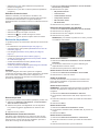 15
15
-
 16
16
-
 17
17
-
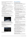 18
18
-
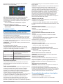 19
19
-
 20
20
-
 21
21
-
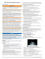 22
22
-
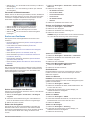 23
23
-
 24
24
-
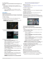 25
25
-
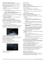 26
26
-
 27
27
-
 28
28
-
 29
29
-
 30
30
-
 31
31
-
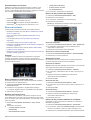 32
32
-
 33
33
-
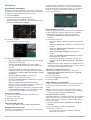 34
34
-
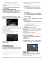 35
35
-
 36
36
-
 37
37
-
 38
38
-
 39
39
-
 40
40
-
 41
41
-
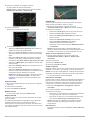 42
42
-
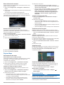 43
43
-
 44
44
-
 45
45
-
 46
46
-
 47
47
-
 48
48
-
 49
49
-
 50
50
-
 51
51
-
 52
52
-
 53
53
-
 54
54
-
 55
55
-
 56
56
-
 57
57
-
 58
58
-
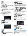 59
59
-
 60
60
-
 61
61
-
 62
62
-
 63
63
-
 64
64
-
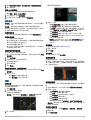 65
65
-
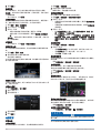 66
66
-
 67
67
-
 68
68
-
 69
69
-
 70
70


Garmin Map Pilot for Mercedes-Benz Manual de usuario
- Tipo
- Manual de usuario
En otros idiomas
Documentos relacionados
-
Garmin Map Pilot for Mercedes-Benz Manual de usuario
-
-
-
-
-
 Garmin Map Map Pilot for Mercedes_Benz El manual del propietario
